1960s Maps of Grafton, Nebraska
Explore 2 historic maps of Grafton from the 1960s. These maps offer a rare glimpse into what life looked like during the 1960s — showing old roads, neighborhoods, homes, and landmarks that have changed or disappeared over time.
Whether you're researching your family's past, planning a metal detecting trip, or studying how Grafton's landscape evolved across the 1960s, these high-resolution maps are a powerful tool for exploring the history of this region.
- Focus on a specific era: All maps on this page are from the 1960s, giving you a focused view of this time period.
- See what’s changed: Compare century-old streets, trails, and buildings to today's modern landscape using overlays and satellite layers.
- Research with precision: Use these maps for genealogy, historical research, land use analysis, or educational projects.
- View, download, or print: Maps are fully viewable online in high resolution, and can be downloaded or printed for your own records.
Start exploring Grafton's history through authentic maps from the 1960s. This is your window into the past.
Grafton, NE maps
(2)- 1969 Map of Grafton, 1971 Print
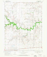 1969 Grafton1971 Print · USGSThe York and Fillmore County line in the late 1960s reveals a landscape of prairie agriculture and shifting railroads. Genealogists and local historians can trace the foundations of Grafton and Lushton while locating Lushton Cem and the Old Grade Railroad.
 - 1969 Map of Geneva SW, 1971 Print
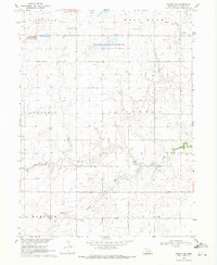 1969 Geneva SW1971 Print · USGSFillmore County at the end of the sixties shows a landscape dedicated to agriculture and conservation before modern irrigation intensified. Family historians can trace local landmarks like Grafton Cem or explore protected prairie waters at Morphy Lagoon National Wildlife Management Area.
End of results
Showing maps 1-2 of 2
Top cities near Grafton
- York historical maps
- Geneva historical maps
- Sutton historical maps
- Henderson historical maps
- Fairmont historical maps
- McCool Junction historical maps
See more
Frequently asked questions
- What are the different types of historical maps available for Grafton?
- What is the oldest map of Grafton?
- Where can I purchase historical maps of Grafton for my home or office?
- Where can I download high-res historical maps of Grafton?
- Are there historical topographic maps available for Grafton?
- Is there historical aerial imagery available for Grafton?
- Where are historical maps of Grafton sourced from?