Old Maps of Pickrell, Nebraska for Metal Detecting
Plan your next treasure hunt with 9 historic maps of Pickrell. Find old homesites, ghost towns, trails, and gathering spots that may be lost to time — perfect for identifying promising metal detecting locations.
- Locate forgotten sites: Uncover places like long-lost settlements, abandoned rail lines, or gathering spots.
- Plan better hunts: Use map overlays combined with LiDAR or satellite views to narrow in on historically rich areas.
- Made for detectorists: Thousands of hobbyists use these maps to discover relics, coins, and hidden history.
Use these historic maps to boost your research and find new opportunities beneath the surface of Pickrell.
Pickrell, NE maps
(9)- 1955 Map of Lincoln, 1967 Print
 1955 Lincoln1967 Print · USGSSoutheast Nebraska in the mid-fifties presents a landscape of thriving railroad towns and the expanding footprint of the capital city. Researchers can trace the legacy of the pioneer era at the Homestead National Monument of America or locate mid-century military infrastructure like Lincoln Air Force Base.5 unique versions available
 - 1957 Map of Lincoln
 1957 Lincoln1957 Print · USGSSoutheastern Nebraska at mid-century shows a landscape of thriving rail towns and expanding infrastructure centered on Lincoln. Researchers can trace the path of the Chicago Burlington and Quincy railroad through communities like Weeping Water, Fairmont, and Seward.
 - 1958 Map of Lincoln
 1958 Lincoln1958 Print · USGSSoutheast Nebraska at the end of the 1950s shows a region defined by agricultural trade and the expansion of the state capital. Genealogists can trace family footprints across the Blue Valley and locate landmarks like the Lincoln AFB or the U.S. Veterans Hospital.
 - 1964 Map of Pickrell, 1965 Print
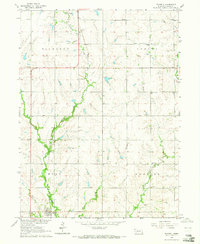 1964 Pickrell1965 Print · USGSGage County agriculture and the Union Pacific rail line define this prairie landscape in the mid-1960s. Genealogists can locate several rural schools and churches, including Island Center Sch, St James Ch, and the Sunnyside Cem.
 - 1986 Map of Beatrice
 1986 Beatrice1986 Print · USGSSoutheast Nebraska and the Kansas borderlands appear in the mid-1980s as a thriving agricultural region centered on the Big Blue River. Researchers can trace historic rail routes like the Burlington Northern through hubs such as Beatrice and Pawnee City.2 unique versions available
 - 2011 Map of Pickrell, 2011 Print
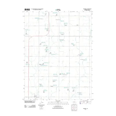 2011 Pickrell2011 Print · USGSCovers Pickrell, including Gage County, United States, and other nearby areas
 - 2014 Map of Pickrell, 2014 Print
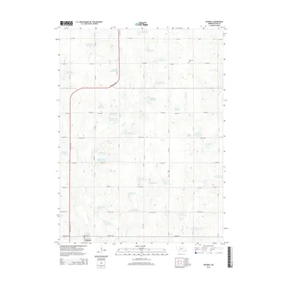 2014 Pickrell2014 Print · USGSCovers Pickrell, including Gage County, United States, and other nearby areas
 - 2017 Map of Pickrell, 2017 Print
 2017 Pickrell2017 Print · USGSCovers Pickrell, including Gage County, United States, and other nearby areas
 - 2021 Map of Pickrell, 2021 Print
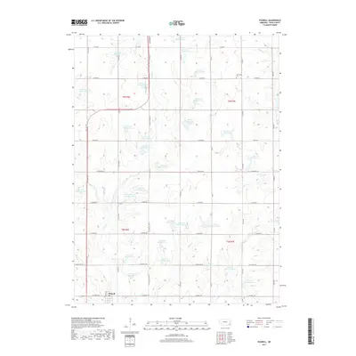
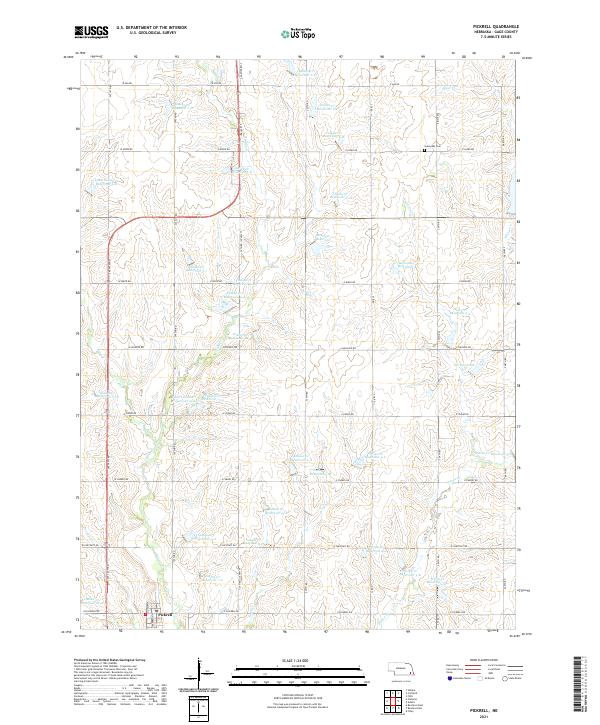 2021 Pickrell2021 Print · USGSAgricultural Gage County comes into focus in this recent survey, showcasing a landscape defined by water management and rural sections. Genealogists and local historians can locate Pickrell and Sunnyside Cem, or trace the numerous impoundments like Boesiger Reservoir and Busboom Reservoir.
End of results
Showing maps 1-9 of 9
Top cities near Pickrell
- Beatrice historical maps
- Wilber historical maps
- Firth historical maps
- Hallam historical maps
- De Witt historical maps
- Cortland historical maps
See more
Frequently asked questions
- What are the different types of historical maps available for Pickrell?
- What is the oldest map of Pickrell?
- Where can I purchase historical maps of Pickrell for my home or office?
- Where can I download high-res historical maps of Pickrell?
- Are there historical topographic maps available for Pickrell?
- Is there historical aerial imagery available for Pickrell?
- Where are historical maps of Pickrell sourced from?