Old Maps of Spalding, Nebraska for Metal Detecting
Plan your next treasure hunt with 8 historic maps of Spalding. Find old homesites, ghost towns, trails, and gathering spots that may be lost to time — perfect for identifying promising metal detecting locations.
- Locate forgotten sites: Uncover places like long-lost settlements, abandoned rail lines, or gathering spots.
- Plan better hunts: Use map overlays combined with LiDAR or satellite views to narrow in on historically rich areas.
- Made for detectorists: Thousands of hobbyists use these maps to discover relics, coins, and hidden history.
Use these historic maps to boost your research and find new opportunities beneath the surface of Spalding.
Spalding, NE maps
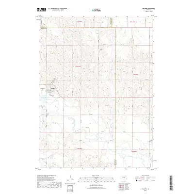
(8)- 1954 Map of Spalding, 1956 Print
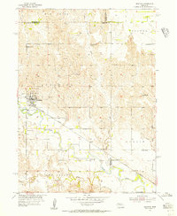 1954 Spalding1956 Print · USGSGreeley County and its neighbors in the mid-1950s show a landscape defined by the Union Pacific rail line and the Cedar River. Genealogists and local historians can trace a dozen numbered school sites and several family burial grounds, including Dublin Cem and Grand View Cem.3 unique versions available
 - 1955 Map of Broken Bow
 1955 Broken Bow1955 Print · USGSCentral Nebraska in the mid-fifties is defined by the sweeping Sand Hills and the vital river valleys that supported its ranching and rail towns. Researchers can trace the rail corridors of the Union Pacific RR and locate settlements like Dannebrog, Broken Bow, and Brewster.5 unique versions available
 - 1956 Map of Broken Bow
 1956 Broken Bow1956 Print · USGSCentral Nebraska during the mid-fifties reveals a region defined by its river-valley railroads and the rolling Sand Hills. Genealogists and local historians can trace the paths of the Chicago Burlington and Quincy through towns like Broken Bow, Merna, and Anselmo.
 - 1985 Map of Ord
 1985 Ord1985 Print · USGSCentral Nebraska's river valleys were defined by the rail and irrigation networks of the mid-1980s. Genealogists can trace family roots in towns like Ord and Albion or locate landmarks like Pilot Knob and the Pibel Lake State Recreation Area.2 unique versions available
 - 2011 Map of Spalding, 2011 Print
 2011 Spalding2011 Print · USGSCovers Spalding, including Greeley County, Boone County, and other nearby areas
 - 2014 Map of Spalding, 2014 Print
 2014 Spalding2014 Print · USGSCovers Spalding, including Greeley County, Boone County, and other nearby areas
 - 2017 Map of Spalding, 2017 Print
 2017 Spalding2017 Print · USGSCovers Spalding, including Greeley County, Boone County, and other nearby areas
 - 2021 Map of Spalding, 2021 Print
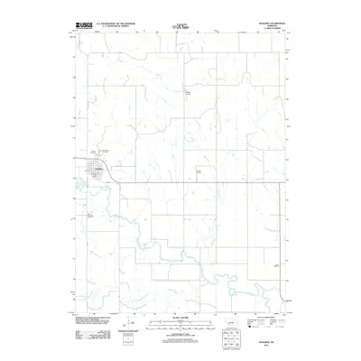
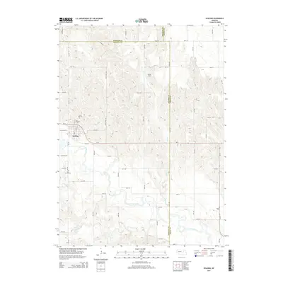
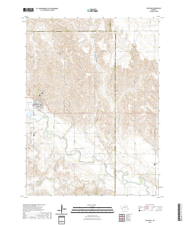 2021 Spalding2021 Print · USGSThe village of Spalding and the surrounding Nebraska plains are captured here in the early 2020s as the Cedar River winds through the landscape. Genealogists can locate several local burial sites including Grand View Cem and the remote Dublin Cem.
End of results
Showing maps 1-8 of 8
Top cities near Spalding
- Greeley Center historical maps
- Cedar Rapids historical maps
- Bartlett historical maps
- Primrose, abandoned school historical maps
Frequently asked questions
- What are the different types of historical maps available for Spalding?
- What is the oldest map of Spalding?
- Where can I purchase historical maps of Spalding for my home or office?
- Where can I download high-res historical maps of Spalding?
- Are there historical topographic maps available for Spalding?
- Is there historical aerial imagery available for Spalding?
- Where are historical maps of Spalding sourced from?