1970s Maps of Harlan County, Nebraska
Explore 9 historic maps of Harlan County from the 1970s. These maps offer a rare glimpse into what life looked like during the 1970s — showing old roads, neighborhoods, homes, and landmarks that have changed or disappeared over time.
Whether you're researching your family's past, planning a metal detecting trip, or studying how Harlan County's landscape evolved across the 1970s, these high-resolution maps are a powerful tool for exploring the history of this region.
- Focus on a specific era: All maps on this page are from the 1970s, giving you a focused view of this time period.
- See what’s changed: Compare century-old streets, trails, and buildings to today's modern landscape using overlays and satellite layers.
- Research with precision: Use these maps for genealogy, historical research, land use analysis, or educational projects.
- View, download, or print: Maps are fully viewable online in high resolution, and can be downloaded or printed for your own records.
Start exploring Harlan County's history through authentic maps from the 1970s. This is your window into the past.
Harlan County, NE maps
(9)- 1970 Map of Wilcox, 1972 Print
 1970 Wilcox1972 Print · USGSIn the early 1970s, the rural junction of Kearney and Phelps counties featured a landscape of conservation basins and rail corridors. Researchers can locate the Freewater Cem and St Johns Cem, or trace the path of the Burlington Northern and an Old Railroad Grade.
 - 1970 Map of Ragan, 1972 Print
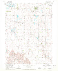
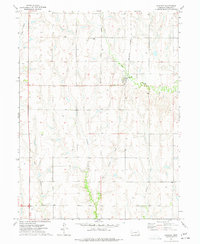
 1970 Ragan1972 Print · USGSThe rural uplands of south-central Nebraska are captured here in the early 1970s, centered on the village of Ragan. Researchers can trace local genealogy and land use through landmarks like Antelope Cem, Immanuel Ch, and the Burlington Northern rail corridor.
 - 1970 Map of Atlanta, 1973 Print
 1970 Atlanta1973 Print · USGSThe rural landscape near the Phelps and Harlan county line is captured here in the early 1970s. Local researchers can trace the Burlington Northern rail line through Atlanta and locate the Bethel Ch near Flag Creek.
 - 1973 Map of Orleans, 1977 Print
 1973 Orleans1977 Print · USGSOrleans and the Republican River valley are documented here in the early seventies, showing a landscape defined by irrigation and rail. Researchers can trace the Burlington Northern line, locate Calvary Cemetery, or find the small settlement at Wienand.
 - 1974 Map of Republican City, 1977 Print
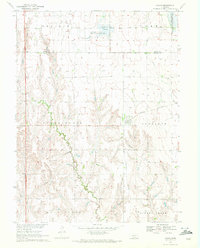
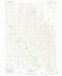
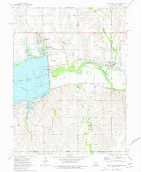 1974 Republican City1977 Print · USGSRepublican City and the surrounding valley are shown here in the mid-1970s, as the landscape adjusted to the presence of Harlan County Lake. You can trace the Burlington Northern railroad, find the old town site of Naponee, and locate the Old RR Grade along the river.
 - 1974 Map of Alma SW, 1977 Print
 1974 Alma SW1977 Print · USGSThe Republican River valley meets the Kansas border in the mid-1970s, shortly after the landscape was transformed by the waters of Harlan County Lake. Genealogists and local historians can trace the paths of Sappa Creek and the Burlington Northern rail line through Orleans.
 - 1974 Map of Alma, 1977 Print
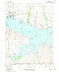 1974 Alma1977 Print · USGSThe town of Alma and the waters of Harlan County Lake define this mid-seventies look at the Nebraska-Kansas border. Researchers can trace the Old Railroad Grade and Burlington Northern lines or locate the Republican City Cem.
 - 1974 Map of Huntley, 1977 Print
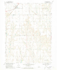
 1974 Huntley1977 Print · USGSHuntley and the surrounding Harlan County plains are captured in the mid-seventies during a period of evolving rail infrastructure. Researchers can trace the path of the Old Grade Railroad or locate family roots near Bainbridge Cem and Huntley.
 - 1974 Map of Republican City NW, 1977 Print
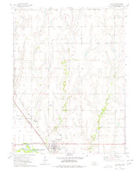
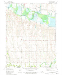
 1974 Republican City NW1977 Print · USGSHarlan and Franklin counties are captured in the mid-1970s, showcasing a landscape of creek-side farming and prairie life. Researchers can locate family landmarks like Zion Cem, St Pauls Ch, and the winding path of Turkey Creek.
End of results
Showing maps 1-9 of 9
Top cities of Harlan County
- Alma historical maps
- Orleans historical maps
- Stamford historical maps
- Republican City historical maps
- Huntley historical maps
- Ragan historical maps
Frequently asked questions
- What are the different types of historical maps available for Harlan County?
- What is the oldest map of Harlan County?
- Where can I purchase historical maps of Harlan County for my home or office?
- Where can I download high-res historical maps of Harlan County?
- Are there historical topographic maps available for Harlan County?
- Is there historical aerial imagery available for Harlan County?
- Where are historical maps of Harlan County sourced from?