1960s Maps of Howard County, Nebraska
Explore 4 historic maps of Howard County from the 1960s. These maps offer a rare glimpse into what life looked like during the 1960s — showing old roads, neighborhoods, homes, and landmarks that have changed or disappeared over time.
Whether you're researching your family's past, planning a metal detecting trip, or studying how Howard County's landscape evolved across the 1960s, these high-resolution maps are a powerful tool for exploring the history of this region.
- Focus on a specific era: All maps on this page are from the 1960s, giving you a focused view of this time period.
- See what’s changed: Compare century-old streets, trails, and buildings to today's modern landscape using overlays and satellite layers.
- Research with precision: Use these maps for genealogy, historical research, land use analysis, or educational projects.
- View, download, or print: Maps are fully viewable online in high resolution, and can be downloaded or printed for your own records.
Start exploring Howard County's history through authentic maps from the 1960s. This is your window into the past.
Howard County, NE maps
(4)- 1960 Map of St. Paul, 1962 Print
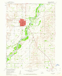 1960 St. Paul1962 Print · USGSHoward County's river-and-rail hub comes to life in the early 1960s, showing the town's role as a regional center between the forks of the Loup. Genealogists and local historians can trace civic life at the Courthouse, St Paul Cemetery, and rural landmarks like School No 15.2 unique versions available
 - 1961 Map of Palmer, 1963 Print
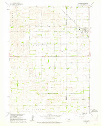 1961 Palmer1963 Print · USGSThe agricultural heart of Howard and Merrick counties comes to life in this early 1960s survey of the plains. Genealogists and historians can trace the foundations of local life through rural landmarks like Rose Hill Cem, School No 19, and the village of Palmer.
 - 1961 Map of St. Paul SW, 1963 Print
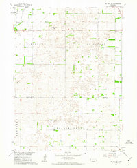 1961 St. Paul SW1963 Print · USGSHoward and Hall Counties are shown in the early sixties as a network of established townships and rural districts. Genealogists can locate specific homestead sites near School No 16, School No 51, or the Union Pacific line crossing the St Libory border.
 - 1961 Map of St. Libory, 1963 Print
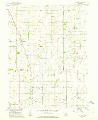 1961 St. Libory1963 Print · USGSThe rural landscape of Howard and Hall counties in the early sixties is defined by a dense network of country schools and the tracks of the Union Pacific. Genealogists can locate family-named landmarks like the Norwegian Cem, Worms, and School No 41.
End of results
Showing maps 1-4 of 4
Top cities of Howard County
- Saint Paul historical maps
- Dannebrog historical maps
- Saint Libory historical maps
- Elba historical maps
- Farwell historical maps
- Cotesfield historical maps
See more
Frequently asked questions
- What are the different types of historical maps available for Howard County?
- What is the oldest map of Howard County?
- Where can I purchase historical maps of Howard County for my home or office?
- Where can I download high-res historical maps of Howard County?
- Are there historical topographic maps available for Howard County?
- Is there historical aerial imagery available for Howard County?
- Where are historical maps of Howard County sourced from?