Old Maps of Niobrara, Nebraska for Genealogy
Trace your family roots with 16 historic maps of Niobrara. These high-res maps reveal old neighborhoods, homesites, landmarks, and streets — helping you uncover where your ancestors lived and how the area evolved over time.
- Explore historic neighborhoods: Identify where your relatives may have lived in the 1800s or 1900s.
- Compare maps over time: Trace the changes in streets, buildings, and landmarks for multi-generational research.
- Perfect for genealogy & ancestry research: Used by family historians and researchers to map out lineage and migration.
These maps are an incredible resource for exploring your personal connection to Niobrara's past.
Niobrara, NE maps
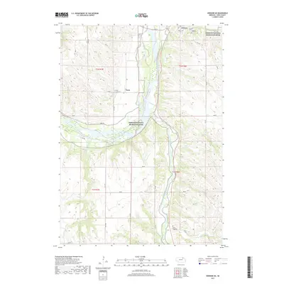
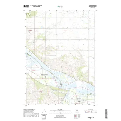
(16)- 1950 Map of Niobrara, 1952 Print
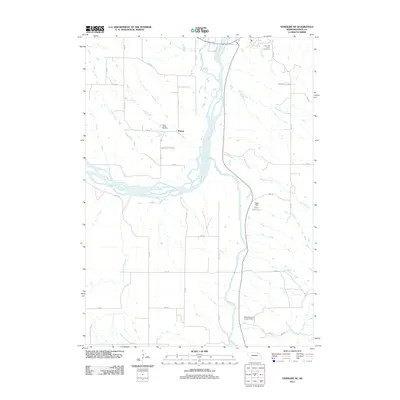
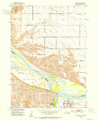 1950 Niobrara1952 Print · USGSThe Missouri and Niobrara rivers converge here in the mid-twentieth century, just as the town of Niobrara prepared for major changes. Genealogists can locate many rural landmarks including Norwegian Cem, Wagner Sch, and the Chicago and North Western rail line.2 unique versions available
 - 1950 Map of Verdigre NE, 1952 Print
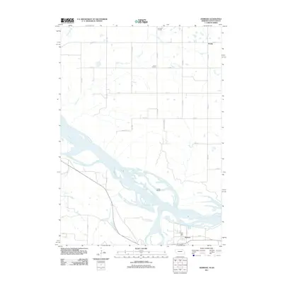
 1950 Verdigre NE1952 Print · USGSKnox County was a land of valley farms and rural school districts during the early post-war years. Researchers can trace the Chicago and North Western rail line and locate community landmarks like St Johns Cem and Ponca Sch.3 unique versions available
 - 1955 Map of O'Neill, 1974 Print
 1955 O'Neill1974 Print · USGSNorth-central Nebraska in the 1950s reveals a vast cattle-ranching landscape transitioning from the Missouri River breaks to the iconic Sand Hills. Researchers can trace the path of the Chicago and North Western rail line and locate rural landmarks like the Dustin Post Office and St Johns Lake Ch.2 unique versions available
 - 1959 Map of O'Neill
 1959 O'Neill1959 Print · USGSNorth-central Nebraska in the late fifties is defined by the vast Sand Hills and the vital Chicago and North Western rail line. Genealogists and researchers can trace family roots through settlements like Atkinson, Bassett, and Stuart or follow the waters of the Niobrara River.2 unique versions available
 - 1969 Map of O'Neill
 1969 O'Neill1969 Print · USGSCentral Nebraska in the mid-fifties is defined here by the expansive Sand Hills and the winding Niobrara River. Trace the Chicago and North Western rail line through cattle towns like O'Neill and Ainsworth.
 - 1977 Map of Niobrara
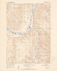
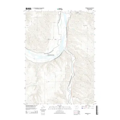
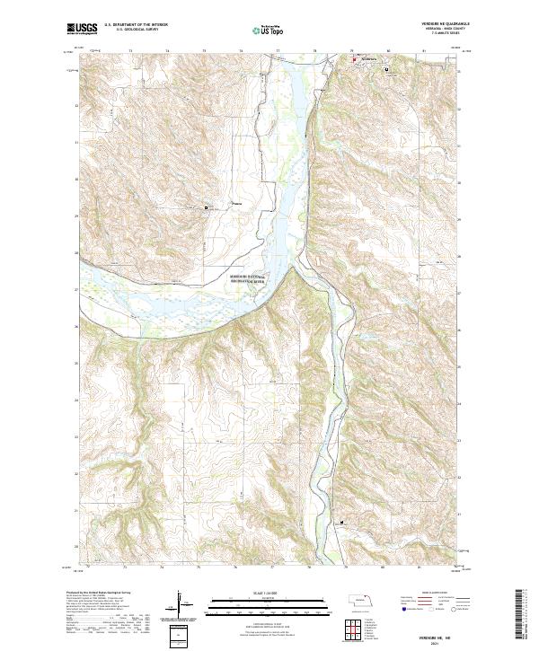
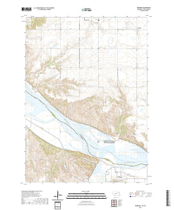
 1977 Niobrara1977 Print · USGSThe Nebraska-South Dakota borderlands come into focus in the late seventies, showing the dramatic confluence of the Niobrara River and Missouri River. Researchers can trace the layout of Niobrara and the varied agricultural patterns near Perkins.
 - 1986 Map of Atkinson
 1986 Atkinson1986 Print · USGSBoyd and Holt counties come into focus during the mid-eighties as they span the river valleys of the Nebraska and South Dakota border. Genealogists can locate family-named townships and remote outposts like Opportunity, Pishelville, and the Yankton Indian Reservation.2 unique versions available
 - 1989 Map of O'Neill
 1989 O'Neill1989 Print · USGSThe Nebraska-South Dakota borderlands are captured here in the late eighties, documenting the ranching and rail infrastructure of the High Plains. Genealogists and collectors can trace historic prairie towns like Monowi, Pishelville, and Santee along the Niobrara River.
 - 2011 Map of Verdigre NE, 2011 Print
 2011 Verdigre NE2011 Print · USGSCovers Niobrara, including Ponca, Knox County, and other nearby areas
 - 2011 Map of Niobrara, 2011 Print
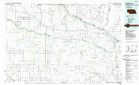
 2011 Niobrara2011 Print · USGSCovers Niobrara, including Running Water Township, Rouse Township, and other nearby areas
 - 2014 Map of Verdigre NE, 2014 Print
 2014 Verdigre NE2014 Print · USGSCovers Niobrara, including Ponca, Knox County, and other nearby areas
 - 2014 Map of Niobrara, 2014 Print
 2014 Niobrara2014 Print · USGSCovers Niobrara, including Running Water Township, Rouse Township, and other nearby areas
 - 2017 Map of Verdigre NE, 2017 Print
 2017 Verdigre NE2017 Print · USGSCovers Niobrara, including Ponca, Knox County, and other nearby areas
 - 2017 Map of Niobrara, 2017 Print
 2017 Niobrara2017 Print · USGSCovers Niobrara, including Running Water Township, Rouse Township, and other nearby areas
 - 2021 Map of Verdigre NE, 2021 Print
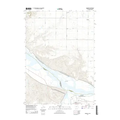
 2021 Verdigre NE2021 Print · USGSKnox County, Nebraska, is documented here in the early 2020s where the Missouri and Niobrara rivers meet. Researchers can trace local lineage at Hillcrest Cem and Saint Johns Cem or explore the rural environs of Niobrara and Ponca.
 - 2021 Map of Niobrara, 2021 Print
 2021 Niobrara2021 Print · USGSNiobrara and the Missouri River corridor are captured here at the start of the 2020s, showing the complex river island geography of the South Dakota border. Genealogists and historians can trace local heritage through Pioneer Cem, Norwegian Cem, and the George Drouillard Trl.
End of results
Showing maps 1-16 of 16
Top cities near Niobrara
- Springfield historical maps
- Verdigre historical maps
- Santee historical maps
- Sparta historical maps
- Center historical maps
- Verdel historical maps
Frequently asked questions
- What are the different types of historical maps available for Niobrara?
- What is the oldest map of Niobrara?
- Where can I purchase historical maps of Niobrara for my home or office?
- Where can I download high-res historical maps of Niobrara?
- Are there historical topographic maps available for Niobrara?
- Is there historical aerial imagery available for Niobrara?
- Where are historical maps of Niobrara sourced from?