Old Maps of Lancaster County, Nebraska for Hiking & Exploration
Hike through history with 139 historic maps of Lancaster County. Explore old trails, ghost towns, and forgotten backroads — perfect for outdoor adventurers and local explorers.
- Rediscover forgotten places: Map out old mining camps, roads, and footpaths that no longer exist on modern maps.
- Layer with modern tools: Combine with LiDAR or satellite views to plan hikes through historical terrain.
- Made for exploration: Popular among hikers, overlanders, and local history lovers.
Use these maps to find adventure and explore the hidden past of Lancaster County.
Lancaster County, NE maps
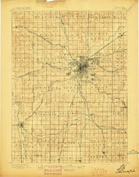
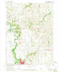
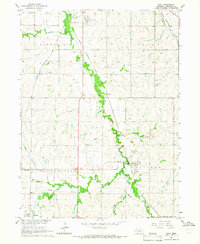
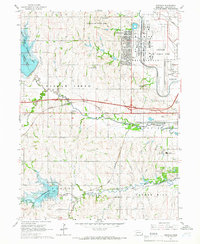
(139)- 1893 Map of Fremont, 1960 Print
 1893 Fremont1960 Print · USGSEastern Nebraska was a nexus of river navigation and rail expansion in the 1890s as the prairie gave way to organized township grids. Genealogists and historians can trace early settlements and transportation corridors through Fort Calhoun, the growth of Fremont, and the junctions of the Union Pacific R.R..
 - 1896 Map of Fremont
 1896 Fremont1896 Print · USGSThe rail-driven growth of eastern Nebraska is captured here in the late nineteenth century as steam power connected the prairie. Researchers can trace ancestral roots through dozens of established settlements like Fontanelle, Gretna, and Papillion, or follow the historic routes of the Union Pacific R.R. and the Elkhorn River.5 unique versions available
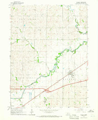
 - 1897 Map of Lincoln
 1897 Lincoln1897 Print · USGSLate-Victorian Nebraska comes into focus here as a bustling hub of steam and steel, centered on the capital. You can trace the early layouts of University Place and Bethany or locate rural landmarks like the Asylum, Lincoln Salt Lake, and the rail stop at Prairie Home.4 unique versions available
 - 1899 Map of Wahoo
 1899 Wahoo1899 Print · USGSSaunders County and its neighbors thrive as a booming rail hub in the 1890s, where the Platte River meets a dense web of iron tracks. Trace the early development of prairie towns like Wahoo, Valparaiso, and the Bohemian settlement at Prague.3 unique versions available
 - 1903 Map of Weeping Water
 1903 Weeping Water1903 Print · USGSSoutheast Nebraska at the start of the twentieth century was a thriving patchwork of rail-dependent prairie towns and river valleys. Genealogists and local historians can trace early property boundaries and township seats like Weeping Water, Syracuse, and the riverside town of Louisville.2 unique versions available
 - 1929 Map of Weeping Water
 1929 Weeping Water1929 Print · USGSEastern Nebraska's fertile prairie was a hub of railroad development and river-valley settlement at the start of the twentieth century. Researchers can trace the early layout of communities like Weeping Water, Syracuse, and Louisville along the Missouri Pacific R. R. and Platte River.
 - 1955 Map of Fremont, 1966 Print
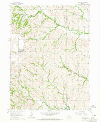
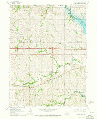
 1955 Fremont1966 Print · USGSEastern Nebraska and the Missouri River border are captured during the mid-fifties, just as the interstate system began to emerge. Researchers can trace the development of Omaha, locate the sprawling Offutt Air Force Base, or study the river-bound ecology of the De Soto National Wildlife Refuge.3 unique versions available
 - 1955 Map of Lincoln, 1967 Print
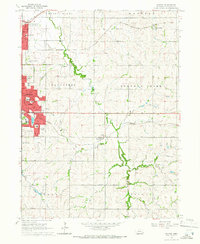
 1955 Lincoln1967 Print · USGSSoutheast Nebraska in the mid-fifties presents a landscape of thriving railroad towns and the expanding footprint of the capital city. Researchers can trace the legacy of the pioneer era at the Homestead National Monument of America or locate mid-century military infrastructure like Lincoln Air Force Base.5 unique versions available
 - 1957 Map of Fremont
 1957 Fremont1957 Print · USGSEastern Nebraska and western Iowa thrive along the Platte and Missouri rivers during the mid-fifties. Genealogists can locate small rural schools like Fairview School and tracing the paths of the Union Pacific through towns like Albion and Humphrey.
 - 1957 Map of Lincoln
 1957 Lincoln1957 Print · USGSSoutheastern Nebraska at mid-century shows a landscape of thriving rail towns and expanding infrastructure centered on Lincoln. Researchers can trace the path of the Chicago Burlington and Quincy railroad through communities like Weeping Water, Fairmont, and Seward.
 - 1958 Map of Fremont
 1958 Fremont1958 Print · USGSEastern Nebraska in the late fifties is captured here as a thriving corridor of river-valley commerce and rail transport. Researchers can trace the development of Omaha and Fremont or locate local landmarks like Midland College and Offutt Air Force Base.
 - 1958 Map of Lincoln
 1958 Lincoln1958 Print · USGSSoutheast Nebraska at the end of the 1950s shows a region defined by agricultural trade and the expansion of the state capital. Genealogists can trace family footprints across the Blue Valley and locate landmarks like the Lincoln AFB or the U.S. Veterans Hospital.
 - 1964 Map of Cortland, 1965 Print
 1964 Cortland1965 Print · USGSSoutheast Nebraska farmland is captured here in the mid-sixties, centered on the Union Pacific rail corridor between Hickman and Cortland. Genealogists and local historians can locate early landmarks like Stockfeldt Cem, Good Hope Sch, and the Stagecoach Lake recreation area.2 unique versions available
 - 1964 Map of Hallam, 1965 Print
 1964 Hallam1965 Print · USGSSoutheastern Nebraska is captured in the mid-sixties as utility and recreation developments reshaped the rural landscape. Researchers can locate several historic burial grounds like Kramer Community Cem and schoolhouses such as School No 11 along the Rock Island line.
 - 1964 Map of Crete South, 1965 Print
 1964 Crete South1965 Print · USGSSaline County agricultural life and early education are preserved here in the mid-1960s. Genealogists can trace family footprints at Bohemian National Cem and locate rural landmarks like Big Blue Sch or the hamlet of Shestak.2 unique versions available
 - 1964 Map of Crete North, 1965 Print
 1964 Crete North1965 Print · USGSSaline County and the surrounding plains are captured in the mid-1960s as the riverfront community of Crete expands. Genealogists and local historians can trace rural school sites like Valley View Sch and the rail-side settlement of Berks along the Chicago Burlington and Quincy line.2 unique versions available
 - 1964 Map of Waverly, 1965 Print
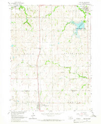
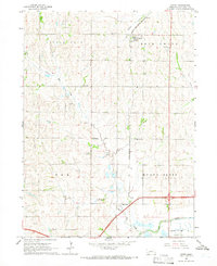
 1964 Waverly1965 Print · USGSLancaster County's agricultural and rail-dependent landscape comes into focus during the mid-sixties, centered on the growing town of Waverly. Genealogists and local historians can trace rural landmarks like Bethlehem Ch, Pierce Cem, and the path of the Chicago Burlington and Quincy railroad.2 unique versions available
 - 1964 Map of Garland, 1965 Print
 1964 Garland1965 Print · USGSSeward County's agricultural and rail landscape is meticulously detailed in the mid-sixties, centered on the village of Garland. Researchers can locate historic rural sites including Germantown Cem, Immanuel Sch, and the junction of the Chicago and North Western railroad.2 unique versions available
 - 1964 Map of Denton, 1965 Print
 1964 Denton1965 Print · USGSSouthwestern Lancaster County in the mid-1960s shows a landscape of rail-connected villages and new reservoir projects. Genealogists and local historians can trace rural roots through Wesley Chapel Cem or locate the village of Martell along the Rock Island tracks.2 unique versions available
 - 1964 Map of Roca, 1965 Print
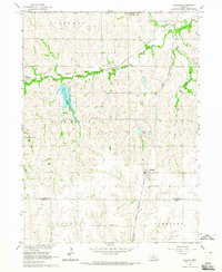
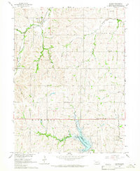
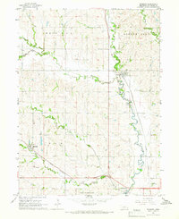
 1964 Roca1965 Print · USGSSoutheast of Lincoln in the mid-1960s, a dense network of five major railroads converges along the Salt Creek valley. Researchers can trace the heritage of local industry and education through Quarries near Roca and rural schoolhouses like Hedge Hill Sch.2 unique versions available
 - 1964 Map of Pleasant Dale, 1965 Print
 1964 Pleasant Dale1965 Print · USGSPleasant Dale and the surrounding prairie of eastern Nebraska are shown here in the mid-sixties as new reservoirs reshaped the landscape. Genealogists and local historians can trace family locations near Zion Ch, Burd Sch, and the Pleasant Dale Cem.2 unique versions available
 - 1964 Map of Davey, 1966 Print
 1964 Davey1966 Print · USGSNorth of Lincoln in the mid-1960s, this area of Lancaster County shows a landscape of traditional farming and rural education. Genealogists can locate family sites near Tothill Cem or trace the old rail-side life of Davey and School No 122.2 unique versions available
 - 1964 Map of Walton, 1966 Print
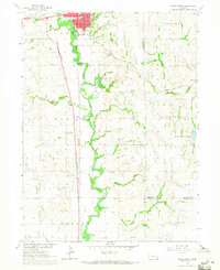
 1964 Walton1966 Print · USGSThe eastern outskirts of Lincoln and the surrounding Lancaster County townships appear here during a period of mid-century suburban growth. Genealogists and local historians can trace the development of Bethany and Havelock, or locate rural landmarks like Schultz Cem and the community of Walton.3 unique versions available
 - 1964 Map of Emerald, 1966 Print
 1964 Emerald1966 Print · USGSThe western edge of the Nebraska capital was defined by military and recreational expansion in the early sixties. Researchers can trace the legacy of Lincoln Air Force Base, find local schools like School No 69, and locate St Johns Cem.3 unique versions available
 - 1964 Map of Raymond, 1966 Print
 1964 Raymond1966 Print · USGSThe area northwest of Lincoln comes alive in the mid-sixties, showing a landscape defined by meandering creek beds and vital rail connections. Researchers can trace family history through sites like St Pauls Cem or explore the footprint of Lincoln Air Force Base.2 unique versions available
Showing maps 1-25 of 139
Top cities of Lancaster County
- Lincoln historical maps
- Waverly historical maps
- Hickman historical maps
- Bennet historical maps
- Firth historical maps
- Hallam historical maps
See more
Frequently asked questions
- What are the different types of historical maps available for Lancaster County?
- What is the oldest map of Lancaster County?
- Where can I purchase historical maps of Lancaster County for my home or office?
- Where can I download high-res historical maps of Lancaster County?
- Are there historical topographic maps available for Lancaster County?
- Is there historical aerial imagery available for Lancaster County?
- Where are historical maps of Lancaster County sourced from?