Old Maps of Village Square, North Platte for Academic Research
Study the evolution of Village Square with 12 high-resolution historic maps. Whether you're teaching, researching, or modeling changes in land use, these maps provide essential visual documentation of urban, environmental, and geographic change.
- Analyze long-term change: Track patterns in development, transportation, and natural features.
- Ideal for environmental or urban studies: Support academic projects with primary historical map data.
- Use in the classroom or lab: Educators and researchers rely on these maps to bring historical context to life.
These maps are a powerful tool for teaching, research, and visualizing how Village Square has changed over the decades.
Village Square, North Platte maps
(12)- 1899 Map of North Platte, 1957 Print
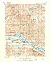 1899 North Platte1957 Print · USGSNorth Platte and the surrounding river valleys are captured here at the end of the nineteenth century, as irrigation canals began to reshape the Nebraska prairie. Genealogists and researchers can trace early homestead-era landmarks like Newberries Crossroads, Lemley, and the Union Pacific RR corridor.
 - 1902 Map of North Platte
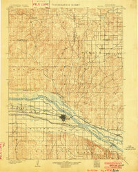 1902 North Platte1902 Print · USGSNorth Platte and the Platte River forks are shown here at the start of the twentieth century, during a period of massive irrigation expansion. Researchers can trace early railroad siding stops like Spuds and Gannett or find old crossroads like Newberries Crossroads.3 unique versions available
 - 1954 Map of North Platte, 1968 Print
 1954 North Platte1968 Print · USGSThe Nebraska Sand Hills and the Platte River valley are captured here during a period of mid-century growth and agricultural expansion. Trace the vast irrigation network of the Sutherland Canal, locate old rural schoolhouses like Rose Hill School, and find family holdings such as Conrey Ranch.3 unique versions available
 - 1956 Map of North Platte
 1956 North Platte1956 Print · USGSThe Nebraska Sand Hills meet the high plains river valleys in the mid-1950s, a period of intensive water management and rail commerce. Genealogists and historians can trace early prairie settlements like Stapleton and Tryon, or follow the industrial corridor of the Union Pacific through North Platte.
 - 1957 Map of North Platte
 1957 North Platte1957 Print · USGSThe Nebraska Sand Hills and the Platte River valley are captured here in the mid-fifties as the ranching and irrigation economy matured. Genealogists and historians can locate family-named schoolhouses like Maire School or trace the railroad hubs at North Platte and the Fort McPherson National Cemetery.
 - 1967 Map of North Platte
 1967 North Platte1967 Print · USGSThe Nebraska Sand Hills and the Platte River valley meet in the 1960s, showing a landscape shaped by water management and rail. Genealogists can trace rural school districts like the Prairie Dell School or find landmarks like the Scott Lookout Tower and Geo P Kingsley Dam.
 - 1970 Map of North Platte West, 1973 Print
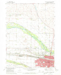 1970 North Platte West1973 Print · USGSNorth Platte flourished as a vital rail and river hub in the early 1970s. Researchers can trace the town's civic growth through Buffalo Bill Ranch State Park, St Patricks Cath Ch, and the sprawling Union Pacific rail yards.2 unique versions available
 - 1985 Map of North Platte
 1985 North Platte1985 Print · USGSThe Platte River valley in the mid-1980s reveals a landscape of massive rail yards and vital irrigation works. Trace the Union Pacific lines through North Platte or locate family sites near Stapleton, Gandy, and Fort Mc Pherson National Cemetery.2 unique versions available
 - 2011 Map of North Platte West, 2011 Print
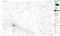
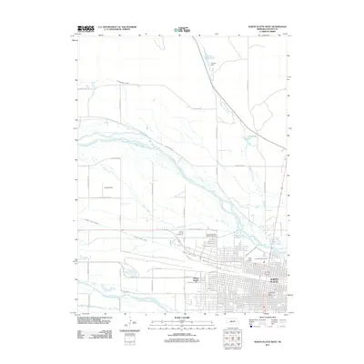 2011 North Platte West2011 Print · USGSCovers Village Square, including North Platte, Green Acres Trailer Court, and other nearby areas
 - 2014 Map of North Platte West, 2014 Print
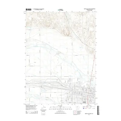 2014 North Platte West2014 Print · USGSCovers Village Square, including North Platte, Green Acres Trailer Court, and other nearby areas
 - 2017 Map of North Platte West, 2017 Print
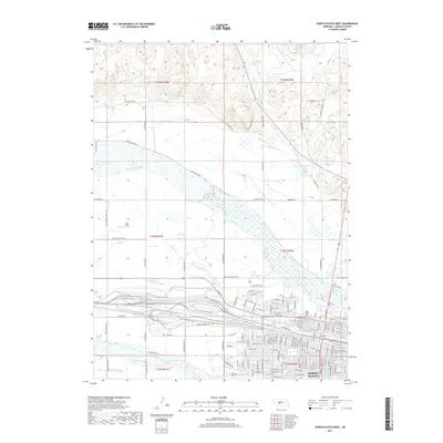 2017 North Platte West2017 Print · USGSCovers Village Square, including North Platte, Green Acres Trailer Court, and other nearby areas
 - 2021 Map of North Platte West, 2021 Print
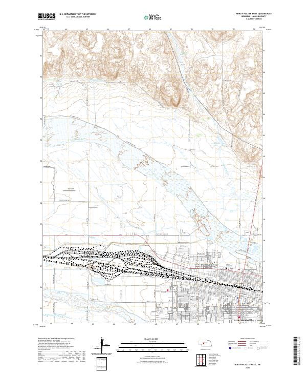 2021 North Platte West2021 Print · USGSNorth Platte and the Platte River valleys are documented here in the early 2020s, showing the intersection of heavy rail infrastructure and vital irrigation waterways. Researchers can trace the layout of the Lincoln County Courthouse and find family-named landmarks like Annie Oakley Trail and Scouts Rest Ranch Road.
End of results
Showing maps 1-12 of 12
Top cities near Village Square
Frequently asked questions
- What are the different types of historical maps available for Village Square?
- What is the oldest map of Village Square?
- Where can I purchase historical maps of Village Square for my home or office?
- Where can I download high-res historical maps of Village Square?
- Are there historical topographic maps available for Village Square?
- Is there historical aerial imagery available for Village Square?
- Where are historical maps of Village Square sourced from?