1970s Maps of Palisade, Nebraska
Explore 3 historic maps of Palisade from the 1970s. These maps offer a rare glimpse into what life looked like during the 1970s — showing old roads, neighborhoods, homes, and landmarks that have changed or disappeared over time.
Whether you're researching your family's past, planning a metal detecting trip, or studying how Palisade's landscape evolved across the 1970s, these high-resolution maps are a powerful tool for exploring the history of this region.
- Focus on a specific era: All maps on this page are from the 1970s, giving you a focused view of this time period.
- See what’s changed: Compare century-old streets, trails, and buildings to today's modern landscape using overlays and satellite layers.
- Research with precision: Use these maps for genealogy, historical research, land use analysis, or educational projects.
- View, download, or print: Maps are fully viewable online in high resolution, and can be downloaded or printed for your own records.
Start exploring Palisade's history through authentic maps from the 1970s. This is your window into the past.
Palisade, NE maps
(3)- 1973 Map of Palisade, 1977 Print
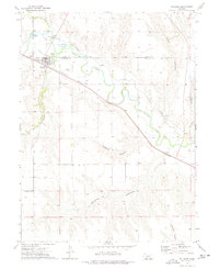 1973 Palisade1977 Print · USGSPalisade sat at the confluence of prairie creeks and the railroad during the early 1970s. Researchers can trace the layout of the town, find three burial sites like Old Palisade Cem, and follow the deep cuts of Massacre Canyon and Boevau Canyon.
 - 1974 Map of Palisade, 1977 Print
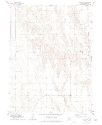 1974 Palisade1977 Print · USGSThe Nebraska plains at the junction of Hitchcock and Hayes counties are revealed in this mid-seventies survey. Genealogists and researchers can locate the Union Mission Cem and trace the winding paths of Blackwood Creek and Government Canyon.
 - 1979 Map of Benkelman
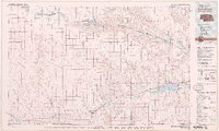 1979 Benkelman1979 Print · USGSSouthwestern Nebraska in the late seventies is shown as a network of river-valley towns and high-plains ranching country. Genealogists and researchers can trace the rail corridor through Benkelman, Culbertson, and Haigler, or locate the reservoir lands at Enders.
End of results
Showing maps 1-3 of 3
Top cities near Palisade
Top neighborhoods of Palisade
Frequently asked questions
- What are the different types of historical maps available for Palisade?
- What is the oldest map of Palisade?
- Where can I purchase historical maps of Palisade for my home or office?
- Where can I download high-res historical maps of Palisade?
- Are there historical topographic maps available for Palisade?
- Is there historical aerial imagery available for Palisade?
- Where are historical maps of Palisade sourced from?