Old Maps of Hadar, Nebraska for Metal Detecting
Plan your next treasure hunt with 9 historic maps of Hadar. Find old homesites, ghost towns, trails, and gathering spots that may be lost to time — perfect for identifying promising metal detecting locations.
- Locate forgotten sites: Uncover places like long-lost settlements, abandoned rail lines, or gathering spots.
- Plan better hunts: Use map overlays combined with LiDAR or satellite views to narrow in on historically rich areas.
- Made for detectorists: Thousands of hobbyists use these maps to discover relics, coins, and hidden history.
Use these historic maps to boost your research and find new opportunities beneath the surface of Hadar.
Hadar, NE maps
(9)- 1955 Map of Sioux City, 1959 Print
 1955 Sioux City1959 Print · USGSThe Missouri River valley in the mid-fifties is captured here during a time of major engineering and social transition. Genealogists and historians can trace the foundations of Gavins Point Dam, tribal boundaries on the Santee Sioux Indian Reservation, and local landmarks like the Norfolk State Hospital.4 unique versions available
 - 1958 Map of Sioux City
 1958 Sioux City1958 Print · USGSThe Missouri River valley in the late fifties was a bustling intersection of tribal lands, rail corridors, and river towns. Genealogists can trace family roots through specific rural sites like Daisy Valley School, St Johns Church and School, and Yankton State Hospital.
 - 1959 Map of Sioux City
 1959 Sioux City1959 Print · USGSThe tri-state region surrounding the Missouri River is captured here in the late fifties, showing the convergence of Nebraska, South Dakota, and Iowa. Researchers can trace rural lineages through numerous country schoolhouses like Cemetery School and the many numbered Washington School districts.
 - 1963 Map of Norfolk, 1964 Print
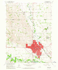 1963 Norfolk1964 Print · USGSMid-century Madison County is defined by the convergence of major rail lines and the winding Elkhorn River at a time of steady urban expansion. Trace the footprints of early institutions like the Norfolk State Hospital and Christian College, or locate vanished rural schoolhouses such as School No 20 and School No 1.2 unique versions available
 - 1985 Map of Norfolk, 1986 Print
 1985 Norfolk1986 Print · USGSNortheast Nebraska in the mid-eighties shows a landscape shaped by the Elkhorn River and established rail corridors. Trace the growth of towns like Norfolk and Wayne, locating institutional landmarks such as Wayne State College and Norfolk Regional Center.2 unique versions available
 - 2011 Map of Norfolk, 2011 Print
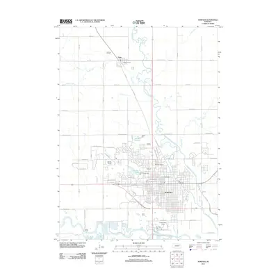 2011 Norfolk2011 Print · USGSCovers Hadar, including Norfolk, Mackels Mobile Home Court, and other nearby areas
 - 2014 Map of Norfolk, 2014 Print
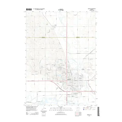 2014 Norfolk2014 Print · USGSCovers Hadar, including Norfolk, Mackels Mobile Home Court, and other nearby areas
 - 2017 Map of Norfolk, 2017 Print
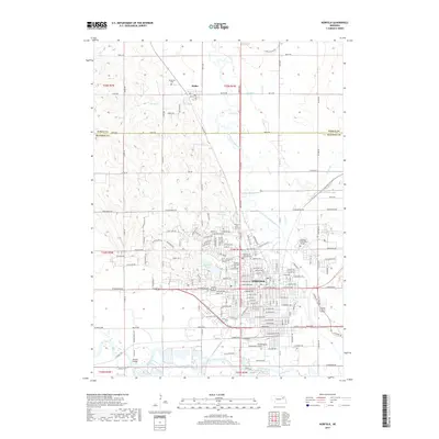 2017 Norfolk2017 Print · USGSCovers Hadar, including Norfolk, Mackels Mobile Home Court, and other nearby areas
 - 2021 Map of Norfolk, 2021 Print
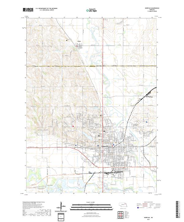 2021 Norfolk2021 Print · USGSMadison County at the start of the 2020s shows the expansion of its primary urban center where two river forks meet. Researchers can trace local history through sites like Prospect Hill Cem and Northeast Community College or the rural roads around Hadar.
End of results
Showing maps 1-9 of 9
Top cities near Hadar
- Norfolk historical maps
- Woodland Park historical maps
- Pierce historical maps
- Stanton historical maps
- Battle Creek historical maps
- Hoskins historical maps
See more
Frequently asked questions
- What are the different types of historical maps available for Hadar?
- What is the oldest map of Hadar?
- Where can I purchase historical maps of Hadar for my home or office?
- Where can I download high-res historical maps of Hadar?
- Are there historical topographic maps available for Hadar?
- Is there historical aerial imagery available for Hadar?
- Where are historical maps of Hadar sourced from?