2020s Maps of Polk County, Nebraska
Explore 16 historic maps of Polk County from the 2020s. These maps offer a rare glimpse into what life looked like during the 2020s — showing old roads, neighborhoods, homes, and landmarks that have changed or disappeared over time.
Whether you're researching your family's past, planning a metal detecting trip, or studying how Polk County's landscape evolved across the 2020s, these high-resolution maps are a powerful tool for exploring the history of this region.
- Focus on a specific era: All maps on this page are from the 2020s, giving you a focused view of this time period.
- See what’s changed: Compare century-old streets, trails, and buildings to today's modern landscape using overlays and satellite layers.
- Research with precision: Use these maps for genealogy, historical research, land use analysis, or educational projects.
- View, download, or print: Maps are fully viewable online in high resolution, and can be downloaded or printed for your own records.
Start exploring Polk County's history through authentic maps from the 2020s. This is your window into the past.
Polk County, NE maps
(16)- 2021 Map of Columbus SE, 2021 Print
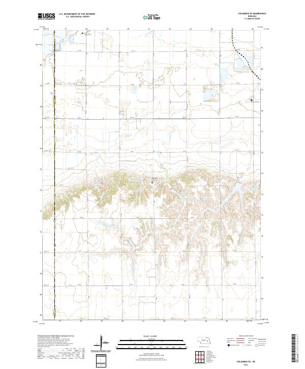 2021 Columbus SE2021 Print · USGSButler County and Polk County land ownership patterns are visible here in the modern era of rural Nebraska farming. Genealogists can locate family burial sites at Saint Joseph Cem and Pleasant View Cem or trace the drainage of Clear Creek.
 - 2021 Map of Osceola, 2021 Print
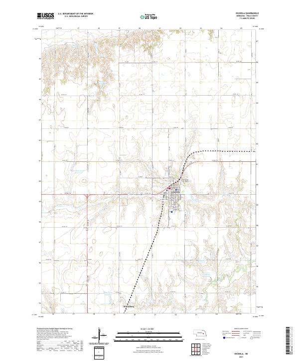 2021 Osceola2021 Print · USGSPolk County at the start of the 2020s shows a landscape of precision agriculture and careful water management. Researchers can locate the Polk County Courthouse in Osceola or trace local watersheds through Davis Cr and Anderson Reservoir.
 - 2021 Map of Clarks, 2021 Print
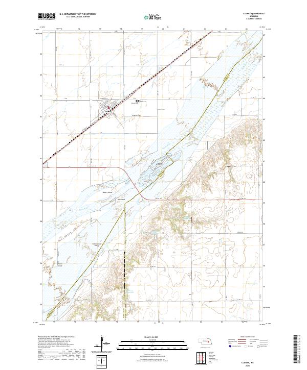 2021 Clarks2021 Print · USGSThe braided channels of the Platte River dominate the Nebraska plains near Clarks in this modern survey. Researchers can trace land use through the town's local cemeteries and island formations like Prairie Island and Cottonwood Island.
 - 2021 Map of Columbus SW, 2021 Print
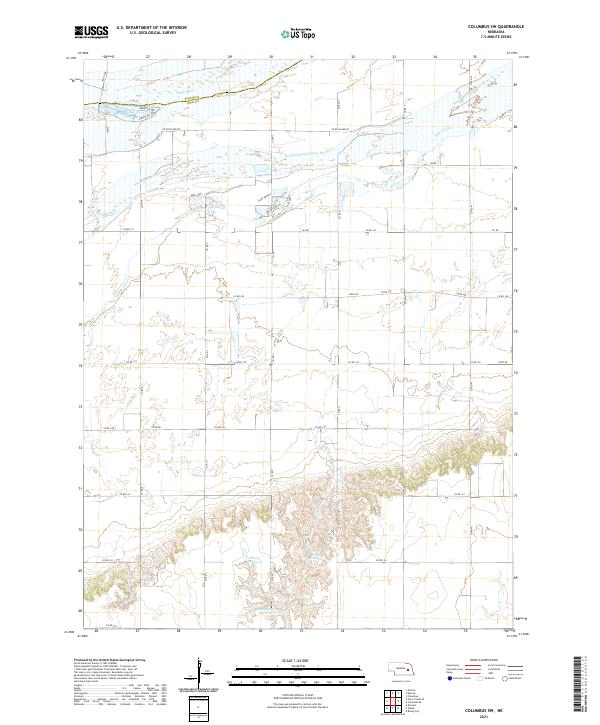 2021 Columbus SW2021 Print · USGSThe Platte River bottomlands in Polk County are captured here in the early twenty-first century, showing a highly developed agricultural landscape. Researchers can trace local water management through family-named features like Messing-Scow Reservoir, Perry Reservoir, and Deer Lake.
 - 2021 Map of Rising City, 2021 Print
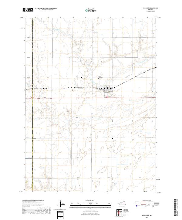 2021 Rising City2021 Print · USGSRising City and the surrounding Butler County farmlands are shown here in the early twenty-first century as the landscape remains defined by its agricultural roots. Researchers can trace family history at Circle Mound Cem, Fairview Cem, and Rising Sun Cem or map old property lines along the N Br Big Blue River.
 - 2021 Map of Silver Creek, 2021 Print
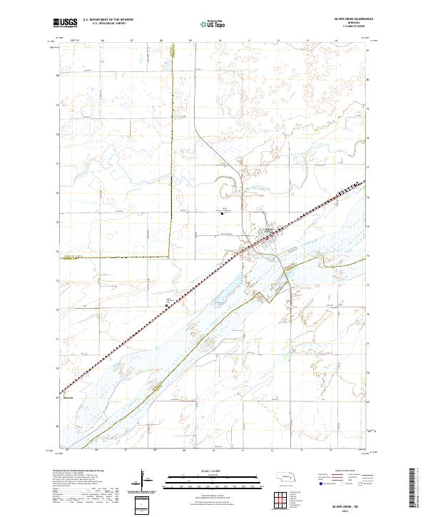 2021 Silver Creek2021 Print · USGSThe Platte River valley in Central Nebraska comes into focus here, showing the town of Silver Creek and the small siding at Havens. Researchers can trace local heritage at Silver Creek Cem or follow the meandering course of Prairie Creek.
 - 2021 Map of Durant, 2021 Print
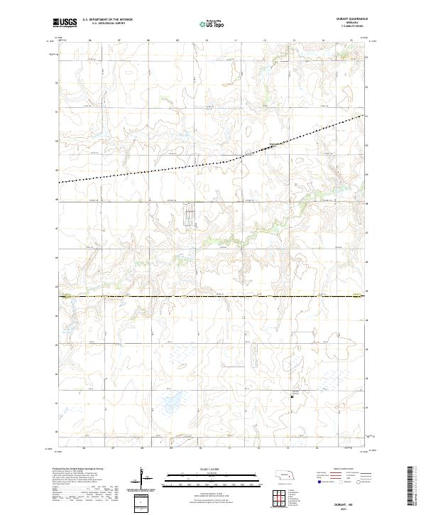 2021 Durant2021 Print · USGSAgricultural life in Polk and York Counties is captured here in the early 2020s, showing the intersection of the Big Blue River and the local road grid. Researchers can find the Pleasant Hill Cem and the settlement of Durant among the section lines.
 - 2021 Map of Silver Creek SE, 2021 Print
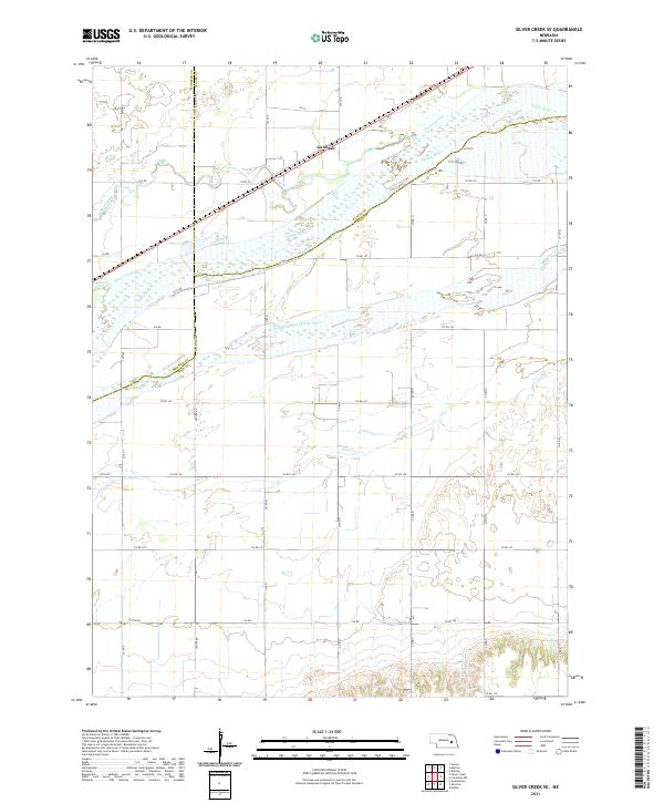 2021 Silver Creek SE2021 Print · USGSThe braided channels of the Platte River valley define this eastern Nebraska landscape as it appeared in the early twenty-first century. Genealogists and local historians can trace the rural grid around Gardiner and the complex waterways of Silver Creek and Clear Cr.
 - 2021 Map of Shelby, 2021 Print
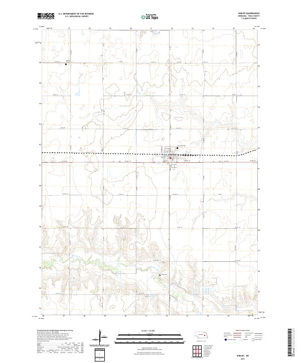 2021 Shelby2021 Print · USGSThe town of Shelby and the surrounding Polk County farmlands are captured in this recent survey. Researchers can trace family roots at Graceland Cem or Union Cem and follow the path of the Big Blue River.
 - 2021 Map of Swedehome, 2021 Print
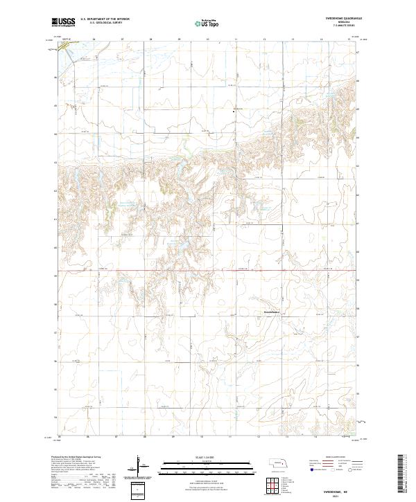 2021 Swedehome2021 Print · USGSThe agricultural plains of Polk County are captured in this modern survey, centered on the historic Swedish community of Swedehome. Genealogists and local historians can locate Calvary Cem & Ch and trace the path of Clear Creek through the section-line grid.
 - 2021 Map of Surprise, 2021 Print
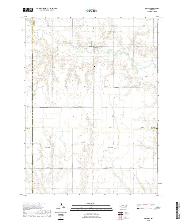 2021 Surprise2021 Print · USGSThe village of Surprise and the upper reaches of the Big Blue River are captured here at the start of the 2020s. Genealogists and local historians can trace the four-county boundary lines and locate landmarks like the Blue Valley Cem and Aldrich Reservoir.
 - 2021 Map of Gresham, 2021 Print
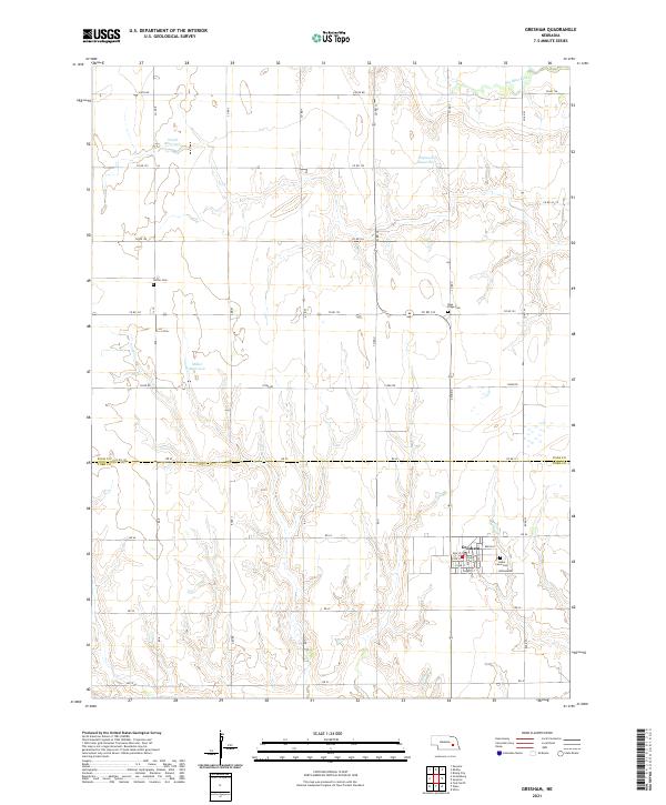 2021 Gresham2021 Print · USGSThe agricultural lands of York and Polk counties appear here in the early twenty-first century, centered on the village of Gresham. Researchers can locate family sites near rural landmarks like Cedar Lawn Cem, Blue Ridge Cem, and Hoffer Cem.
 - 2021 Map of Polk, 2021 Print
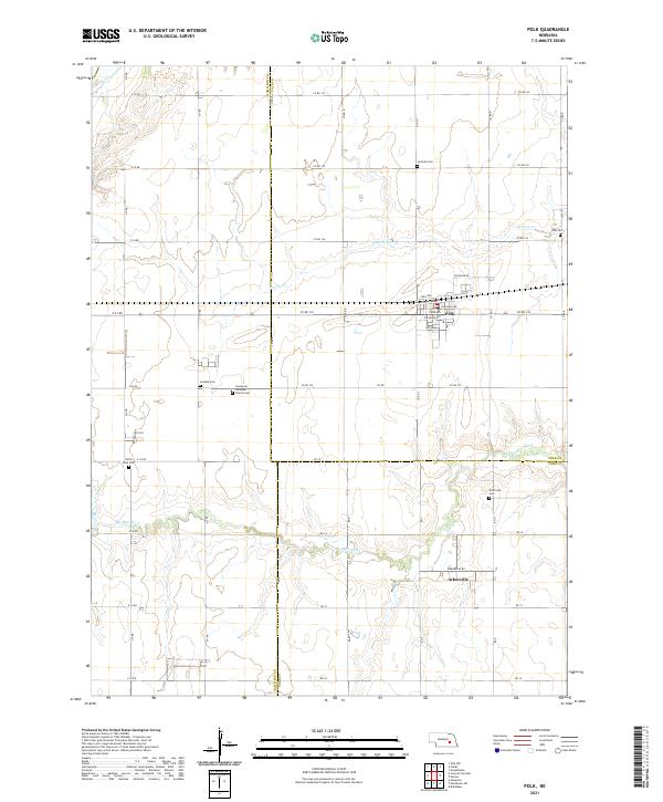 2021 Polk2021 Print · USGSPolk and the surrounding plains of eastern Nebraska are captured here at the start of the 2020s. Researchers can locate numerous rural burial grounds like Laclede Cem and Arborville Cem, or trace the winding course of the Big Blue River.
 - 2021 Map of Stromsburg, 2021 Print
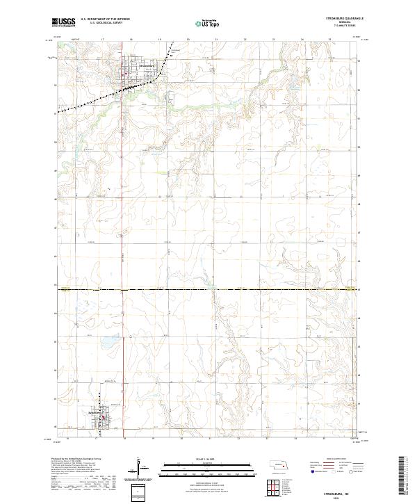 2021 Stromsburg2021 Print · USGSThe Polk and York County borderlands are documented here in the early 2020s, centered on the settled grids of Stromsburg and Benedict. Researchers can trace local land divisions and landmarks like Stromsburg Cem and the Big Blue River.
 - 2021 Map of Duncan, 2021 Print
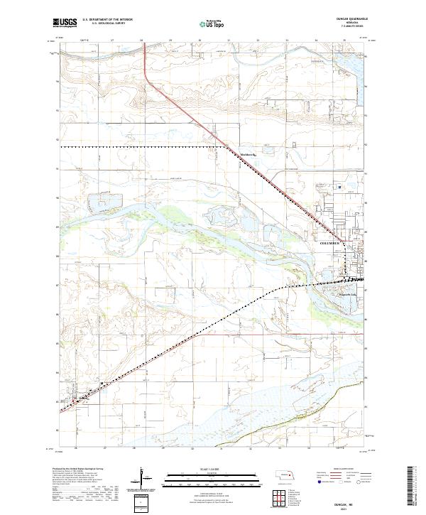 2021 Duncan2021 Print · USGSThe river valleys and farmsteads near Columbus and Duncan are documented in this recent survey. Local historians can trace the paths of Barnum Cr and Lost Cr or locate the historic Jackson Cem near the riverbanks.
 - 2021 Map of Columbus, 2021 Print
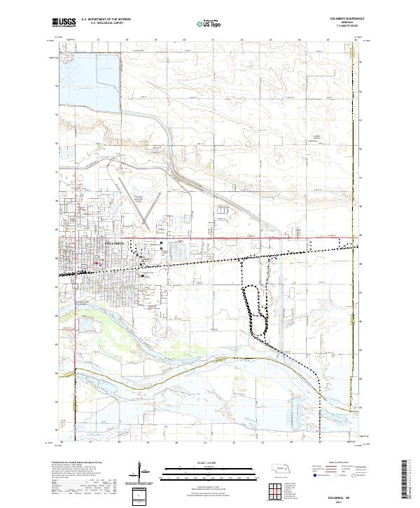 2021 Columbus2021 Print · USGSColumbus at the start of the 2020s shows a landscape of river-driven industry and growing suburban reach at the Platte and Loup confluence. Researchers can trace local heritage through sites like the Platte County Courthouse, Columbus Cem, and Roselawn Cem.
End of results
Showing maps 1-16 of 16
Top cities of Polk County
Frequently asked questions
- What are the different types of historical maps available for Polk County?
- What is the oldest map of Polk County?
- Where can I purchase historical maps of Polk County for my home or office?
- Where can I download high-res historical maps of Polk County?
- Are there historical topographic maps available for Polk County?
- Is there historical aerial imagery available for Polk County?
- Where are historical maps of Polk County sourced from?