2020s Maps of Crete, Nebraska
Explore 2 historic maps of Crete from the 2020s. These maps offer a rare glimpse into what life looked like during the 2020s — showing old roads, neighborhoods, homes, and landmarks that have changed or disappeared over time.
Whether you're researching your family's past, planning a metal detecting trip, or studying how Crete's landscape evolved across the 2020s, these high-resolution maps are a powerful tool for exploring the history of this region.
- Focus on a specific era: All maps on this page are from the 2020s, giving you a focused view of this time period.
- See what’s changed: Compare century-old streets, trails, and buildings to today's modern landscape using overlays and satellite layers.
- Research with precision: Use these maps for genealogy, historical research, land use analysis, or educational projects.
- View, download, or print: Maps are fully viewable online in high resolution, and can be downloaded or printed for your own records.
Start exploring Crete's history through authentic maps from the 2020s. This is your window into the past.
Crete, NE maps
(2)- 2021 Map of Crete South, 2021 Print
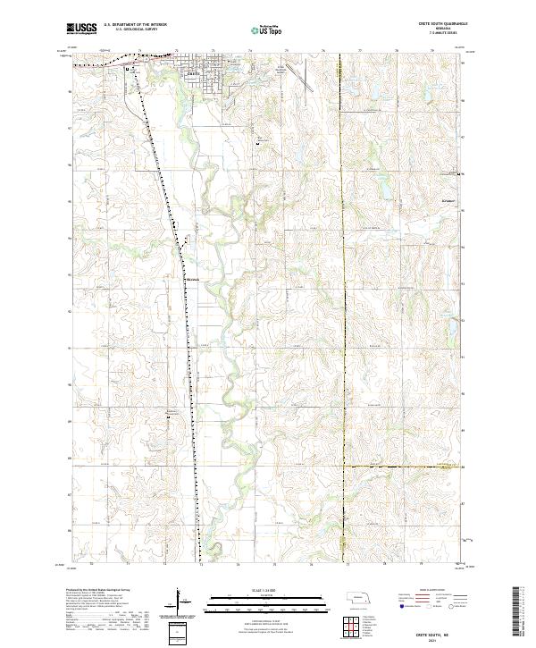 2021 Crete South2021 Print · USGSThe rural lands of Saline and Lancaster counties come into focus in the early 2020s, centered on the river valleys south of the university. Family historians can trace local landmarks like Bohemian National Cem and the small settlements of Shestak and Kramer.
 - 2021 Map of Crete North, 2021 Print
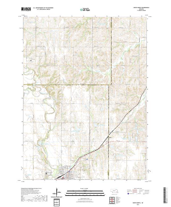 2021 Crete North2021 Print · USGSThe northern reaches of Crete and the surrounding farm country are captured here in the early 2020s. Researchers can trace rural lineages at Camden Cem and Riverside Cem or locate the tiny community of Berks along the corridor of Walnut Cr.
End of results
Showing maps 1-2 of 2
Top cities near Crete
- Lincoln historical maps
- Milford historical maps
- Wilber historical maps
- Dorchester historical maps
- Hallam historical maps
- Clatonia historical maps
See more
Frequently asked questions
- What are the different types of historical maps available for Crete?
- What is the oldest map of Crete?
- Where can I purchase historical maps of Crete for my home or office?
- Where can I download high-res historical maps of Crete?
- Are there historical topographic maps available for Crete?
- Is there historical aerial imagery available for Crete?
- Where are historical maps of Crete sourced from?