1900s (20th Century) Maps of Hubbell, Nebraska
Explore 6 historic maps of Hubbell from the 1900s (20th Century). These maps offer a rare glimpse into what life looked like during the 1900s — showing old roads, neighborhoods, homes, and landmarks that have changed or disappeared over time.
Whether you're researching your family's past, planning a metal detecting trip, or studying how Hubbell's landscape evolved across the 1900s, these high-resolution maps are a powerful tool for exploring the history of this region.
- Focus on a specific era: All maps on this page are from the 1900s, giving you a focused view of this time period.
- See what’s changed: Compare century-old streets, trails, and buildings to today's modern landscape using overlays and satellite layers.
- Research with precision: Use these maps for genealogy, historical research, land use analysis, or educational projects.
- View, download, or print: Maps are fully viewable online in high resolution, and can be downloaded or printed for your own records.
Start exploring Hubbell's history through authentic maps from the 1900s. This is your window into the past.
Hubbell, NE maps
(6)- 1955 Map of Lincoln, 1967 Print
 1955 Lincoln1967 Print · USGSSoutheast Nebraska in the mid-fifties presents a landscape of thriving railroad towns and the expanding footprint of the capital city. Researchers can trace the legacy of the pioneer era at the Homestead National Monument of America or locate mid-century military infrastructure like Lincoln Air Force Base.5 unique versions available
 - 1957 Map of Lincoln
 1957 Lincoln1957 Print · USGSSoutheastern Nebraska at mid-century shows a landscape of thriving rail towns and expanding infrastructure centered on Lincoln. Researchers can trace the path of the Chicago Burlington and Quincy railroad through communities like Weeping Water, Fairmont, and Seward.
 - 1958 Map of Lincoln
 1958 Lincoln1958 Print · USGSSoutheast Nebraska at the end of the 1950s shows a region defined by agricultural trade and the expansion of the state capital. Genealogists can trace family footprints across the Blue Valley and locate landmarks like the Lincoln AFB or the U.S. Veterans Hospital.
 - 1960 Map of Chester, 1961 Print
 1960 Chester1961 Print · USGSThe Nebraska-Kansas border in the early sixties was a landscape of rail-connected farming communities and rural schools. Genealogists can locate family burial sites at Chester Cem or St Johns Cem and trace the path of the Chicago Burlington and Quincy railroad.2 unique versions available
 - 1960 Map of Hubbell, 1961 Print
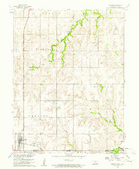
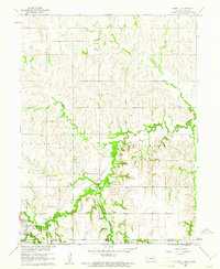 1960 Hubbell1961 Print · USGSThe Nebraska-Kansas borderlands come alive in the early sixties, showing a landscape defined by rail and river. Genealogists can trace family footprints through St Pauls Cem, Williams Cem, and the tracks of the Chicago Burlington and Quincy.2 unique versions available
 - 1985 Map of Fairbury
 1985 Fairbury1985 Print · USGSThe borderlands of Nebraska and Kansas thrive as a rail and agricultural hub in the mid-1980s. Genealogists and historians can trace local family lands near Fairbury or follow the historic Burlington Northern tracks through Hebron and Deshler.2 unique versions available
End of results
Showing maps 1-6 of 6
Top cities near Hubbell
- Belleville historical maps
- Hebron historical maps
- Deshler historical maps
- Chester historical maps
- Cuba historical maps
- Haddam historical maps
See more
Frequently asked questions
- What are the different types of historical maps available for Hubbell?
- What is the oldest map of Hubbell?
- Where can I purchase historical maps of Hubbell for my home or office?
- Where can I download high-res historical maps of Hubbell?
- Are there historical topographic maps available for Hubbell?
- Is there historical aerial imagery available for Hubbell?
- Where are historical maps of Hubbell sourced from?