Old Maps of Valley County, Nebraska for Metal Detecting
Plan your next treasure hunt with 68 historic maps of Valley County. Find old homesites, ghost towns, trails, and gathering spots that may be lost to time — perfect for identifying promising metal detecting locations.
- Locate forgotten sites: Uncover places like long-lost settlements, abandoned rail lines, or gathering spots.
- Plan better hunts: Use map overlays combined with LiDAR or satellite views to narrow in on historically rich areas.
- Made for detectorists: Thousands of hobbyists use these maps to discover relics, coins, and hidden history.
Use these historic maps to boost your research and find new opportunities beneath the surface of Valley County.
Valley County, NE maps
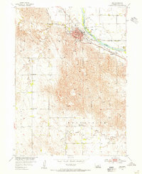
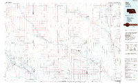
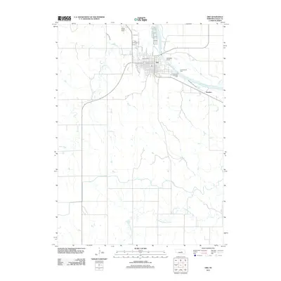
(68)- 1899 Map of Loup
 1899 Loup1899 Print · USGSCentral Nebraska at the end of the century was a land defined by its rivers and expanding rail lines. Genealogists can trace the early pioneer hubs of Dannebrog, Ashton, and Scotia along the Union Pacific RR.2 unique versions available
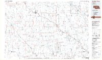
 - 1951 Map of Arcadia West, 1953 Print
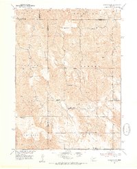
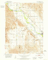 1951 Arcadia West1953 Print · USGSThe Middle Loup River valley in the early fifties shows a landscape defined by rail, irrigation, and dozens of rural schoolhouses. Trace the path of the Chicago Burlington and Quincy railroad past Arcadia, Sacred Heart Cem, and Knight Sch.3 unique versions available
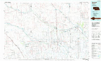
 - 1951 Map of Arcadia East, 1953 Print
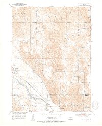 1951 Arcadia East1953 Print · USGSValley and Sherman Counties come alive in this early postwar record of the Middle Loup River valley. Genealogists and local historians can locate numerous rural schoolhouses like Old Yale Sch and Arbordale Sch or trace the Chicago Burlington and Quincy rail line.3 unique versions available
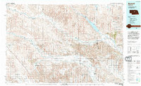
 - 1952 Map of Elyria, 1954 Print
 1952 Elyria1954 Print · USGSValley County farming and rail life are centered on the river in the early fifties. Genealogists and historians can locate the Site of Fort Hartsuff, the Elyria Cem, and rural schools like Sunnyside Sch or Goodenow Sch.2 unique versions available
 - 1952 Map of Comstock, 1954 Print
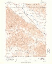
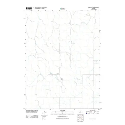
 1952 Comstock1954 Print · USGSThe village of Comstock and the Middle Loup River valley are captured here in the early fifties, showing the rural infrastructure of central Nebraska. Genealogists can trace family footprints at Bohemian Cem, Round Park Cem, and the district's many schoolhouses like Pleasant View Sch.3 unique versions available
 - 1952 Map of Comstock NW, 1954 Print
 1952 Comstock NW1954 Print · USGSThe high plains of central Nebraska were a patchwork of rural school districts and immigrant parish life in the early fifties. Genealogists can trace local roots through landmarks like the Bohemian Brotherhood Cemetery, Jungmann Hall, and the Boleszyn Church.2 unique versions available
 - 1952 Map of Comstock SE, 1954 Print
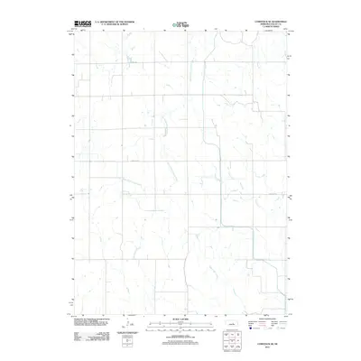
 1952 Comstock SE1954 Print · USGSValley County schoolhouses and creeks define the rural landscape in the early fifties. Genealogists and local historians can locate early prairie school sites including Hardscrabble Sch, Sunny Slope Sch, and Geranium Sch along the banks of Dane Creek.2 unique versions available
 - 1953 Map of Loup City NW, 1955 Print
 1953 Loup City NW1955 Print · USGSValley and Sherman Counties were defined by a robust network of rural schoolhouses and small creeks in the early fifties. Researchers can trace ancestral connections through the Davis Creek Cem, Evangelical Ch, and numerous school sites like School No 47.2 unique versions available
 - 1953 Map of North Loup, 1955 Print
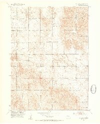
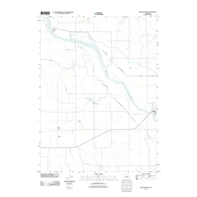
 1953 North Loup1955 Print · USGSNorth Loup and its surrounding townships are shown in the early fifties, capturing a period when rural schoolhouses still dotted the Nebraska landscape. Researchers can trace the Union Pacific rail line and find local landmarks like Hillside Cem, Pleasant Hill Sch, and Deer Creek Sch.2 unique versions available
 - 1954 Map of Ord SE, 1955 Print
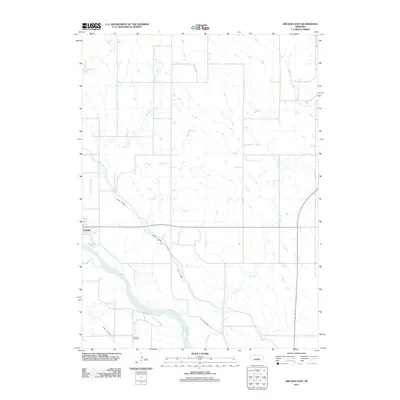
 1954 Ord SE1955 Print · USGSValley and Greeley Counties are captured here in the mid-fifties, showing a river valley defined by its irrigation canals and dual railroads. Genealogists and historians can trace the locations of rural schools like Olean Sch and the rail junctions at Spelts and North Loup.3 unique versions available
 - 1954 Map of Ord, 1955 Print
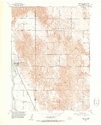
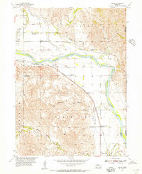
 1954 Ord1955 Print · USGSValley County, Nebraska, serves as a busy rail and river hub during the mid-fifties, anchored by the town of Ord. Genealogists and local historians can trace rural school locations like Vinton Sch and Brace Sch or explore the vanished settlement of Saunders.3 unique versions available
 - 1954 Map of Ord NE, 1955 Print
 1954 Ord NE1955 Print · USGSThe rural Nebraska prairie in the mid-1950s was a landscape defined by small township school districts and essential water infrastructure. Researchers can trace the locations of historic schools like Plain Valley and Brick Sch or follow the paths of Elm Creek and Spring Creek.2 unique versions available
 - 1954 Map of Ord NW, 1955 Print
 1954 Ord NW1955 Print · USGSThe North Loup River valley in Valley County is captured here in the mid-1950s during the development of the Missouri River Basin. Genealogists and local historians can locate several rural schoolhouses like Sunnyslope Sch and trace the Chicago Burlington and Quincy rail line.2 unique versions available
 - 1955 Map of Broken Bow
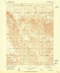
 1955 Broken Bow1955 Print · USGSCentral Nebraska in the mid-fifties is defined by the sweeping Sand Hills and the vital river valleys that supported its ranching and rail towns. Researchers can trace the rail corridors of the Union Pacific RR and locate settlements like Dannebrog, Broken Bow, and Brewster.5 unique versions available
 - 1956 Map of Broken Bow
 1956 Broken Bow1956 Print · USGSCentral Nebraska during the mid-fifties reveals a region defined by its river-valley railroads and the rolling Sand Hills. Genealogists and local historians can trace the paths of the Chicago Burlington and Quincy through towns like Broken Bow, Merna, and Anselmo.
 - 1985 Map of St. Paul
 1985 St. Paul1985 Print · USGSCentral Nebraska's river valleys and rail towns are captured here in the mid-eighties, showing the region's agricultural and cultural foundations. Researchers can trace historic communities like Dannebrog, Scotia, and Nysted, or locate landmarks such as Sherman Reservoir and Happy Jack Peak.2 unique versions available
 - 1985 Map of Ord
 1985 Ord1985 Print · USGSCentral Nebraska's river valleys were defined by the rail and irrigation networks of the mid-1980s. Genealogists can trace family roots in towns like Ord and Albion or locate landmarks like Pilot Knob and the Pibel Lake State Recreation Area.2 unique versions available
 - 1985 Map of Broken Bow
 1985 Broken Bow1985 Print · USGSCuster County in the mid-1980s displays a landscape of high tablelands and river valleys shaped by the reach of the railroad. Genealogists and researchers can trace the old rail stops along Mud Creek, from Berwyn to Litchfield, or locate land near Redfern Table and West Table.2 unique versions available
 - 1985 Map of Burwell
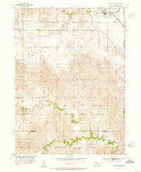
 1985 Burwell1985 Print · USGSCentral Nebraska in the mid-eighties reveals a landscape shaped by the Middle Loup River and the Burlington Northern rail line. Researchers can trace the layout of small towns like Sargent, Anselmo, and Burwell or locate New Helena and Victoria Springs State Recreation Area.
 - 1994 Map of Burwell
 1994 Burwell1994 Print · USGSThe Nebraska Sandhills region is captured here in the mid-nineties, showing a landscape shaped by the Loup River systems and vital irrigation networks. Researchers can trace the development of small towns like Burwell and Brewster or locate landmarks like the Milburn Diversion Dam.
 - 2011 Map of Comstock NW, 2011 Print
 2011 Comstock NW2011 Print · USGSCovers Valley County, including Garfield County, Custer County, and other nearby areas
 - 2011 Map of Comstock SE, 2011 Print
 2011 Comstock SE2011 Print · USGSCovers Valley County, including United States, Nebraska, and other nearby areas
 - 2011 Map of Arcadia West, 2011 Print
 2011 Arcadia West2011 Print · USGSCovers Valley County, including Arcadia, Custer County, and other nearby areas
 - 2011 Map of Arcadia East, 2011 Print
 2011 Arcadia East2011 Print · USGSCovers Valley County, including Arcadia, Sherman County, and other nearby areas
 - 2011 Map of Ord, 2011 Print
 2011 Ord2011 Print · USGSCovers Valley County, including Ord, Manchester Trailer Court, and other nearby areas
Showing maps 1-25 of 68
Top cities of Valley County
Frequently asked questions
- What are the different types of historical maps available for Valley County?
- What is the oldest map of Valley County?
- Where can I purchase historical maps of Valley County for my home or office?
- Where can I download high-res historical maps of Valley County?
- Are there historical topographic maps available for Valley County?
- Is there historical aerial imagery available for Valley County?
- Where are historical maps of Valley County sourced from?