Old Maps of Ord, Nebraska for Metal Detecting
Plan your next treasure hunt with 8 historic maps of Ord. Find old homesites, ghost towns, trails, and gathering spots that may be lost to time — perfect for identifying promising metal detecting locations.
- Locate forgotten sites: Uncover places like long-lost settlements, abandoned rail lines, or gathering spots.
- Plan better hunts: Use map overlays combined with LiDAR or satellite views to narrow in on historically rich areas.
- Made for detectorists: Thousands of hobbyists use these maps to discover relics, coins, and hidden history.
Use these historic maps to boost your research and find new opportunities beneath the surface of Ord.
Ord, NE maps
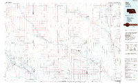
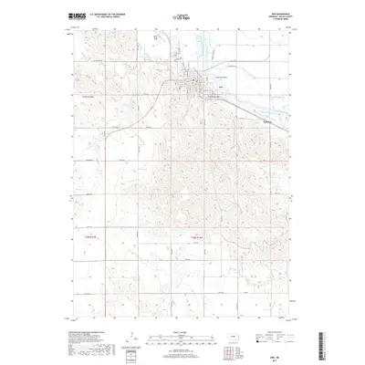
(8)- 1954 Map of Ord, 1955 Print
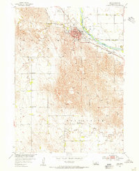 1954 Ord1955 Print · USGSValley County, Nebraska, serves as a busy rail and river hub during the mid-fifties, anchored by the town of Ord. Genealogists and local historians can trace rural school locations like Vinton Sch and Brace Sch or explore the vanished settlement of Saunders.3 unique versions available
 - 1955 Map of Broken Bow
 1955 Broken Bow1955 Print · USGSCentral Nebraska in the mid-fifties is defined by the sweeping Sand Hills and the vital river valleys that supported its ranching and rail towns. Researchers can trace the rail corridors of the Union Pacific RR and locate settlements like Dannebrog, Broken Bow, and Brewster.5 unique versions available
 - 1956 Map of Broken Bow
 1956 Broken Bow1956 Print · USGSCentral Nebraska during the mid-fifties reveals a region defined by its river-valley railroads and the rolling Sand Hills. Genealogists and local historians can trace the paths of the Chicago Burlington and Quincy through towns like Broken Bow, Merna, and Anselmo.
 - 1985 Map of Ord
 1985 Ord1985 Print · USGSCentral Nebraska's river valleys were defined by the rail and irrigation networks of the mid-1980s. Genealogists can trace family roots in towns like Ord and Albion or locate landmarks like Pilot Knob and the Pibel Lake State Recreation Area.2 unique versions available
 - 2011 Map of Ord, 2011 Print
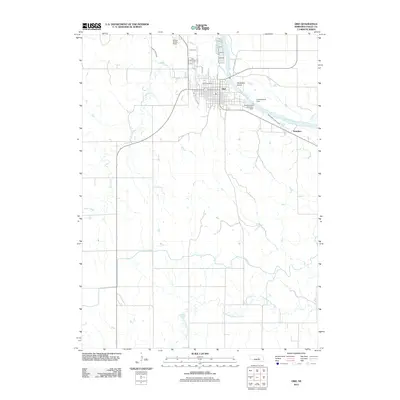 2011 Ord2011 Print · USGSCovers Ord, including Manchester Trailer Court, Saunders, and other nearby areas
 - 2014 Map of Ord, 2014 Print
 2014 Ord2014 Print · USGSCovers Ord, including Manchester Trailer Court, Saunders, and other nearby areas
 - 2017 Map of Ord, 2017 Print
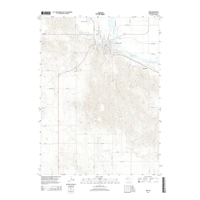
 2017 Ord2017 Print · USGSCovers Ord, including Manchester Trailer Court, Saunders, and other nearby areas
 - 2021 Map of Ord, 2021 Print
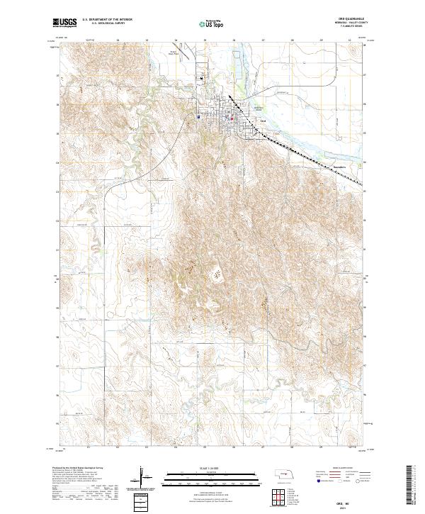 2021 Ord2021 Print · USGSThe North Loup River valley of central Nebraska is shown here in modern detail, illustrating the settlement of Ord and its surrounding irrigation network. Trace local genealogy at the Ord Cem or locate historical landmarks like the Valley County Courthouse and Evelyn Sharp Field.
End of results
Showing maps 1-8 of 8
Top cities near Ord
- Burwell historical maps
- Arcadia historical maps
- North Loup historical maps
- Scotia historical maps
- Elyria historical maps
Top neighborhoods of Ord
Frequently asked questions
- What are the different types of historical maps available for Ord?
- What is the oldest map of Ord?
- Where can I purchase historical maps of Ord for my home or office?
- Where can I download high-res historical maps of Ord?
- Are there historical topographic maps available for Ord?
- Is there historical aerial imagery available for Ord?
- Where are historical maps of Ord sourced from?