
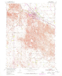
1954 Map of Ord
USGS Topo · Published 1955About this map
The Ord townsite serves as the central hub of this mid-century Nebraska landscape, situated where the North Loup River meets Dane Creek. As a vital rail junction, the town is served by both the Union Pacific and the Chicago Burlington and Quincy railroads, reflecting its role as a regional transportation and agricultural center. The Valley County courthouse and the Post Office anchor the street grid, while the Ord Municipal Airport to the north signals post-war modernization.
Find a feature on this map
28 named features on this map. Tap any name to fly to it.
Don’t see what you’re looking for? This feature index may not catch every label — zoom into the map to look around manually.
Map Details
Editions of this 1954 Ord Map
Other maps of this area

1899 · Loup
USGS Topo · 1:125,000

1951 · Arcadia East
USGS Topo · 1:24,000

1952 · Elyria
USGS Topo · 1:24,000

1952 · Comstock SE
USGS Topo · 1:24,000

1953 · Loup City NW
USGS Topo · 1:24,000

1953 · North Loup
USGS Topo · 1:24,000

1954 · Ord SE
USGS Topo · 1:24,000

1954 · Ord NE
USGS Topo · 1:24,000

1954 · Ord NW
USGS Topo · 1:24,000

1955 · Broken Bow
USGS Topo · 1:250,000