
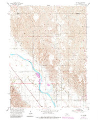
1954 Map of Ord NW
USGS Topo · Published 1955About this map
The North Loup River valley in Valley County defines this mid-century landscape, where irrigation and transportation networks shaped rural development. The Chicago Burlington and Quincy railroad line cuts diagonally across the southern plains, paralleling the Burwell Sumter and Quincy Canal as it draws water from the river. This survey captures a dense network of one-room schoolhouses that served the surrounding agricultural townships, including Haskell Creek Sch, Sunnyslope Sch, and Post Sch. The terrain transitions from the river bottomlands of Ord and Michigan townships into the dissected uplands of Midvale and Dry Cedar. Key local infrastructure is clearly marked, from the Ord Municipal Airport at the southern edge to various flumes and windmills that supported the area's cattle and grain operations during the post-war era.
Find a feature on this map
24 named features on this map. Tap any name to fly to it.
Don’t see what you’re looking for? This feature index may not catch every label — zoom into the map to look around manually.
Map Details
Editions of this 1954 Ord NW Map
2 editions found
Other maps of this area

1952 · Elyria
USGS Topo · 1:24,000

1952 · Burwell SE
USGS Topo · 1:24,000

1952 · Comstock SE
USGS Topo · 1:24,000

1954 · Ord SE
USGS Topo · 1:24,000

1954 · Ord
USGS Topo · 1:24,000

1954 · Gables SE
USGS Topo · 1:24,000

1954 · Gables SW
USGS Topo · 1:24,000

1954 · Ord NE
USGS Topo · 1:24,000

1955 · Broken Bow
USGS Topo · 1:250,000

1956 · Broken Bow
USGS Topo · 1:250,000