Old Maps of Amboy, Nebraska for Genealogy
Trace your family roots with 10 historic maps of Amboy. These high-res maps reveal old neighborhoods, homesites, landmarks, and streets — helping you uncover where your ancestors lived and how the area evolved over time.
- Explore historic neighborhoods: Identify where your relatives may have lived in the 1800s or 1900s.
- Compare maps over time: Trace the changes in streets, buildings, and landmarks for multi-generational research.
- Perfect for genealogy & ancestry research: Used by family historians and researchers to map out lineage and migration.
These maps are an incredible resource for exploring your personal connection to Amboy's past.
Amboy, NE maps
(10)- 1898 Map of Superior
 1898 Superior1898 Print · USGSSouthern Nebraska and northern Kansas were dominated by a growing rail network in the late nineteenth century. Genealogists can trace family roots through early settlements like Superior, Nelson, and Guide Rock, or locate vanished tracks of the Kansas City and Omaha R. R.3 unique versions available
 - 1955 Map of Grand Island, 1967 Print
 1955 Grand Island1967 Print · USGSCentral Nebraska is seen here during a period of industrial and agricultural growth, centered on the vital Platte River corridor. Researchers can trace the mid-century footprints of the U S Naval Ammunition Depot and the Cornhusker Ordnance Plant.3 unique versions available
 - 1957 Map of Grand Island
 1957 Grand Island1957 Print · USGSCentral Nebraska and Northern Kansas are shown here during a period of massive hydraulic and military expansion in the mid-fifties. Researchers can trace the development of the Harlan County Reservoir and the massive wartime legacy of the Cornhusker Ordnance Plant.
 - 1958 Map of Grand Island
 1958 Grand Island1958 Print · USGSSouth-central Nebraska thrived as a rail and industrial hub during the late fifties, shaped by the braided Platte River. Genealogists and historians can trace rail lines like the Union Pacific RR through towns such as Kearney or locate the sprawling Cornhusker Ordnance Plant.
 - 1974 Map of Amboy, 1977 Print
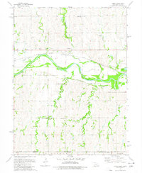 1974 Amboy1977 Print · USGSThe Nebraska-Kansas border region comes into focus during the mid-seventies as the Republican River winds past Amboy. Genealogists and historians can trace rail history at Lester Junction or locate family plots at Pleasant Hill Cem and Wagoner Cem.
 - 1985 Map of Red Cloud
 1985 Red Cloud1985 Print · USGSSouth Central Nebraska and the Kansas borderlands appear in high detail during the mid-eighties as a landscape of river-fed agriculture and rail-connected prairie towns. Researchers can trace the Burlington Northern tracks through Red Cloud or locate the extensive Courtland Canal and Superior-Courtland Diversion Dam.2 unique versions available
 - 2011 Map of Amboy, 2011 Print
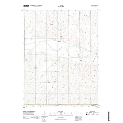
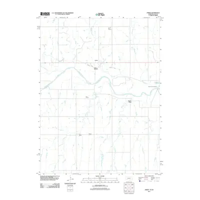 2011 Amboy2011 Print · USGSCovers Amboy, including Pawnee Village, Webster County, and other nearby areas
 - 2014 Map of Amboy, 2014 Print
 2014 Amboy2014 Print · USGSCovers Amboy, including Pawnee Village, Webster County, and other nearby areas
 - 2017 Map of Amboy, 2017 Print
 2017 Amboy2017 Print · USGSCovers Amboy, including Pawnee Village, Webster County, and other nearby areas
 - 2021 Map of Amboy, 2021 Print
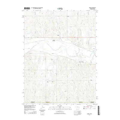
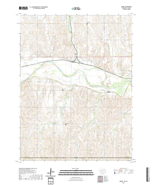 2021 Amboy2021 Print · USGSThe Nebraska-Kansas borderland comes into focus in the early 2020s, centered on the river valley south of Red Cloud. Researchers can trace rural lineages at Wagoner Cem and Martin Cem or explore the geography of Pawnee Village and Amboy.
End of results
Showing maps 1-10 of 10
Top cities near Amboy
- Red Cloud historical maps
- Lawrence historical maps
- Burr Oak historical maps
- Guide Rock historical maps
- Cowles historical maps
Frequently asked questions
- What are the different types of historical maps available for Amboy?
- What is the oldest map of Amboy?
- Where can I purchase historical maps of Amboy for my home or office?
- Where can I download high-res historical maps of Amboy?
- Are there historical topographic maps available for Amboy?
- Is there historical aerial imagery available for Amboy?
- Where are historical maps of Amboy sourced from?