Old Maps of Pinion Hills, Carson City for Genealogy
Trace your family roots with 14 historic maps of Pinion Hills. These high-res maps reveal old neighborhoods, homesites, landmarks, and streets — helping you uncover where your ancestors lived and how the area evolved over time.
- Explore historic neighborhoods: Identify where your relatives may have lived in the 1800s or 1900s.
- Compare maps over time: Trace the changes in streets, buildings, and landmarks for multi-generational research.
- Perfect for genealogy & ancestry research: Used by family historians and researchers to map out lineage and migration.
These maps are an incredible resource for exploring your personal connection to Pinion Hills's past.
Pinion Hills, Carson City maps
(14)- 1891 Map of Carson
 1891 Carson1891 Print · USGSSilver mining and rail expansion dominate this late-century look at the Comstock Lode region, from the heights of Virginia to the capital at Carson. Researchers can trace the winding Virginia and Truckee Railroad and locate early sites like Gold Hill, Sutro, and the State Prison.
 - 1893 Map of Carson
 1893 Carson1893 Print · USGSThe Comstock Lode era is in full view here during the 1890s, centering on the silver mining centers and early rail networks of the Nevada territory. Trace the path of the Virginia and Truckee R.R. and locate historic sites like Sutro, Gold Hill, and the State Prison near Carson.9 unique versions available
 - 1956 Map of Dayton, 1958 Print
 1956 Dayton1958 Print · USGSThe silver-country landscape around the Carson River is shown here in the mid-1950s, bridging the mining era and modern institutional development. Researchers can trace the Old RR Grade and locate historic sites such as Mound House and the Daney Mine.3 unique versions available
 - 1957 Map of Reno, 1963 Print
 1957 Reno1963 Print · USGSWestern Nevada in the early sixties is a land of sprawling desert sinks and rising mountain ranges. Genealogists and historians can trace the rail-and-river network connecting Reno, the mining legacy of Rawhide Mine, and the boundaries of the Pyramid Lake Indian Reservation.5 unique versions available
 - 1959 Map of Reno
 1959 Reno1959 Print · USGSWestern Nevada in the late fifties was a land of expanding military airbases and high-desert irrigation projects. You can trace the lineage of the Comstock era through Carson City, locate the Pony Express Monument, or study the rail networks of the Southern Pacific RR.
 - 1960 Map of Reno
 1960 Reno1960 Print · USGSThe high desert of western Nevada comes alive in this mid-century survey of the Reno-Tahoe region. Genealogists and historians can trace rail lines like the Southern Pacific RR and locate remote outposts such as Olinghouse, Nixon, and the Olinghouse Mine.2 unique versions available
 - 1968 Map of New Empire, 1971 Print
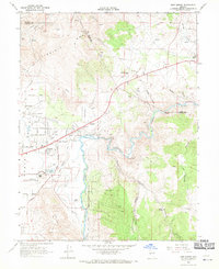 1968 New Empire1971 Print · USGSCarson City and the Virginia Range meet in this late-sixties study of Nevada's industrial heartland and growing capital. Researchers can trace the ruins of historic silver-processing sites like the Morgan Mill and the Old Mexican Mill along the Carson River.3 unique versions available
 - 1974 Map of New Empire, 1977 Print
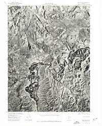 1974 New Empire1977 Print · USGSCarson City and the adjacent industrial site of New Empire are shown in detail through mid-1970s aerial photography. Trace the city’s expansion into Eagle Valley and follow the natural curves of the Carson River as it winds toward the foothills.
 - 1979 Map of Carson City, 1980 Print
 1979 Carson City1980 Print · USGSWestern Nevada in the late seventies reveals a landscape of historic mining districts and expanding mountain communities. Researchers can trace the Comstock Lode through Virginia City, locate the Stewart Indian School, or explore the shores of Lake Tahoe near Incline Village.2 unique versions available
 - 1994 Map of New Empire
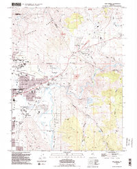 1994 New Empire1994 Print · USGSEastern Carson City and the rugged foothills of the Virginia Range are captured in the mid-1990s as the state capital expanded toward its historic mining districts. Researchers can find landmarks like the Nevada State Prison and the Old Mexican Mill, along with the site of Mound House.2 unique versions available
 - 2011 Map of New Empire, 2011 Print
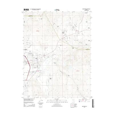
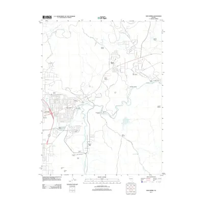 2011 New Empire2011 Print · USGSCovers Pinion Hills, including Mound House, Washoe County, and other nearby areas
 - 2014 Map of New Empire, 2014 Print
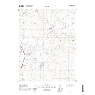
 2014 New Empire2014 Print · USGSCovers Pinion Hills, including Mound House, Washoe County, and other nearby areas
 - 2018 Map of New Empire, 2018 Print
 2018 New Empire2018 Print · USGSCovers Pinion Hills, including Mound House, Washoe County, and other nearby areas
 - 2021 Map of New Empire, 2021 Print
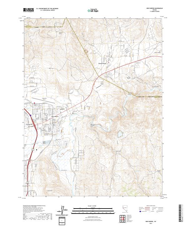 2021 New Empire2021 Print · USGSEagle Valley and the Carson River corridor are shown during a period of modern growth and historical preservation. Genealogists and local historians can trace family sites at Empire Cem or explore the rugged reaches of Brunswick Canyon and Mound House.
End of results
Showing maps 1-14 of 14
Frequently asked questions
- What are the different types of historical maps available for Pinion Hills?
- What is the oldest map of Pinion Hills?
- Where can I purchase historical maps of Pinion Hills for my home or office?
- Where can I download high-res historical maps of Pinion Hills?
- Are there historical topographic maps available for Pinion Hills?
- Is there historical aerial imagery available for Pinion Hills?
- Where are historical maps of Pinion Hills sourced from?