Old Maps of Logandale, Moapa Valley for Genealogy
Trace your family roots with 13 historic maps of Logandale. These high-res maps reveal old neighborhoods, homesites, landmarks, and streets — helping you uncover where your ancestors lived and how the area evolved over time.
- Explore historic neighborhoods: Identify where your relatives may have lived in the 1800s or 1900s.
- Compare maps over time: Trace the changes in streets, buildings, and landmarks for multi-generational research.
- Perfect for genealogy & ancestry research: Used by family historians and researchers to map out lineage and migration.
These maps are an incredible resource for exploring your personal connection to Logandale's past.
Logandale, Moapa Valley maps
(13)- 1886 Map of Saint Thomas
 1886 Saint Thomas1886 Print · USGSSoutheastern Nevada's river valleys and early trails are captured here in the late nineteenth century, long before the creation of Lake Mead. Genealogists and historians can locate early settlements like Saint Thomas and Old Callville, and trace river crossings at Stone Ferry and Scanlon Ferry.6 unique versions available
 - 1893 Map of Saint Thomas
 1893 Saint Thomas1893 Print · USGSSouthern Nevada at the close of the nineteenth century reveals a network of river-based settlements and trails. Genealogists and researchers can trace the early locations of Saint Thomas, Old Callville, and the Stone Ferry crossing.
 - 1954 Map of Las Vegas
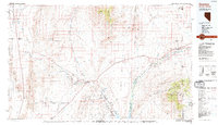
 1954 Las Vegas1954 Print · USGSLas Vegas and the Mojave Desert are shown in the early fifties as the region's military and recreational footprint expanded. Genealogists and historians can trace the early layout of North Las Vegas, the sites of Indian Springs Air Force Base, and long-established towns like Bunkerville.5 unique versions available
 - 1957 Map of Las Vegas
 1957 Las Vegas1957 Print · USGSSouthern Nevada in the mid-fifties is a landscape of massive federal ranges and the early growth of Las Vegas. Researchers can trace the development of McCarran Field, the expansive Lake Mead National Recreation Area, and the industrial footprint of Henderson.
 - 1958 Map of Overton, 1960 Print
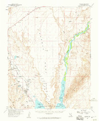 1958 Overton1960 Print · USGSEastern Clark County's desert valley appears here in the late fifties as a hub of rail transit and river management. Genealogists and historians can trace the foundations of Overton and Logandale alongside the Union Pacific line and the shores of Mead Lake.3 unique versions available
 - 1959 Map of Las Vegas
 1959 Las Vegas1959 Print · USGSSouthern Nevada in the late fifties was a landscape of rapid suburban growth and massive federal installations. Genealogists and historians can trace early housing at Victory Village, the grounds of Camp Desert Rock, and the remote Tule Springs Ranch.
 - 1962 Map of Las Vegas
 1962 Las Vegas1962 Print · USGSSouthern Nevada is captured here during a period of significant military and industrial growth in the early sixties. Researchers can trace the development of Las Vegas alongside the Magnesium Plant in Henderson and the expansive Nellis Air Force Base.
 - 1983 Map of Overton, 1984 Print
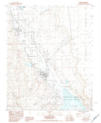 1983 Overton1984 Print · USGSThe Moapa Valley comes alive in this early 1980s survey as the northern arm of Mead Lake meets the desert. Genealogists and historians can trace the streets of Overton and Logandale, locate the local Cem, or follow the path of the Union Pacific railroad.
 - 1987 Map of Overton, 1988 Print
 1987 Overton1988 Print · USGSSoutheastern Nevada at the end of the 1980s reveals a desert landscape of river-valley settlements and vast public lands. Trace the Union Pacific line through Moapa or locate family sites in Logandale and Bunkerville along the Virgin River.2 unique versions available
 - 2012 Map of Overton, 2012 Print
 2012 Overton2012 Print · USGSCovers Logandale, including Moapa Valley, Clark County, and other nearby areas
 - 2014 Map of Overton, 2014 Print
 2014 Overton2014 Print · USGSCovers Logandale, including Moapa Valley, Clark County, and other nearby areas
 - 2018 Map of Overton, 2018 Print
 2018 Overton2018 Print · USGSCovers Logandale, including Moapa Valley, Clark County, and other nearby areas
 - 2021 Map of Overton, 2021 Print
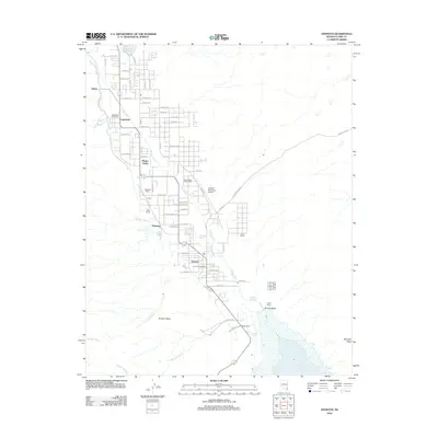
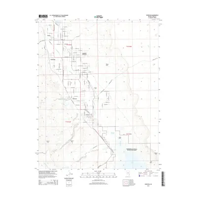
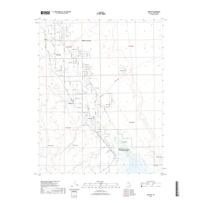
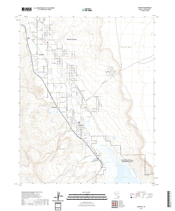 2021 Overton2021 Print · USGSMoapa Valley and its desert margins are shown in detail as the communities of Logandale and Overton thrive along the Muddy River in the early twenty-first century. Genealogists and local historians can trace residential developments and rural landmarks like Perkins Field and Overton Mesa.
End of results
Showing maps 1-13 of 13
Frequently asked questions
- What are the different types of historical maps available for Logandale?
- What is the oldest map of Logandale?
- Where can I purchase historical maps of Logandale for my home or office?
- Where can I download high-res historical maps of Logandale?
- Are there historical topographic maps available for Logandale?
- Is there historical aerial imagery available for Logandale?
- Where are historical maps of Logandale sourced from?