Old Maps of Spanish Trail, Clark County for Genealogy
Trace your family roots with 12 historic maps of Spanish Trail. These high-res maps reveal old neighborhoods, homesites, landmarks, and streets — helping you uncover where your ancestors lived and how the area evolved over time.
- Explore historic neighborhoods: Identify where your relatives may have lived in the 1800s or 1900s.
- Compare maps over time: Trace the changes in streets, buildings, and landmarks for multi-generational research.
- Perfect for genealogy & ancestry research: Used by family historians and researchers to map out lineage and migration.
These maps are an incredible resource for exploring your personal connection to Spanish Trail's past.
Spanish Trail, Clark County maps
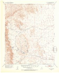
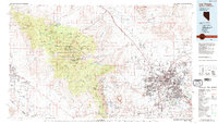
(12)- 1907 Map of Las Vegas, 1956 Print
 1907 Las Vegas1956 Print · USGSCovers Spanish Trail, including Las Vegas, Henderson, and other nearby areas
 - 1908 Map of Las Vegas
 1908 Las Vegas1908 Print · USGSCovers Spanish Trail, including Las Vegas, Henderson, and other nearby areas4 unique versions available
 - 1952 Map of Blue Diamond, 1953 Print
 1952 Blue Diamond1953 Print · USGSCovers Spanish Trail, including Las Vegas, Summerlin South, and other nearby areas5 unique versions available
 - 1952 Map of Las Vegas, 1956 Print
 1952 Las Vegas1956 Print · USGSCovers Spanish Trail, including Las Vegas, Henderson, and other nearby areas
 - 1954 Map of Las Vegas
 1954 Las Vegas1954 Print · USGSCovers Spanish Trail, including Las Vegas, Henderson, and other nearby areas5 unique versions available
 - 1957 Map of Las Vegas
 1957 Las Vegas1957 Print · USGSCovers Spanish Trail, including Las Vegas, Henderson, and other nearby areas
 - 1959 Map of Las Vegas
 1959 Las Vegas1959 Print · USGSCovers Spanish Trail, including Las Vegas, Henderson, and other nearby areas
 - 1962 Map of Las Vegas
 1962 Las Vegas1962 Print · USGSCovers Spanish Trail, including Las Vegas, Henderson, and other nearby areas
 - 1967 Map of Las Vegas SW, 1968 Print
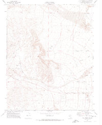
 1967 Las Vegas SW1968 Print · USGSCovers Spanish Trail, including Enterprise, Spring Valley, and other nearby areas5 unique versions available
 - 1972 Map of Blue Diamond SE, 1974 Print
 1972 Blue Diamond SE1974 Print · USGSCovers Spanish Trail, including Clark County, United States, and other nearby areas2 unique versions available
 - 1973 Map of Las Vegas SW, 1977 Print
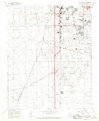
 1973 Las Vegas SW1977 Print · USGSCovers Spanish Trail, including Enterprise, Spring Valley, and other nearby areas
 - 1986 Map of Las Vegas
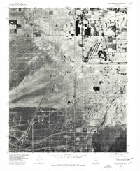
 1986 Las Vegas1986 Print · USGSCovers Spanish Trail, including Las Vegas, Henderson, and other nearby areas4 unique versions available
End of results
Showing maps 1-12 of 12
Frequently asked questions
- What are the different types of historical maps available for Spanish Trail?
- What is the oldest map of Spanish Trail?
- Where can I purchase historical maps of Spanish Trail for my home or office?
- Where can I download high-res historical maps of Spanish Trail?
- Are there historical topographic maps available for Spanish Trail?
- Is there historical aerial imagery available for Spanish Trail?
- Where are historical maps of Spanish Trail sourced from?