Old Maps of Imlay, Nevada for Hiking & Exploration
Hike through history with 11 historic maps of Imlay. Explore old trails, ghost towns, and forgotten backroads — perfect for outdoor adventurers and local explorers.
- Rediscover forgotten places: Map out old mining camps, roads, and footpaths that no longer exist on modern maps.
- Layer with modern tools: Combine with LiDAR or satellite views to plan hikes through historical terrain.
- Made for exploration: Popular among hikers, overlanders, and local history lovers.
Use these maps to find adventure and explore the hidden past of Imlay.
Imlay, NV maps
(11)- 1931 Map of Lovelock, 1955 Print
 1931 Lovelock1955 Print · USGSPershing County's high-desert mining landscape is frozen in time during the early 1930s, as gold and tungsten districts drove the local economy. Genealogists and historians can trace the foundations of Unionville, the industrial footprint of the Nevada Massachusetts Tungsten Mine, and the route of the Victory Highway.
 - 1935 Map of Lovelock
 1935 Lovelock1935 Print · USGSPershing County in the mid-1930s is a landscape of high-desert mining camps and essential rail hubs along the Humboldt. Researchers can trace the legacy of the silver and tungsten booms at Rochester, the Sulphur Mine, and the now-quiet streets of Unionville or Mazuma.3 unique versions available
 - 1955 Map of Lovelock, 1963 Print
 1955 Lovelock1963 Print · USGSNorthwestern Nevada’s vast desert basins and military ranges are captured here in the mid-fifties, showing a landscape defined by the Humboldt River and the great Pyramid Lake. Genealogists and historians can trace isolated rail stops like Gerlach and Empire, or locate historic workings such as the Golden Eagle Mine and Pershing Mine.5 unique versions available
 - 1956 Map of Imlay, 1958 Print
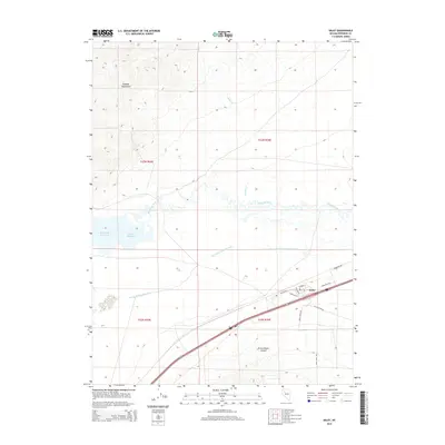
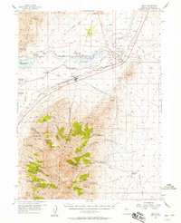 1956 Imlay1958 Print · USGSPershing County's mining and transit history is preserved here in the mid-1950s as the rail town of Imlay supports the surrounding silver and fluorspar districts. Trace the legacy of the Old Emigrant Trail past the Humboldt City (Site) and active workings like the Queen of Sheba Mine.3 unique versions available
 - 1959 Map of Lovelock
 1959 Lovelock1959 Print · USGSNorthwestern Nevada in the late fifties is a study in vast desert basins and isolated rail outposts like Gerlach and Sulphur. You can trace the Humboldt River corridor through Lovelock, identify mid-century military zones, and locate the Mine Mill in the northern ranges.2 unique versions available
 - 1985 Map of Eugene Mts
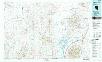 1985 Eugene Mts1985 Print · USGSNorthern Nevada mining districts and desert basins are captured here during the mid-eighties. You can trace the Southern Pacific rail line through remote stops like Sulphur or locate deep-country operations like the Nevada-Massachusetts (Tungsten) Mine.2 unique versions available
 - 1987 Map of Imlay
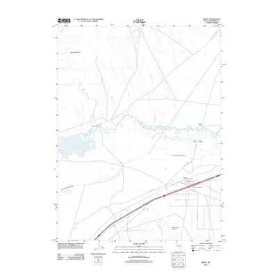
 1987 Imlay1987 Print · USGSThe Humboldt River valley and the Eugene Mountains come into focus during the late 1980s, highlighting a landscape shaped by transportation and water. Genealogists and historians can trace the route of the Emigrant Trail past Imlay and the Southern Pacific tracks.
 - 2011 Map of Imlay, 2011 Print
 2011 Imlay2011 Print · USGSCovers Imlay, including Pershing County, United States, and other nearby areas
 - 2014 Map of Imlay, 2014 Print
 2014 Imlay2014 Print · USGSCovers Imlay, including Pershing County, United States, and other nearby areas
 - 2018 Map of Imlay, 2018 Print
 2018 Imlay2018 Print · USGSCovers Imlay, including Pershing County, United States, and other nearby areas
 - 2021 Map of Imlay, 2021 Print
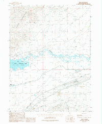
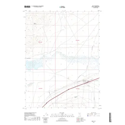
 2021 Imlay2021 Print · USGSModern-day Imlay is depicted here alongside the expansive Rye Patch Reservoir and the Lassens Meadows wetlands. Local historians can trace the road networks of the valley, from Flying M Ranch Rd to the rising terrain of the Eugene Mountains.
End of results
Showing maps 1-11 of 11
Top cities near Imlay
Frequently asked questions
- What are the different types of historical maps available for Imlay?
- What is the oldest map of Imlay?
- Where can I purchase historical maps of Imlay for my home or office?
- Where can I download high-res historical maps of Imlay?
- Are there historical topographic maps available for Imlay?
- Is there historical aerial imagery available for Imlay?
- Where are historical maps of Imlay sourced from?