Old Maps of Empire, Nevada for Genealogy
Trace your family roots with 11 historic maps of Empire. These high-res maps reveal old neighborhoods, homesites, landmarks, and streets — helping you uncover where your ancestors lived and how the area evolved over time.
- Explore historic neighborhoods: Identify where your relatives may have lived in the 1800s or 1900s.
- Compare maps over time: Trace the changes in streets, buildings, and landmarks for multi-generational research.
- Perfect for genealogy & ancestry research: Used by family historians and researchers to map out lineage and migration.
These maps are an incredible resource for exploring your personal connection to Empire's past.
Empire, NV maps
(11)- 1886 Map of Granite Range
 1886 Granite Range1886 Print · USGSNorthwestern Nevada in the late nineteenth century was a frontier of great lakes and dry basins. Researchers can trace early geography from the Salt Works 3830 in the northern flats to water sources like Sheep-head Spring and Hot Springs.
 - 1894 Map of Granite Range
 1894 Granite Range1894 Print · USGSNorthwestern Nevada was a landscape of stark basins and vital springs during the late nineteenth century. Researchers can trace the early industrial footprint of the Salt Works 3830 and locate perennial water sources like Sheep-head Spring and Smoke Creek.7 unique versions available
 - 1955 Map of Lovelock, 1963 Print
 1955 Lovelock1963 Print · USGSNorthwestern Nevada’s vast desert basins and military ranges are captured here in the mid-fifties, showing a landscape defined by the Humboldt River and the great Pyramid Lake. Genealogists and historians can trace isolated rail stops like Gerlach and Empire, or locate historic workings such as the Golden Eagle Mine and Pershing Mine.5 unique versions available
 - 1959 Map of Lovelock
 1959 Lovelock1959 Print · USGSNorthwestern Nevada in the late fifties is a study in vast desert basins and isolated rail outposts like Gerlach and Sulphur. You can trace the Humboldt River corridor through Lovelock, identify mid-century military zones, and locate the Mine Mill in the northern ranges.2 unique versions available
 - 1964 Map of Gerlach, 1966 Print
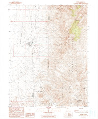
 1964 Gerlach1966 Print · USGSWashoe and Pershing counties meet in the high desert during the mid-sixties, where the railroad and ranching life intersect. Genealogists and historians can locate remote sites like Deephole Ranch, the Gerlach Cem, and the industrial layout of Empire.2 unique versions available
 - 1981 Map of Gerlach
 1981 Gerlach1981 Print · USGSThe high desert of northwestern Nevada and eastern California is mapped here during the early eighties, centered on the vital rail and mining hub of Gerlach. Researchers can trace the Western Pacific corridor through Trego and locate remote operations like the Arcturus Mine and the gypsum works at Empire.2 unique versions available
 - 1990 Map of Empire
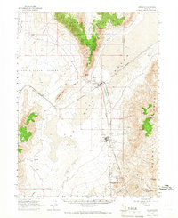
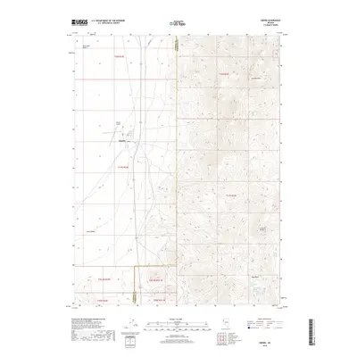
 1990 Empire1990 Print · USGSEmpire and the surrounding high desert come alive in this late twentieth-century survey at the edge of the Black Rock Desert. Researchers can trace the industrial layout of Empire or locate remote water sources like Last Chance Spring and Texas Basin Spring.
 - 2011 Map of Empire, 2011 Print
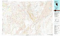
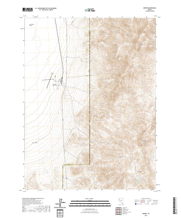
 2011 Empire2011 Print · USGSCovers Empire, including Washoe County, Pershing County, and other nearby areas
 - 2014 Map of Empire, 2014 Print
 2014 Empire2014 Print · USGSCovers Empire, including Washoe County, Pershing County, and other nearby areas
 - 2018 Map of Empire, 2018 Print
 2018 Empire2018 Print · USGSCovers Empire, including Washoe County, Pershing County, and other nearby areas
 - 2021 Map of Empire, 2021 Print
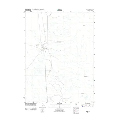
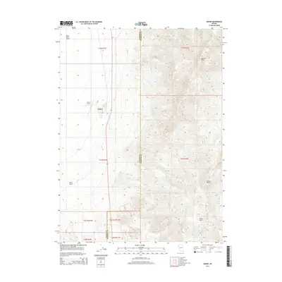
 2021 Empire2021 Print · USGSThe settlement of Empire and its surrounding desert basins are captured here during the early twenty-first century. Genealogists and researchers can trace local streets and vital water sources like Last Chance Spring and Double Spout Spring near the Selenite Range.
End of results
Showing maps 1-11 of 11
Top cities near Empire
Frequently asked questions
- What are the different types of historical maps available for Empire?
- What is the oldest map of Empire?
- Where can I purchase historical maps of Empire for my home or office?
- Where can I download high-res historical maps of Empire?
- Are there historical topographic maps available for Empire?
- Is there historical aerial imagery available for Empire?
- Where are historical maps of Empire sourced from?