1900s (20th Century) Maps of Effingham, New Hampshire
Explore 25 historic maps of Effingham from the 1900s (20th Century). These maps offer a rare glimpse into what life looked like during the 1900s — showing old roads, neighborhoods, homes, and landmarks that have changed or disappeared over time.
Whether you're researching your family's past, planning a metal detecting trip, or studying how Effingham's landscape evolved across the 1900s, these high-resolution maps are a powerful tool for exploring the history of this region.
- Focus on a specific era: All maps on this page are from the 1900s, giving you a focused view of this time period.
- See what’s changed: Compare century-old streets, trails, and buildings to today's modern landscape using overlays and satellite layers.
- Research with precision: Use these maps for genealogy, historical research, land use analysis, or educational projects.
- View, download, or print: Maps are fully viewable online in high resolution, and can be downloaded or printed for your own records.
Start exploring Effingham's history through authentic maps from the 1900s. This is your window into the past.
Effingham, NH maps
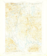
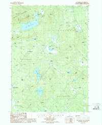
(25)- 1910 Map of Kezar Falls
 1910 Kezar Falls1910 Print · USGSMaine and New Hampshire borderlands are captured here at the height of the railroad era, as the Maine Central linked river towns. Genealogists can trace family footprints through sites like the Parsonsfield Seminary, Merrill Corner, and the Haley School.5 unique versions available
 - 1911 Map of Kezar Falls
 1911 Kezar Falls1911 Print · USGSThe Saco River valley at the turn of the century shows a landscape defined by riverside industry and mountain schools. Genealogists and historians can trace rail depots like Bridgton Junction and early landmarks such as Parsonsfield Seminary and Rankins Mill.5 unique versions available
 - 1928 Map of Wolfeboro
 1928 Wolfeboro1928 Print · USGSThe Lakes Region thrives in the late twenties as a premier destination for rail travelers and summer residents. Trace family history through Wolfeboro landmarks like Brewster Academy or find old stop-offs along the Boston and Maine RR.7 unique versions available
 - 1930 Map of Ossipee Lake
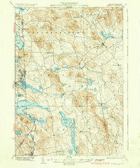
 1930 Ossipee Lake1930 Print · USGSCarroll County at the dawn of the 1930s shows a landscape of lakeside villages and mountain resorts connected by the Boston and Maine Railroad. Genealogy researchers can trace family sites like the Albany Cem, Mountain Ch, or old schoolhouses like the Nickerson Sch.8 unique versions available
 - 1933 Map of Newfield
 1933 Newfield1933 Print · USGSThe Maine-New Hampshire borderlands in the early 1930s are captured here as a series of connected lakeside settlements. Trace family roots and old property lines near Milton Mills, Spinney Church, and the shores of Great East Lake.
 - 1937 Map of Newfield
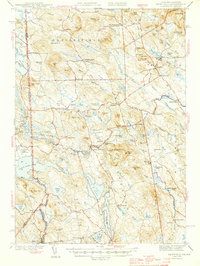
 1937 Newfield1937 Print · USGSThe Maine and New Hampshire borderlands are captured here during the late 1930s, showing a landscape defined by riverside villages and glacial lakes. Genealogists and historians can trace family locations near Ossipee Mills, Spuney Ch, and the many hamlets of Parsonsfield.3 unique versions available
 - 1942 Map of Newfield, 1959 Print
 1942 Newfield1959 Print · USGSThe Maine and New Hampshire borderlands come to life in the early 1940s, showing a network of mill towns and mountain peaks. Researchers can trace family lines through small settlements like South Parsonsfield, locate the Spinney Ch, or explore the shores of Great East Lake and Mousam Lake.
 - 1944 Map of Newfield
 1944 Newfield1944 Print · USGSYork County and the New Hampshire borderlands are captured here during the mid-1940s, showing a landscape of mill towns and interconnected lakes. Genealogists and historians can trace family-named sites like Dearborn Mtn and Stevens Cor or explore the early layouts of Limerick and Milton Mills.2 unique versions available
 - 1949 Map of Portland
 1949 Portland1949 Print · USGSCoastal Maine and the New Hampshire interior are shown in detail during the late forties, from the bustling harbors to the lakeside villages. Researchers can trace historical rail networks like the Boston & Maine RR and locate coastal defenses such as Fort Preble.3 unique versions available
 - 1956 Map of Portland, 1963 Print
 1956 Portland1963 Print · USGSSouthern Maine and eastern New Hampshire are captured here in the mid-fifties, during a time of major highway expansion and military growth. You can trace the path of the Maine Turnpike and locate landmarks like the Portsmouth Naval Shipyard and Sebago Lake.4 unique versions available
 - 1958 Map of Ossipee Lake, 1960 Print
 1958 Ossipee Lake1960 Print · USGSEastern Carroll County in the late fifties was a landscape of timbered peaks and rising lakeside tourism. Genealogists and historians can trace the region's development through the Boston and Maine Railroad stations, the Albany Chapel, and landmarks like Madison Boulder.4 unique versions available
 - 1958 Map of Wolfeboro, 1960 Print
 1958 Wolfeboro1960 Print · USGSCentral New Hampshire's lake country is captured here in the late fifties, showing the established rail lines and summer colonies. Genealogists can trace family names across Federal Corner, locate Union Church, or study the grounds of Brewster Academy.2 unique versions available
 - 1958 Map of Newfield, 1961 Print
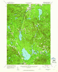
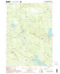
 1958 Newfield1961 Print · USGSThe Maine-New Hampshire borderlands in the late fifties show a landscape of interconnected glacial lakes and upland settlements. Genealogists and historians can trace family-named sites like Stevens Corner, the Shapleigh Mem Sch Cem, and industrial relics at Limerick Mills.5 unique versions available
 - 1959 Map of Portland
 1959 Portland1959 Print · USGSThe Maine and New Hampshire coastlines meet in this mid-century portrait of maritime commerce and inland rail networks. Researchers can trace the legacy of coastal defense at Fort Williams and follow the historic path of the Maine Central RR through the White Mountain National Forest.2 unique versions available
 - 1963 Map of Portland
 1963 Portland1963 Print · USGSCoastal Maine and New Hampshire thrived as maritime and industrial hubs during the mid-sixties, linked by a dense network of rail and river. Researchers can trace historic transit corridors like the Maine Central RR and locate key sites such as the Portsmouth Naval Shipyard or Pease Air Force Base.3 unique versions available
 - 1964 Map of Kezar Falls, 1966 Print
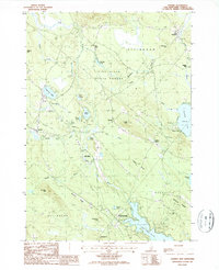
 1964 Kezar Falls1966 Print · USGSThe Maine-New Hampshire borderlands near Kezar Falls are captured here in the mid-sixties, showing a landscape of river-driven towns and upland ponds. Genealogists can trace family lines through numerous rural burial grounds like Churchill Cem and local landmarks such as the Parsonsfield Seminary.4 unique versions available
 - 1983 Map of West Newfield
 1983 West Newfield1983 Print · USGSYork County and Carroll County meet at the state line during the early eighties, where upland townships like Parsonsfield and Newfield bridge the Maine and New Hampshire border. Genealogists can locate family names at Mee Corners or trace properties near Maplewood and Rock Haven Lake.2 unique versions available
 - 1985 Map of Portland, 1986 Print
 1985 Portland1986 Print · USGSThe Maine coast and Sebago Lake region are captured in the mid-1980s, showcasing the transition from traditional maritime centers to a modern transportation hub. Genealogists and historians can trace rail lines like the Grand Trunk RR and find local landmarks such as the U.S. Marine Hospital or Old Orchard Beach.2 unique versions available
 - 1986 Map of Lake Winnipesaukee
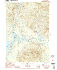
 1986 Lake Winnipesaukee1986 Print · USGSThe Lakes Region in the mid-eighties shows a landscape of dense water bodies and mountain ranges at the peak of its twentieth-century character. Trace the legacy of old rail lines like the Boston and Maine RR and locate historic centers from Rumney Depot to Melvin Village.2 unique versions available
 - 1987 Map of Ossipee Lake
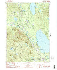 1987 Ossipee Lake1987 Print · USGSCarroll County’s lake country is captured here in the late eighties, showing the transitional landscape between the southern peaks and the central water basin. Researchers can trace historic village centers like Moultonville and Chocorua or locate the seasonal grounds of Camp Weetamoe.
 - 1987 Map of Tuftonboro
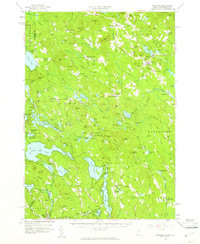
 1987 Tuftonboro1987 Print · USGSTuftonboro and the surrounding New Hampshire highlands are captured here during the late eighties, showing a landscape defined by glacial ponds and small mountain hamlets. Researchers can trace family sites near Water Village, identify old crossroads like Federal Corner, or locate the shores of Dan Hole Pond.
 - 1987 Map of Ossipee
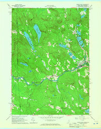
 1987 Ossipee1987 Print · USGSCarroll County was a landscape of winding rivers and lakeside hamlets during the late eighties. Genealogists and historians can trace local family roots through numerous cemeteries and settlements like Ossipee, North Wakefield, and the mill site at Chases Mill.
 - 1987 Map of Freedom
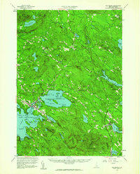
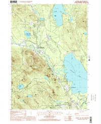
 1987 Freedom1987 Print · USGSFreedom and the surrounding Ossipee Valley are captured in the late eighties, a landscape shaped by glacial lakes and forested peaks. Genealogists and local historians can trace family-named sites like Durgin Hill, the settlement at Effingham Falls, and the grounds of Camp Huckins.2 unique versions available
 - 1998 Map of Ossipee, 1999 Print
 1998 Ossipee1999 Print · USGSThe rural landscapes of Carroll County are captured here in the late nineties, documenting a network of small settlements and conservation forests. Researchers can locate specific family landmarks and local businesses like Chases Mill, the Drive-in Theater, and Leighton Corners.
 - 1998 Map of Ossipee Lake, 2001 Print
 1998 Ossipee Lake2001 Print · USGSThe Carroll County lake region is captured here in the late nineties, documenting a landscape of mountain peaks and lowland waters. Genealogists and historians can locate old stations at West Ossipee or trace family sites near Moultonville and Dorrs Corner.
End of results
Showing maps 1-25 of 25
Top cities near Effingham
- Bridgton historical maps
- Wakefield historical maps
- Moultonborough historical maps
- Milton historical maps
- Ossipee historical maps
- Conway historical maps
See more
Top neighborhoods of Effingham
- Grape Corner historical maps
- Pine River historical maps
- Chases Mill historical maps
- Effingham Falls historical maps
- Center Effingham historical maps
- South Effingham historical maps
Frequently asked questions
- What are the different types of historical maps available for Effingham?
- What is the oldest map of Effingham?
- Where can I purchase historical maps of Effingham for my home or office?
- Where can I download high-res historical maps of Effingham?
- Are there historical topographic maps available for Effingham?
- Is there historical aerial imagery available for Effingham?
- Where are historical maps of Effingham sourced from?