Old Maps of Sandwich Landing, Sandwich for Hiking & Exploration
Hike through history with 14 historic maps of Sandwich Landing. Explore old trails, ghost towns, and forgotten backroads — perfect for outdoor adventurers and local explorers.
- Rediscover forgotten places: Map out old mining camps, roads, and footpaths that no longer exist on modern maps.
- Layer with modern tools: Combine with LiDAR or satellite views to plan hikes through historical terrain.
- Made for exploration: Popular among hikers, overlanders, and local history lovers.
Use these maps to find adventure and explore the hidden past of Sandwich Landing.
Sandwich Landing, Sandwich maps
(14)- 1931 Map of Mt. Chocorua
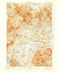 1931 Mt. Chocorua1931 Print · USGSCarroll County’s timber and mountain landscape is captured here in the late Prohibition era. Researchers can trace the path of the Beebe River RR, locate old schoolhouses like Fellows Sch, and find family sites near Wonalancet or Center Sandwich.7 unique versions available
 - 1949 Map of Portland
 1949 Portland1949 Print · USGSCoastal Maine and the New Hampshire interior are shown in detail during the late forties, from the bustling harbors to the lakeside villages. Researchers can trace historical rail networks like the Boston & Maine RR and locate coastal defenses such as Fort Preble.3 unique versions available
 - 1956 Map of Portland, 1963 Print
 1956 Portland1963 Print · USGSSouthern Maine and eastern New Hampshire are captured here in the mid-fifties, during a time of major highway expansion and military growth. You can trace the path of the Maine Turnpike and locate landmarks like the Portsmouth Naval Shipyard and Sebago Lake.4 unique versions available
 - 1958 Map of Mt. Chocorua, 1960 Print
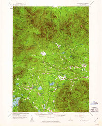 1958 Mt. Chocorua1960 Print · USGSThe Sandwich Range and Tamworth valley are captured here in the late fifties as modern forest access began to expand. Family historians can trace rural schoolhouses and numerous local burial grounds, including Riverside Cem and Wonalancet Cem.3 unique versions available
 - 1959 Map of Portland
 1959 Portland1959 Print · USGSThe Maine and New Hampshire coastlines meet in this mid-century portrait of maritime commerce and inland rail networks. Researchers can trace the legacy of coastal defense at Fort Williams and follow the historic path of the Maine Central RR through the White Mountain National Forest.2 unique versions available
 - 1963 Map of Portland
 1963 Portland1963 Print · USGSCoastal Maine and New Hampshire thrived as maritime and industrial hubs during the mid-sixties, linked by a dense network of rail and river. Researchers can trace historic transit corridors like the Maine Central RR and locate key sites such as the Portsmouth Naval Shipyard or Pease Air Force Base.3 unique versions available
 - 1986 Map of Lake Winnipesaukee
 1986 Lake Winnipesaukee1986 Print · USGSThe Lakes Region in the mid-eighties shows a landscape of dense water bodies and mountain ranges at the peak of its twentieth-century character. Trace the legacy of old rail lines like the Boston and Maine RR and locate historic centers from Rumney Depot to Melvin Village.2 unique versions available
 - 1987 Map of Center Sandwich
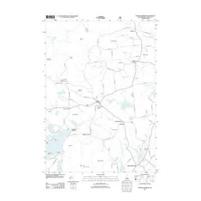
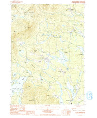 1987 Center Sandwich1987 Print · USGSCarroll County's interior is captured in the late 1980s, as the rural villages of the Lakes Region meet the high ridges of the White Mountains. Researchers can locate family landmarks at Chicks Corner, trace the shoreline at Sandwich Landing, or find old burial sites marked Cem.2 unique versions available
 - 1995 Map of Center Sandwich, 2000 Print
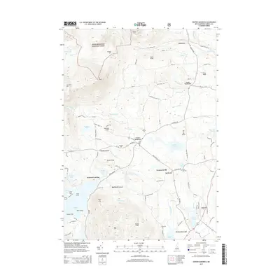
 1995 Center Sandwich2000 Print · USGSThe Sandwich and Moultonborough area is shown here in the mid-1990s, where the White Mountains meet the northern shores of Squam Lake. Genealogists and historians can trace local homesteads and landmarks like Chicks Corner, Diamond Ledge, and the old cemeteries near Center Sandwich.
 - 2012 Map of Center Sandwich, 2012 Print
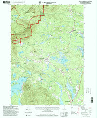
 2012 Center Sandwich2012 Print · USGSCovers Sandwich Landing, including Moultonborough, Sandwich, and other nearby areas
 - 2015 Map of Center Sandwich, 2015 Print
 2015 Center Sandwich2015 Print · USGSCovers Sandwich Landing, including Moultonborough, Sandwich, and other nearby areas
 - 2018 Map of Center Sandwich, 2018 Print
 2018 Center Sandwich2018 Print · USGSCovers Sandwich Landing, including Moultonborough, Sandwich, and other nearby areas
 - 2021 Map of Center Sandwich, 2021 Print
 2021 Center Sandwich2021 Print · USGSCovers Sandwich Landing, including Moultonborough, Sandwich, and other nearby areas
 - 2024 Map of Center Sandwich, 2024 Print
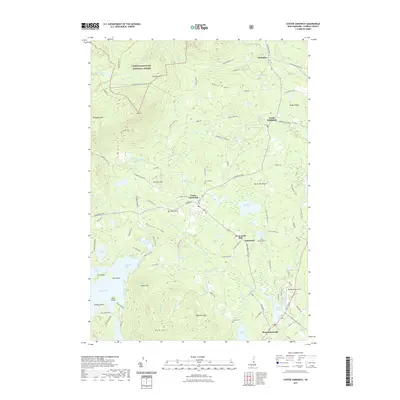
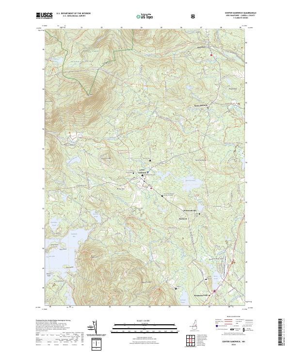 2024 Center Sandwich2024 Print · USGSThe northern shores of Squam Lake and the peaks of the Sandwich Range define this Carroll County landscape in the early 2020s. Researchers can locate historic burial sites like the Baptist Burial Ground or trace the drainage of the Bearcamp River from the White Mountain National Forest.
End of results
Showing maps 1-14 of 14
Top cities near Sandwich Landing
- Laconia historical maps
- Gilford historical maps
- Moultonborough historical maps
- Plymouth historical maps
- Ossipee historical maps
- Campton historical maps
See more
Frequently asked questions
- What are the different types of historical maps available for Sandwich Landing?
- What is the oldest map of Sandwich Landing?
- Where can I purchase historical maps of Sandwich Landing for my home or office?
- Where can I download high-res historical maps of Sandwich Landing?
- Are there historical topographic maps available for Sandwich Landing?
- Is there historical aerial imagery available for Sandwich Landing?
- Where are historical maps of Sandwich Landing sourced from?