Old Maps of Wolfeboro, New Hampshire for Genealogy
Trace your family roots with 42 historic maps of Wolfeboro. These high-res maps reveal old neighborhoods, homesites, landmarks, and streets — helping you uncover where your ancestors lived and how the area evolved over time.
- Explore historic neighborhoods: Identify where your relatives may have lived in the 1800s or 1900s.
- Compare maps over time: Trace the changes in streets, buildings, and landmarks for multi-generational research.
- Perfect for genealogy & ancestry research: Used by family historians and researchers to map out lineage and migration.
These maps are an incredible resource for exploring your personal connection to Wolfeboro's past.
Wolfeboro, NH maps
(42)- 1909 Map of Winnepesaukee
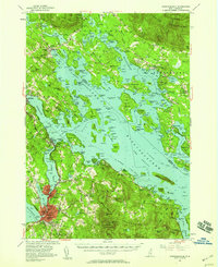
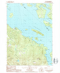
 1909 Winnepesaukee1909 Print · USGSNew Hampshire’s Lakes Region is captured here during the height of the steamship era, showing the intricate shoreline and island networks of the state's largest lake. Researchers can trace the Boston and Maine RR through LACONIA or locate early lakeside landings like The Weirs, Center Harbor, and Melvin Village.9 unique versions available
 - 1928 Map of Wolfeboro
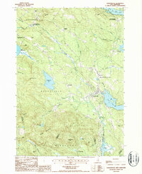
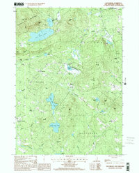
 1928 Wolfeboro1928 Print · USGSThe Lakes Region thrives in the late twenties as a premier destination for rail travelers and summer residents. Trace family history through Wolfeboro landmarks like Brewster Academy or find old stop-offs along the Boston and Maine RR.7 unique versions available
 - 1949 Map of Portland
 1949 Portland1949 Print · USGSCoastal Maine and the New Hampshire interior are shown in detail during the late forties, from the bustling harbors to the lakeside villages. Researchers can trace historical rail networks like the Boston & Maine RR and locate coastal defenses such as Fort Preble.3 unique versions available
 - 1956 Map of Winnipesaukee, 1958 Print
 1956 Winnipesaukee1958 Print · USGSCentral New Hampshire in the mid-fifties is captured here as a premier lake destination and transportation corridor. Genealogists and historians can trace rail routes along the Boston and Maine RR and locate local landmarks like Red Hill Cem and Union Wharf.4 unique versions available
 - 1956 Map of Portland, 1963 Print
 1956 Portland1963 Print · USGSSouthern Maine and eastern New Hampshire are captured here in the mid-fifties, during a time of major highway expansion and military growth. You can trace the path of the Maine Turnpike and locate landmarks like the Portsmouth Naval Shipyard and Sebago Lake.4 unique versions available
 - 1958 Map of Wolfeboro, 1960 Print
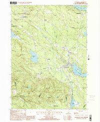
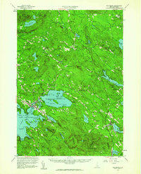 1958 Wolfeboro1960 Print · USGSCentral New Hampshire's lake country is captured here in the late fifties, showing the established rail lines and summer colonies. Genealogists can trace family names across Federal Corner, locate Union Church, or study the grounds of Brewster Academy.2 unique versions available
 - 1959 Map of Portland
 1959 Portland1959 Print · USGSThe Maine and New Hampshire coastlines meet in this mid-century portrait of maritime commerce and inland rail networks. Researchers can trace the legacy of coastal defense at Fort Williams and follow the historic path of the Maine Central RR through the White Mountain National Forest.2 unique versions available
 - 1963 Map of Portland
 1963 Portland1963 Print · USGSCoastal Maine and New Hampshire thrived as maritime and industrial hubs during the mid-sixties, linked by a dense network of rail and river. Researchers can trace historic transit corridors like the Maine Central RR and locate key sites such as the Portsmouth Naval Shipyard or Pease Air Force Base.3 unique versions available
 - 1986 Map of Lake Winnipesaukee
 1986 Lake Winnipesaukee1986 Print · USGSThe Lakes Region in the mid-eighties shows a landscape of dense water bodies and mountain ranges at the peak of its twentieth-century character. Trace the legacy of old rail lines like the Boston and Maine RR and locate historic centers from Rumney Depot to Melvin Village.2 unique versions available
 - 1987 Map of Tuftonboro
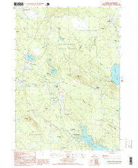
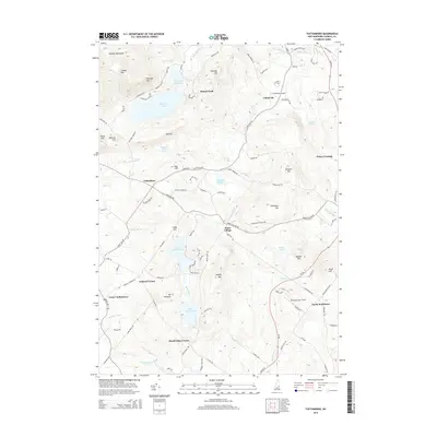
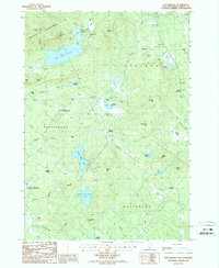 1987 Tuftonboro1987 Print · USGSTuftonboro and the surrounding New Hampshire highlands are captured here during the late eighties, showing a landscape defined by glacial ponds and small mountain hamlets. Researchers can trace family sites near Water Village, identify old crossroads like Federal Corner, or locate the shores of Dan Hole Pond.
 - 1987 Map of Ossipee
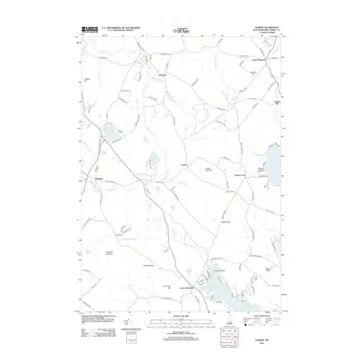
 1987 Ossipee1987 Print · USGSCarroll County was a landscape of winding rivers and lakeside hamlets during the late eighties. Genealogists and historians can trace local family roots through numerous cemeteries and settlements like Ossipee, North Wakefield, and the mill site at Chases Mill.
 - 1987 Map of Sanbornville
 1987 Sanbornville1987 Print · USGSSanbornville and the surrounding lake country are captured in the late eighties, documenting a landscape where rail history still marks the local geography. Researchers can trace rural cemetery locations and old rail stops like Burleyville Station and Cotton Valley Station.
 - 1987 Map of West Alton
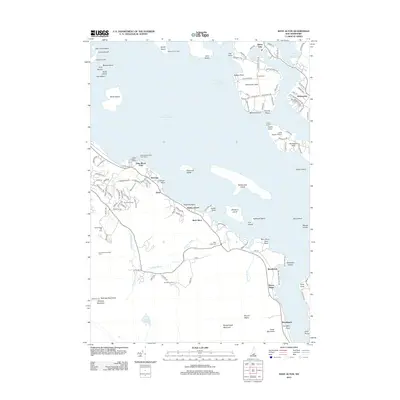
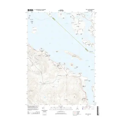
 1987 West Alton1987 Print · USGSLake Winnipesaukee's southern reaches were well-defined by the late twentieth century, showing a mix of established summer camps and mountain preserves. Researchers can trace land ownership and community layout around West Alton, Sandy Island Camp, and the historic Mt Washington Boat Route.2 unique versions available
 - 1987 Map of Wolfeboro
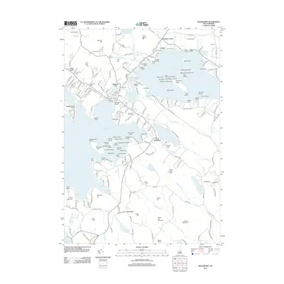
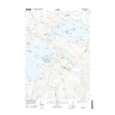
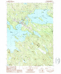 1987 Wolfeboro1987 Print · USGSThe Lakes Region of New Hampshire thrives in the late eighties, centered on the bustling resort community of Wolfeboro. Genealogists and historians can trace family-named landmarks like Cates Hill and Hayes Hill, or explore the shorelines of Lake Winnipesaukee and Lake Wentworth.
 - 1998 Map of Ossipee, 1999 Print
 1998 Ossipee1999 Print · USGSThe rural landscapes of Carroll County are captured here in the late nineties, documenting a network of small settlements and conservation forests. Researchers can locate specific family landmarks and local businesses like Chases Mill, the Drive-in Theater, and Leighton Corners.
 - 2000 Map of Tuftonboro, 2001 Print
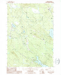
 2000 Tuftonboro2001 Print · USGSThe lakeside communities and mountain foothills of Carroll County are captured here at the turn of the millennium. Genealogists and local historians can locate early homestead sites near Water Village, Chickville, and the historic Stockbridge Corner.
 - 2000 Map of Sanbornville, 2001 Print
 2000 Sanbornville2001 Print · USGSThe eastern Carroll County highlands at the turn of the millennium show a landscape of historic rail stations and protected forests. Trace local heritage at Cotton Valley Station, the Governor Wentworth State Farm, and the slopes of the Moose Mountains.
 - 2012 Map of Tuftonboro, 2012 Print
 2012 Tuftonboro2012 Print · USGSCovers Wolfeboro, including Ossipee, Tuftonboro, and other nearby areas
 - 2012 Map of Sanbornville, 2012 Print
 2012 Sanbornville2012 Print · USGSCovers Wolfeboro, including Wakefield, Milton, and other nearby areas
 - 2012 Map of West Alton, 2012 Print
 2012 West Alton2012 Print · USGSCovers Wolfeboro, including Gilford, Gilmanton, and other nearby areas
 - 2012 Map of Ossipee, 2012 Print
 2012 Ossipee2012 Print · USGSCovers Wolfeboro, including Wakefield, Ossipee, and other nearby areas
 - 2012 Map of Wolfeboro, 2012 Print
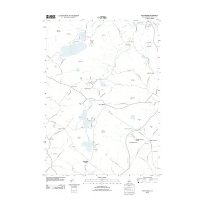
 2012 Wolfeboro2012 Print · USGSCovers Wolfeboro, including New Durham, Tuftonboro, and other nearby areas
 - 2015 Map of Wolfeboro, 2015 Print
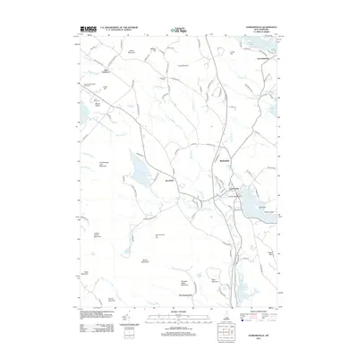
 2015 Wolfeboro2015 Print · USGSCovers Wolfeboro, including New Durham, Tuftonboro, and other nearby areas
 - 2015 Map of West Alton, 2015 Print
 2015 West Alton2015 Print · USGSCovers Wolfeboro, including Gilford, Gilmanton, and other nearby areas
 - 2015 Map of Tuftonboro, 2015 Print
 2015 Tuftonboro2015 Print · USGSCovers Wolfeboro, including Ossipee, Tuftonboro, and other nearby areas
Showing maps 1-25 of 42
Top cities near Wolfeboro
- Gilford historical maps
- Belmont historical maps
- Farmington historical maps
- Lebanon historical maps
- Wakefield historical maps
- Loudon historical maps
See more
Top neighborhoods of Wolfeboro
- Stockbridge Corner historical maps
- Clarke Point historical maps
- East Wolfeboro historical maps
- Fernald historical maps
- Goose Corner historical maps
- Keewayden historical maps
See more
Frequently asked questions
- What are the different types of historical maps available for Wolfeboro?
- What is the oldest map of Wolfeboro?
- Where can I purchase historical maps of Wolfeboro for my home or office?
- Where can I download high-res historical maps of Wolfeboro?
- Are there historical topographic maps available for Wolfeboro?
- Is there historical aerial imagery available for Wolfeboro?
- Where are historical maps of Wolfeboro sourced from?