Old Maps of Jaffrey, New Hampshire for Metal Detecting
Plan your next treasure hunt with 39 historic maps of Jaffrey. Find old homesites, ghost towns, trails, and gathering spots that may be lost to time — perfect for identifying promising metal detecting locations.
- Locate forgotten sites: Uncover places like long-lost settlements, abandoned rail lines, or gathering spots.
- Plan better hunts: Use map overlays combined with LiDAR or satellite views to narrow in on historically rich areas.
- Made for detectorists: Thousands of hobbyists use these maps to discover relics, coins, and hidden history.
Use these historic maps to boost your research and find new opportunities beneath the surface of Jaffrey.
Jaffrey, NH maps
(39)- 1898 Map of Monadnock
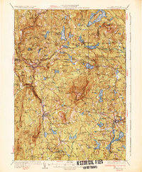
 1898 Monadnock1898 Print · USGSThe peaks and valleys of Southwest New Hampshire are shown here during the late nineteenth-century railroad era. Genealogists and historians can trace the rail-dependent growth of towns like East Jaffrey and locate sites such as Mountain House or the Marlboro Depot.8 unique versions available
 - 1900 Map of Peterboro
 1900 Peterboro1900 Print · USGSHillsborough County villages and mountain ranges come into sharp focus during the late Victorian era as rail lines expanded through the valley. Researchers can trace the Boston and Maine RR corridors and locate family landmarks from Peterboro to New Ipswich and Lithia Spring.9 unique versions available
 - 1936 Map of Monadnock
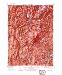
 1936 Monadnock1936 Print · USGSCheshire County in the mid-thirties is a landscape of high summits and quiet mill towns connected by the rail and river. Genealogists and hikers can trace old homesteads near Bowkerville or follow the route to the Fire Lookout atop Monadnock Mtn.4 unique versions available
 - 1942 Map of Keene
 1942 Keene1942 Print · USGSCheshire County at the start of the war shows a landscape of busy river valleys and upland farms. You can trace the path of the Boston & Maine RR through towns like Westmoreland and find old district landmarks like Sch No 10 or the Rand Cem.
 - 1943 Map of Fitchburg
 1943 Fitchburg1943 Print · USGSSouthern New Hampshire and northern Massachusetts are captured during the war years, showing a landscape of river-powered mill towns and mountain trails. You can trace family roots in Peterboro, locate the historic Groton School, or study the rail lines of the Boston & Maine RR.
 - 1948 Map of Boston
 1948 Boston1948 Print · USGSEastern Massachusetts and southern New Hampshire appear at an industrial peak in the late 1940s, just as suburban growth began to accelerate. Genealogists and historians can trace rail lines like the Boston and Albany RR or locate coastal landmarks like Graves Lighthouse and Fort Devens.2 unique versions available
 - 1948 Map of Albany, 1951 Print
 1948 Albany1951 Print · USGSThe Hudson and Connecticut River valleys are captured here in the late 1940s, showing the vital rail and water corridors of the Northeast. You can trace the Boston and Maine tracks past Mt Greylock or locate early settlements like Great Barrington and Bennington.
 - 1949 Map of Monadnock
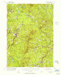
 1949 Monadnock1949 Print · USGSCheshire County at the end of the 1940s is defined by the high peak of Monadnock Mtn and its many hiking paths. Genealogists and hikers can trace old rail lines like the Boston and Maine and find local landmarks such as Roxbury Sch and Hallway House.10 unique versions available
 - 1953 Map of Peterborough, 1956 Print
 1953 Peterborough1956 Print · USGSHillsborough County in the mid-fifties is captured here as a region of mill towns and mountain trails during a period of steady growth. Researchers can locate family landmarks like the Edward MacDowell Grave, trace the Boston and Maine Railroad, or find old school sites like Appleton Academy.3 unique versions available
 - 1956 Map of Boston, 1967 Print
 1956 Boston1967 Print · USGSThe Massachusetts coastline and industrial interior are seen here during the mid-century peak of suburban and highway expansion. Researchers can trace historic harbor defenses like Fort Revere, local landmarks such as Faneuil Hall, and the vast Parker River National Wildlife Refuge.6 unique versions available
 - 1956 Map of Albany, 1968 Print
 1956 Albany1968 Print · USGSThe industrial heart of the Northeast is revealed in the mid-1950s, from the Hudson Valley to the Connecticut River. Researchers can trace the legacy of the Quabbin Reservoir, locate Westover Air Force Base, or follow the Rutland RR through the Green Mountains.2 unique versions available
 - 1957 Map of Albany
 1957 Albany1957 Print · USGSThe Tri-State region and Connecticut River Valley are captured here during a period of significant postwar growth and infrastructure expansion. Genealogists and historians can trace the rail-and-river economy through landmarks like the Boston and Maine railroad, Quabbin Reservoir, and Westover Air Force Base.
 - 1958 Map of Boston
 1958 Boston1958 Print · USGSEastern Massachusetts and southern New Hampshire are shown at the height of the industrial era, before the full expansion of the interstate system. Trace coastal defenses at Fort Warren, historic rail lines like the Boston and Maine, and the development of the Mass. 128 corridor.2 unique versions available
 - 1959 Map of Albany
 1959 Albany1959 Print · USGSThe Hudson and Connecticut River valleys are captured here during the late fifties, showing the region's dense rail networks and massive water projects. Researchers can trace the New York State Thruway or locate local landmarks like Mt Greylock and the Quabbin Reservoir.
 - 1961 Map of Boston
 1961 Boston1961 Print · USGSThe Massachusetts coastline and its industrial interior are detailed here in the mid-twentieth century, from the Monadnock highlands to Cape Cod. Researchers can trace the rail routes of the Boston and Maine or locate landmarks like Fort Devens and the Wachusett Reservoir.2 unique versions available
 - 1962 Map of Albany
 1962 Albany1962 Print · USGSThe Hudson and Connecticut River valleys meet the Green Mountains and Berkshires in this mid-century overview of the Northeast. Genealogists and historians can trace the industrial hearts of Albany and Springfield or locate features like Quabbin Reservoir and Westover Air Force Base.
 - 1984 Map of Monadnock Mountain
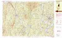 1984 Monadnock Mountain1984 Print · USGSCheshire County in the 1980s remains a landscape of prominent peaks and rail-connected valley towns. Genealogists and hikers can trace the geography of Troy, Fitzwilliam, and Jaffrey Center alongside the trails of Monadnock State Park.2 unique versions available
 - 1984 Map of Lowell
 1984 Lowell1984 Print · USGSThe Merrimack Valley industrial corridor is captured here in the mid-eighties, showing the interconnected growth of Lowell, Nashua, and Lawrence. Genealogists and historians can trace the paths of the Boston and Maine railroad or locate institutional landmarks like Merrimack College and the Fort Devens Military Reservation.
 - 1986 Map of Keene
 1986 Keene1986 Print · USGSThe tri-state borderlands of the Connecticut River Valley come alive in this mid-eighties survey of southern Vermont, New Hampshire, and Massachusetts. Genealogists and historians can trace rail-era villages like Ashuelot and Millers Falls alongside landmarks like Marlboro College and Monadnock Mountain.3 unique versions available
 - 1987 Map of Peterborough South
 1987 Peterborough South1987 Print · USGSSouthern New Hampshire’s highlands and forests come alive in the late 1980s, centered on the ridgelines of the TEMPLE MOUNTAIN RANGE. Hikers and local historians can trace the Wapack Trail past peaks and ponds or locate old settlements like Noone and Drury.
 - 1988 Map of Lowell
 1988 Lowell1988 Print · USGSThe industrial corridor of the Merrimack Valley is captured in the late eighties as it transitioned into a modern technological and residential hub. Genealogists and researchers can trace the urban layouts of Lowell and Nashua alongside landmarks like Massabesic Lake and Miller State Park.2 unique versions available
 - 1997 Map of Peterborough South, 1998 Print
 1997 Peterborough South1998 Print · USGSHillsborough County's highland forests and river valleys are captured here in the late 1990s, highlighting a landscape defined by conservation and topography. Researchers can trace the Wapack Trail over Barrett Mountain or locate historical settlements like Noone and Squantum.
 - 1998 Map of Troy, 2002 Print
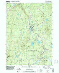 1998 Troy2002 Print · USGSCheshire County at the end of the millennium shows a landscape defined by state forests and historic rail corridors. Researchers can trace the Old Railroad Grade past Fitzwilliam Depot or locate landmarks like the Emerson Sch.
 - 1998 Map of Monadnock Mountain, 2002 Print
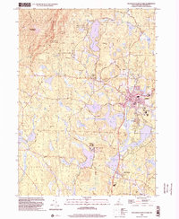 1998 Monadnock Mountain2002 Print · USGSCheshire County at the close of the millennium shows a landscape of outdoor recreation and collegiate growth. Genealogists and hikers can trace paths to Cutler Cem or follow the Monadnock-Sunapee Trail through Monadnock State Park.
 - 2012 Map of Troy, 2012 Print
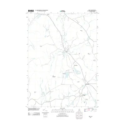 2012 Troy2012 Print · USGSCovers Jaffrey, including Swanzey, Fitzwilliam, and other nearby areas
Showing maps 1-25 of 39
Top cities near Jaffrey
- Fitchburg historical maps
- Keene historical maps
- Gardner historical maps
- Athol historical maps
- Winchendon historical maps
- Westminster historical maps
See more
Top neighborhoods of Jaffrey
- Hadley historical maps
- Jaffrey Center historical maps
- Jaffrey Center Historic District historical maps
Frequently asked questions
- What are the different types of historical maps available for Jaffrey?
- What is the oldest map of Jaffrey?
- Where can I purchase historical maps of Jaffrey for my home or office?
- Where can I download high-res historical maps of Jaffrey?
- Are there historical topographic maps available for Jaffrey?
- Is there historical aerial imagery available for Jaffrey?
- Where are historical maps of Jaffrey sourced from?