1930s Maps of Richmond, New Hampshire
Explore 8 historic maps of Richmond from the 1930s. These maps offer a rare glimpse into what life looked like during the 1930s — showing old roads, neighborhoods, homes, and landmarks that have changed or disappeared over time.
Whether you're researching your family's past, planning a metal detecting trip, or studying how Richmond's landscape evolved across the 1930s, these high-resolution maps are a powerful tool for exploring the history of this region.
- Focus on a specific era: All maps on this page are from the 1930s, giving you a focused view of this time period.
- See what’s changed: Compare century-old streets, trails, and buildings to today's modern landscape using overlays and satellite layers.
- Research with precision: Use these maps for genealogy, historical research, land use analysis, or educational projects.
- View, download, or print: Maps are fully viewable online in high resolution, and can be downloaded or printed for your own records.
Start exploring Richmond's history through authentic maps from the 1930s. This is your window into the past.
Richmond, NH maps
(8)- 1932 Map of Warwick
 1932 Warwick1932 Print · USGSIn the early 1930s, the tri-state border region of Massachusetts, New Hampshire, and Vermont was a vital corridor of rail and river transit. Genealogists and researchers can trace the old rail lines of the Central Vermont Ry, locate the East Northfield Sta, or find family landmarks like Curtis Corners and Wheeler Fall.
 - 1932 Map of Winchendon
 1932 Winchendon1932 Print · USGSThe borderlands of New Hampshire and Massachusetts come into focus during the early thirties, showing a rural landscape dominated by glacial lakes and high ridges. Researchers can trace the Boston and Maine line through State Line or locate family sites at Rand Cem and Sch No 1.
 - 1932 Map of Keene, 1954 Print
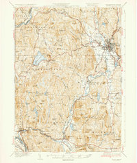
 1932 Keene1954 Print · USGSCheshire County in the early 1930s is a landscape of river-powered mill towns and developing mountain retreats. Local historians can trace the Boston and Maine RR through Keene or find vanished rural landmarks like Meetinghouse Hill and the County Farm.3 unique versions available
 - 1935 Map of Warwick
 1935 Warwick1935 Print · USGSUpper Massachusetts and the Tri-State borderlands thrive during the mid-thirties as rail corridors and river valleys connect mountain villages. Researchers can trace the Central Vermont Ry through Northfield or locate family landmarks like Barrows Cem and Barber Sch.2 unique versions available
 - 1935 Map of Keene
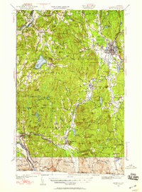
 1935 Keene1935 Print · USGSCheshire County in the mid-1930s reveals a network of mill towns and rail junctions centered on the industrial hub of Keene. Genealogists and researchers can trace local landmarks like Meetinghouse Hill, the County Farm, and the Richmond Trout Rearing Station.5 unique versions available
 - 1935 Map of Winchendon
 1935 Winchendon1935 Print · USGSIn the mid-1930s, the border between Massachusetts and New Hampshire was defined by busy rail corridors and small mill towns. Researchers can trace family-named sites and industrial infrastructure from Athol Center to Pequoig Station and the rural School No 1.4 unique versions available
 - 1936 Map of Monadnock
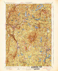 1936 Monadnock1936 Print · USGSCheshire County in the mid-thirties is a landscape of high summits and quiet mill towns connected by the rail and river. Genealogists and hikers can trace old homesteads near Bowkerville or follow the route to the Fire Lookout atop Monadnock Mtn.4 unique versions available
 - 1937 Map of Mt Grace
 1937 Mt Grace1937 Print · USGSThe rural highlands of North-Central Massachusetts are captured here in the late 1930s before modern development. Researchers can trace family-named sites like Mayo Corners and Blissville, or locate early conservation landmarks like the CCC Camp and the Fire Tower on Mt Grace.
End of results
Showing maps 1-8 of 8
Top cities near Richmond
- Keene historical maps
- Athol historical maps
- Winchendon historical maps
- Montague historical maps
- Templeton historical maps
- Orange historical maps
See more
Top neighborhoods of Richmond
Frequently asked questions
- What are the different types of historical maps available for Richmond?
- What is the oldest map of Richmond?
- Where can I purchase historical maps of Richmond for my home or office?
- Where can I download high-res historical maps of Richmond?
- Are there historical topographic maps available for Richmond?
- Is there historical aerial imagery available for Richmond?
- Where are historical maps of Richmond sourced from?