1980s Maps of Holderness, New Hampshire
Explore 5 historic maps of Holderness from the 1980s. These maps offer a rare glimpse into what life looked like during the 1980s — showing old roads, neighborhoods, homes, and landmarks that have changed or disappeared over time.
Whether you're researching your family's past, planning a metal detecting trip, or studying how Holderness's landscape evolved across the 1980s, these high-resolution maps are a powerful tool for exploring the history of this region.
- Focus on a specific era: All maps on this page are from the 1980s, giving you a focused view of this time period.
- See what’s changed: Compare century-old streets, trails, and buildings to today's modern landscape using overlays and satellite layers.
- Research with precision: Use these maps for genealogy, historical research, land use analysis, or educational projects.
- View, download, or print: Maps are fully viewable online in high resolution, and can be downloaded or printed for your own records.
Start exploring Holderness's history through authentic maps from the 1980s. This is your window into the past.
Holderness, NH maps
(5)- 1980 Map of Plymouth, 1981 Print
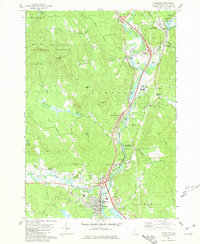 1980 Plymouth1981 Print · USGSGrafton County's river valleys were well-established by the early 1980s, balancing local industry with institutional growth. Genealogists and historians can trace the foundations of Plymouth, locate the Holderness Sch, and find family plots at Blair Cem or the Townhall Campton Ch.2 unique versions available
 - 1980 Map of Squam Mountains, 1981 Print
 1980 Squam Mountains1981 Print · USGSThe Squam Lake shoreline and high peaks of the Sandwich Range define this central New Hampshire landscape in the early eighties. Genealogists and hikers can trace historical routes like the Sandwich Notch Road, the Old RR Grade, and localized landmarks including the Covered Bridge.2 unique versions available
 - 1986 Map of Lake Winnipesaukee
 1986 Lake Winnipesaukee1986 Print · USGSThe Lakes Region in the mid-eighties shows a landscape of dense water bodies and mountain ranges at the peak of its twentieth-century character. Trace the legacy of old rail lines like the Boston and Maine RR and locate historic centers from Rumney Depot to Melvin Village.2 unique versions available
 - 1987 Map of Holderness
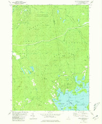
 1987 Holderness1987 Print · USGSThe Lakes Region at the close of the twentieth century shows a landscape of interconnected waters and rising hills. Genealogists and local historians can trace family landmarks like Dolloff Hill, rural Cem sites, and the extent of Sky Pond State Forest.
 - 1987 Map of Ashland
 1987 Ashland1987 Print · USGSGrafton and Belknap counties come together along the Pemigewasset River in the late 1980s, showcasing a landscape of high peaks and winding brooks. Researchers can trace the boundaries of the Scribner-Fellows State Forest or locate early landmarks like Dick Brown Pond and Hicks Hill.
End of results
Showing maps 1-5 of 5
Top cities near Holderness
- Laconia historical maps
- Gilford historical maps
- Belmont historical maps
- Moultonborough historical maps
- Plymouth historical maps
- Campton historical maps
See more
Top neighborhoods of Holderness
- Mooney Point historical maps
- Sunset Point historical maps
- Deephaven historical maps
- Rockywold historical maps
- East Holderness historical maps
- Willoughby Point historical maps
Frequently asked questions
- What are the different types of historical maps available for Holderness?
- What is the oldest map of Holderness?
- Where can I purchase historical maps of Holderness for my home or office?
- Where can I download high-res historical maps of Holderness?
- Are there historical topographic maps available for Holderness?
- Is there historical aerial imagery available for Holderness?
- Where are historical maps of Holderness sourced from?