Old Maps of Lincoln, New Hampshire for Genealogy
Trace your family roots with 64 historic maps of Lincoln. These high-res maps reveal old neighborhoods, homesites, landmarks, and streets — helping you uncover where your ancestors lived and how the area evolved over time.
- Explore historic neighborhoods: Identify where your relatives may have lived in the 1800s or 1900s.
- Compare maps over time: Trace the changes in streets, buildings, and landmarks for multi-generational research.
- Perfect for genealogy & ancestry research: Used by family historians and researchers to map out lineage and migration.
These maps are an incredible resource for exploring your personal connection to Lincoln's past.
Lincoln, NH maps
(64)- 1895 Map of Crawford Notch
 1895 Crawford Notch1895 Print · USGSThe White Mountains in the mid-1890s are shown here as a landscape of rail-accessible mountain passes and logging outposts. Genealogists and historians can trace the early tourism hubs of Crawford House and Willey House or the industrial roots of Livermore.
 - 1896 Map of Crawford Notch
 1896 Crawford Notch1896 Print · USGSHigh peaks and early railroad travel define this White Mountain landscape in the 1890s. Genealogists and historians can trace the foundations of Livermore, the Maine Central Railroad route, and landmark hotels like the Crawford House.9 unique versions available
 - 1929 Map of Moosilauke, 1959 Print
 1929 Moosilauke1959 Print · USGSGrafton County's upland townships and the White Mountain National Forest are shown here in the late twenties during a period of mountain transition. Locate family landmarks and vanished crossroads like Oliverian Sta, Swiftwater, and several rural schools including Brier Hill Sch.
 - 1929 Map of Franconia, 1963 Print
 1929 Franconia1963 Print · USGSThe White Mountains come alive in the late 1920s, showing the early infrastructure of logging and tourism before modern highway expansions. Trace the Boston and Maine RR into Lincoln, or locate local landmarks like The Profile and the Profile Golf Club.2 unique versions available
 - 1932 Map of Franconia
 1932 Franconia1932 Print · USGSThe White Mountains in the early 1930s reveal a landscape caught between industrial timbering and the rise of mountain tourism. Researchers can trace the path of the Logging RR or locate family landmarks like the Russell Farm and Fairview.5 unique versions available
 - 1932 Map of Moosilauke
 1932 Moosilauke1932 Print · USGSGrafton County is captured in the early thirties as a hub of mountain recreation and rail transport within the White Mountain National Forest. Genealogists and hikers can trace early routes of the Appalachian Trail and locate family landmarks like Moulton Hill Cemetery or Pettyboro Sch.5 unique versions available
 - 1946 Map of Crawford Notch, 1955 Print
 1946 Crawford Notch1955 Print · USGSThe White Mountains in the mid-1940s reveal a network of historic rail corridors and backcountry shelters. Trace the Maine Central Railroad through the notch or locate early landmarks like Crawford House and the Willey House P.O.9 unique versions available
 - 1950 Map of Crawford Notch
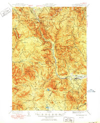 1950 Crawford Notch1950 Print · USGSGrafton and Carroll Counties are shown here during the mid-century peak of White Mountain hiking and rail travel. Researchers can trace historic trails like the Davis Path, find old mountain outposts like Willey House PO, or locate the logging settlement of Livermore.3 unique versions available
 - 1950 Map of Lewiston
 1950 Lewiston1950 Print · USGSThe Maine and New Hampshire borderlands come alive in this post-war survey of the White Mountains and Androscoggin valley. Genealogists and historians can trace rail lines like the Maine Central Railroad and find high-altitude landmarks from Mount Washington to Bretton Woods.2 unique versions available
 - 1956 Map of Lewiston, 1975 Print
 1956 Lewiston1975 Print · USGSThe Northern New England interior is documented here in the mid-fifties, from the industrial Androscoggin River to the high peaks of the White Mountains. Trace the Grand Trunk Railway through mountain passes or locate family landmarks near Sabbathday Lake and Bretton Woods.
 - 1961 Map of Lewiston
 1961 Lewiston1961 Print · USGSWestern Maine and the White Mountains appear here during the early sixties, showing the industrial river towns and vast timberlands before the modern interstate era. Genealogists and historians can trace the Grand Trunk RR through Berlin or locate landmarks like Old Speck Mountain and Elephant Mountain.
 - 1962 Map of Lewiston
 1962 Lewiston1962 Print · USGSThe industrial river valleys and high peaks of Maine and New Hampshire define the region in the early sixties. Trace the rail-and-river network from Lewiston to the White Mountains, passing through mill towns like Berlin and Rumford.
 - 1967 Map of Lincoln, 1972 Print
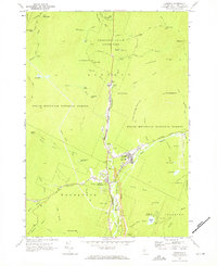 1967 Lincoln1972 Print · USGSGrafton County's mountainous heart is captured here in the late sixties, showing the growth of Lincoln as a mountain gateway. Researchers can trace historic paths like the Appalachian Trail or locate local landmarks including Riverside Cem and the Drive-in Theater.4 unique versions available
 - 1967 Map of Mt. Osceola, 1972 Print
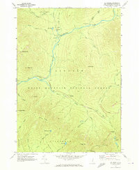 1967 Mt. Osceola1972 Print · USGSGrafton County's interior wilderness is captured here in the late sixties, showing the remote peaks and trail systems of the White Mountain National Forest. Trace the early routes of the Kancamagus Highway and find landmark sites like Thoreau Falls and Greeley Ponds.3 unique versions available
 - 1967 Map of South Twin Mtn, 1972 Print
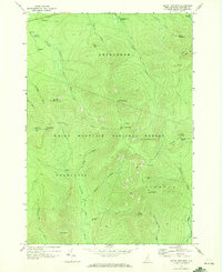 1967 South Twin Mtn1972 Print · USGSThe White Mountains in the late sixties are mapped here in detail, showing the high-altitude trails and peaks of the Twin Range. Trace the Appalachian Trail past the Galehead Hut and the Mt Garfield Lookout Tower.3 unique versions available
 - 1967 Map of Mt Moosilauke, 1973 Print
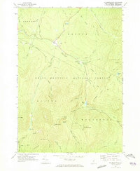 1967 Mt Moosilauke1973 Print · USGSGrafton County in the mid-1960s reveals a high-mountain wilderness where the Appalachian Trail crosses through Kinsman Notch. Researchers can trace the steep geography of Mt Moosilauke and locate landmarks like the Wildwood settlement and Lost River.3 unique versions available
 - 1967 Map of Franconia, 1973 Print
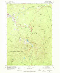 1967 Franconia1973 Print · USGSGrafton County is shown during a period of high-mountain recreation and road development in the late sixties. Researchers can trace the legendary Old Man of the Mountain, find Franconia College, and locate the historic Elmwood Cem.3 unique versions available
 - 1969 Map of Lewiston
 1969 Lewiston1969 Print · USGSThe northern New England highlands come into focus during the mid-fifties, showing the vital rail and river networks connecting industrial centers to the deep woods. Researchers can trace the path of the Grand Trunk RR or locate landmarks like Mt Washington and Rangeley Lake.
 - 1986 Map of Mount Washington
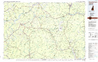 1986 Mount Washington1986 Print · USGSThe northern New England highlands are shown here in the mid-eighties, centered on the high peaks and river valleys of the New Hampshire borderlands. Researchers can trace historic transportation lines like the Mount Washington Cog Railway and the Maine Central Railroad near Gorham and Lancaster.
 - 1987 Map of Mount Carrigain
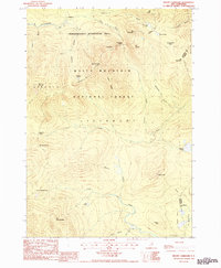 1987 Mount Carrigain1987 Print · USGSThe White Mountains in the late 1980s offer a detailed view of the high peaks and river headwaters near Grafton and Carroll counties. Hikers and historians can trace established paths like the Sawyer River Trail and find landmarks such as Sawyer Pond and Kancamagus Pass.
 - 1987 Map of Crawford Notch
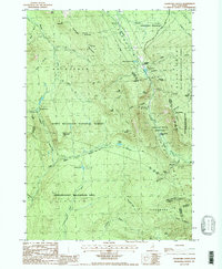 1987 Crawford Notch1987 Print · USGSGrafton County's mountainous pass is captured in the late eighties, documenting the historical lodgings and expansive trail networks of the White Mountains. Local historians can trace the sites of Crawford House and Willey House, or locate the scenic Arethusa Falls and Zealand Falls among the peaks.
 - 1988 Map of Mount Washington, 1989 Print
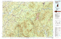 1988 Mount Washington1989 Print · USGSThe New Hampshire high country in the late 1980s is defined by its iconic peaks and the legacy of mountain tourism. Trace the routes of the historic Mount Washington Cog Railway and the Maine Central RR through the gaps of Crawford Notch State Park.
 - 1995 Map of Mount Moosilauke, 2000 Print
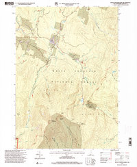 1995 Mount Moosilauke2000 Print · USGSGrafton County's high peaks and forest trails are meticulously mapped here during the mid-nineties. Hikers and historians can trace the Appalachian Trail over Mount Moosilauke or locate the site of the Lost River Reservation and the remote Wildwood settlement.
 - 1995 Map of Mount Carrigain, 2000 Print
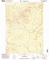 1995 Mount Carrigain2000 Print · USGSThe high peaks of the White Mountains are shown here in the 1990s, when conservation and trail networks defined the region. Hikers and historians can trace the route over Kancamagus Pass or locate remote landmarks like Stillwater and Signal Ridge.
 - 1995 Map of Lincoln, 2000 Print
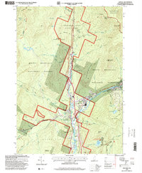 1995 Lincoln2000 Print · USGSGrafton County during the late twentieth century was a landscape shaped by wilderness preservation and alpine recreation. Researchers can locate community landmarks like Lin-Wood High School, Riverside Cem, and the iconic Covered Bridge near the town of Lincoln.
Showing maps 1-25 of 64
Top cities near Lincoln
- Littleton historical maps
- Campton historical maps
- Bartlett historical maps
- Thornton historical maps
- Whitefield historical maps
- Lisbon historical maps
See more
Top neighborhoods of Lincoln
Frequently asked questions
- What are the different types of historical maps available for Lincoln?
- What is the oldest map of Lincoln?
- Where can I purchase historical maps of Lincoln for my home or office?
- Where can I download high-res historical maps of Lincoln?
- Are there historical topographic maps available for Lincoln?
- Is there historical aerial imagery available for Lincoln?
- Where are historical maps of Lincoln sourced from?