1960s Maps of Hillsborough County, New Hampshire
Explore 22 historic maps of Hillsborough County from the 1960s. These maps offer a rare glimpse into what life looked like during the 1960s — showing old roads, neighborhoods, homes, and landmarks that have changed or disappeared over time.
Whether you're researching your family's past, planning a metal detecting trip, or studying how Hillsborough County's landscape evolved across the 1960s, these high-resolution maps are a powerful tool for exploring the history of this region.
- Focus on a specific era: All maps on this page are from the 1960s, giving you a focused view of this time period.
- See what’s changed: Compare century-old streets, trails, and buildings to today's modern landscape using overlays and satellite layers.
- Research with precision: Use these maps for genealogy, historical research, land use analysis, or educational projects.
- View, download, or print: Maps are fully viewable online in high resolution, and can be downloaded or printed for your own records.
Start exploring Hillsborough County's history through authentic maps from the 1960s. This is your window into the past.
Hillsborough County, NH maps
(22)- 1961 Map of Boston
 1961 Boston1961 Print · USGSThe Massachusetts coastline and its industrial interior are detailed here in the mid-twentieth century, from the Monadnock highlands to Cape Cod. Researchers can trace the rail routes of the Boston and Maine or locate landmarks like Fort Devens and the Wachusett Reservoir.2 unique versions available
 - 1962 Map of Albany
 1962 Albany1962 Print · USGSThe Hudson and Connecticut River valleys meet the Green Mountains and Berkshires in this mid-century overview of the Northeast. Genealogists and historians can trace the industrial hearts of Albany and Springfield or locate features like Quabbin Reservoir and Westover Air Force Base.
 - 1963 Map of Portland
 1963 Portland1963 Print · USGSCoastal Maine and New Hampshire thrived as maritime and industrial hubs during the mid-sixties, linked by a dense network of rail and river. Researchers can trace historic transit corridors like the Maine Central RR and locate key sites such as the Portsmouth Naval Shipyard or Pease Air Force Base.3 unique versions available
 - 1964 Map of Glens Falls
 1964 Glens Falls1964 Print · USGSThe tri-state borderlands of New York, Vermont, and New Hampshire appear here in the mid-1960s. Researchers can trace the rail routes of the Rutland RR and find historic sites like Ticonderoga and Saratoga National Historical Park.
 - 1965 Map of Pepperell, 1967 Print
 1965 Pepperell1967 Print · USGSThe Nashua River Valley comes alive in the mid-1960s as it spans the border between New Hampshire and Massachusetts. Genealogists and historians can trace the Boston and Maine Railroad, locate the Covered Bridge, and find old burials at Blood Cem or South Cem.3 unique versions available
 - 1965 Map of Townsend, 1967 Print
 1965 Townsend1967 Print · USGSTownsend and Brookline are captured in the mid-1960s as the rail and river corridor through the Squannacook River valley remained central to local life. Researchers can trace historic family landmarks and civic sites like Lakeview Cem, Daniels Academy, and the Boston and Maine rail line.5 unique versions available
 - 1965 Map of Ashby, 1968 Print
 1965 Ashby1968 Print · USGSThe hill towns of the Massachusetts borderlands are captured here in the mid-1960s, showing a landscape of state forests and quiet village centers. Genealogists can locate family plots in Glenwood Cem or West Cem and trace the paths through South Village and Gibson Four Corners.4 unique versions available
 - 1965 Map of Nashua South, 1968 Print
 1965 Nashua South1968 Print · USGSThe Merrimack River valley and the expanding outskirts of Nashua come into sharp focus in the mid-sixties. Genealogists and local historians can trace the foundations of Dunstable and Tyngsborough, locating Evergreen Cem and Whidden Corner.7 unique versions available
 - 1965 Map of Ashburnham, 1968 Print
 1965 Ashburnham1968 Print · USGSThe Worcester County highlands during the mid-sixties show a landscape of glacial lakes and quiet hill towns. Genealogists can locate family sites near St Dennis Cem or trace the early industrial footprint of Factory Village and Cushing Academy.5 unique versions available
 - 1966 Map of Lawrence, 1968 Print
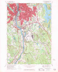
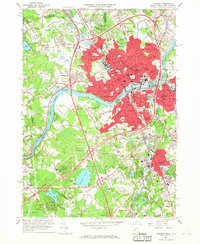 1966 Lawrence1968 Print · USGSThe industrial heart of the Merrimack Valley is captured here in the mid-sixties, showing the intersection of historic rail corridors and new interstate highways. Genealogists can trace family sites across Bellevue Cemetery, Phillips Academy, and the distinct neighborhoods of South Lawrence and Methuen.2 unique versions available
 - 1966 Map of Lowell, 1968 Print
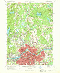 1966 Lowell1968 Print · USGSMid-century Lowell and Dracut are captured here just as the river-based industry was being joined by suburban expansion and interstate connectors. Genealogists and local historians can trace family sites from the Israel Brotherhood Cem to the Lowell Technological Institute and old Middlesex Village.5 unique versions available
 - 1967 Map of Hopkinton, 1971 Print
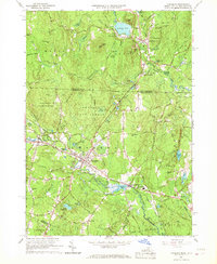
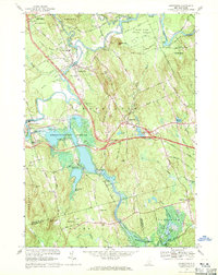 1967 Hopkinton1971 Print · USGSMerrimack County during the late 1960s shows a landscape transformed by the Hopkinton-Everett Reservoir and modern highway interchanges. Researchers can trace ancestral roots at Putney Cem or explore the transit history of the Claremont and Concord Railroad and the landmark Covered Bridge.2 unique versions available
 - 1967 Map of Weare, 1971 Print
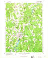
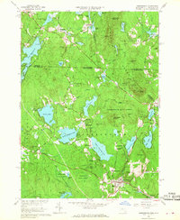
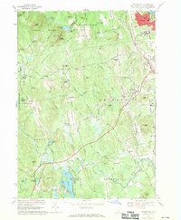
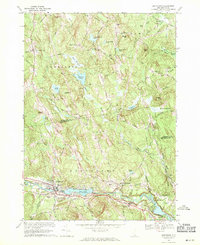
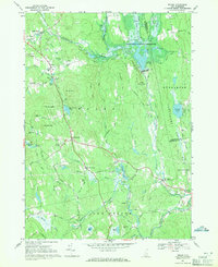 1967 Weare1971 Print · USGSHillsborough County in the late sixties reveals a landscape transformed by water management and historic New England settlement. Researchers can trace ancestral roots at Quaker Cem and Stark Cem or follow the Old Railroad Grade past Tavern Village.3 unique versions available
 - 1968 Map of New Boston, 1971 Print
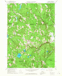
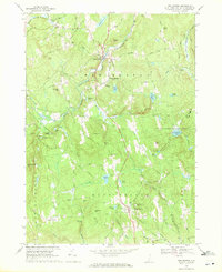 1968 New Boston1971 Print · USGSHillsborough County's rural character is preserved in the late sixties as New Boston and Mont Vernon develop around the Piscataquog River branches. Researchers can trace ancestral lands near Greenlawn Cem, family-named heights like Joe English Hill, and the extensive US Military Reservation.3 unique versions available
 - 1968 Map of Manchester North, 1971 Print
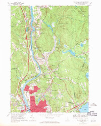 1968 Manchester North1971 Print · USGSThe northern edge of Manchester and the river-bound community of Hooksett are captured here in the late sixties as urban growth meets the wooded New Hampshire hills. Local historians can trace the paths of the Boston and Maine Railroad and find long-standing landmarks like Mt Saint Mary College and the Martin Cem.3 unique versions available
 - 1968 Map of Nashua North, 1971 Print
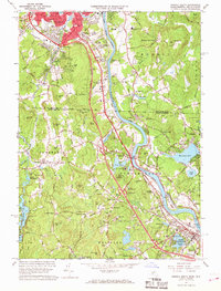
 1968 Nashua North1971 Print · USGSNashua and Hudson appear in a state of mid-century transformation as the suburbs expanded along the Merrimack River in the late sixties. Genealogists can locate several burial grounds like Edgewood Cem and Boyd Cem or trace the path of the Boston and Maine railroad.3 unique versions available
 - 1968 Map of Pinardville, 1971 Print
 1968 Pinardville1971 Print · USGSSouthern New Hampshire in the late sixties displays a mix of growing college campuses and quiet rural ridgelines. Genealogists and local historians can trace family-named sites like the Horace Greeley Birthplace, St Anselms College, and the St Josephs Cem.3 unique versions available
 - 1968 Map of Manchester South, 1971 Print
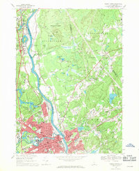
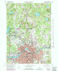
 1968 Manchester South1971 Print · USGSManchester and its southern suburbs were undergoing significant growth in the late sixties as industrial roots met modern infrastructure. Genealogists can trace family plots in Pine Grove Cemetery or locate neighborhood landmarks like St Peters Orphanage and Reeds Ferry.4 unique versions available
 - 1968 Map of South Merrimack, 1971 Print
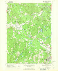 1968 South Merrimack1971 Print · USGSHillsborough County's transition from rural townships to a modern regional hub is evident in this late 1960s survey. Researchers can trace ancestral roots at Town Cem and Turkey Hill Cem or explore the rail-and-river economy near Haydens Millpond and along the BOSTON AND MAINE RAILROAD.4 unique versions available
 - 1968 Map of Milford, 1971 Print
 1968 Milford1971 Print · USGSHillsborough County towns thrive along the river and rail corridors of South Central New Hampshire during the late sixties. Genealogists and hikers can trace family plots at Riverside Cemetery or scout the landscape from the Federal Hill Lookout Tower and Purgatory Falls.3 unique versions available
 - 1969 Map of Goffstown, 1971 Print
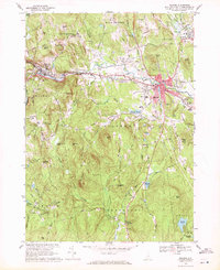
 1969 Goffstown1971 Print · USGSGoffstown and Dunbarton are captured here in the late sixties as the Piscataquog valley balanced its industrial rail heritage with residential growth. Genealogists can trace family plots in Westlawn Cem or Holy Trinity Cemetery and locate civic landmarks like the County Home.3 unique versions available
 - 1969 Map of Lowell, 1988 Print
 1969 Lowell1988 Print · USGSIn the late sixties, the industrial heart of Lowell and its northern neighbors in Dracut were expanding around the historic Merrimack River. Genealogists and local historians can trace the development of neighborhood schools like Keith Academy and old burial grounds such as St Josephs Cem.
End of results
Showing maps 1-22 of 22
Top cities of Hillsborough County
- Manchester historical maps
- Nashua historical maps
- Merrimack historical maps
- Hudson historical maps
- Bedford historical maps
- Goffstown historical maps
See more
Frequently asked questions
- What are the different types of historical maps available for Hillsborough County?
- What is the oldest map of Hillsborough County?
- Where can I purchase historical maps of Hillsborough County for my home or office?
- Where can I download high-res historical maps of Hillsborough County?
- Are there historical topographic maps available for Hillsborough County?
- Is there historical aerial imagery available for Hillsborough County?
- Where are historical maps of Hillsborough County sourced from?