Old Maps of Hillsborough County, New Hampshire for Metal Detecting
Plan your next treasure hunt with 286 historic maps of Hillsborough County. Find old homesites, ghost towns, trails, and gathering spots that may be lost to time — perfect for identifying promising metal detecting locations.
- Locate forgotten sites: Uncover places like long-lost settlements, abandoned rail lines, or gathering spots.
- Plan better hunts: Use map overlays combined with LiDAR or satellite views to narrow in on historically rich areas.
- Made for detectorists: Thousands of hobbyists use these maps to discover relics, coins, and hidden history.
Use these historic maps to boost your research and find new opportunities beneath the surface of Hillsborough County.
Hillsborough County, NH maps
(286)- 1886 Map of Lawrence
 1886 Lawrence1886 Print · USGSThe Merrimack Valley at the close of the nineteenth century was a bustling hub of industry and transit. Researchers can trace ancestral roots through vanished hamlets like Frye Village, locate the original Andover Theological Seminary, and follow the old Salem and Lawrence Railroad line.
 - 1886 Map of Lowell
 1886 Lowell1886 Print · USGSThe industrial heart of the Merrimack Valley is captured here in the late nineteenth century, showing the expansion of textile hubs and rail networks. Genealogists and historians can trace family-named hills and early transit stops like Bedford Springs Station, Forge Village, and the Hudson Poor Farm.
 - 1887 Map of Fitchburg
 1887 Fitchburg1887 Print · USGSThe hills of Worcester County were a beehive of rail and industry when this survey was conducted. Trace the original routes of the Fitchburg Railroad and find long-established local centers like Wachusett Village, Converse Ville, and Rollstone Hill.
 - 1888 Map of Lawrence
 1888 Lawrence1888 Print · USGSThe Merrimack Valley industrial corridor is captured here in the late nineteenth century as a thriving rail and textile hub. Researchers can trace the footprints of the Andover Theological Seminary, locate the State Almshouse, and follow the iron tracks through Ballardvale.
 - 1889 Map of Fitchburg
 1889 Fitchburg1889 Print · USGSNorth-central Massachusetts and southern New Hampshire are captured here in the late Victorian era as industry and rail expanded. Genealogists can trace family homesteads near Whitmanville or locate specific rail depots like Ashburnham Junction and Westminster Station.
 - 1893 Map of Lowell
 1893 Lowell1893 Print · USGSThe Merrimack Valley’s industrial and rail landscape comes alive in the late nineteenth century, centering on the growing city of Lowell. Genealogists and historians can trace old property lines across Pelham, locate the Flat Rock Quarry, or follow the routes of the Stony Brook Railroad through Graniteville.9 unique versions available
 - 1893 Map of Fitchburg
 1893 Fitchburg1893 Print · USGSNorth-central Massachusetts at the close of the nineteenth century was a complex network of industrial valley towns and highland rail junctions. You can trace the path of the Cheshire Railroad as it winds past Lake Monomonac or explore the early street layouts of Fitchburg and Leominster.7 unique versions available
 - 1893 Map of Lawrence
 1893 Lawrence1893 Print · USGSThe Merrimac River valley and its surrounding textile and rail hubs are captured here at their industrial peak during the 1880s. Genealogists can trace family footprints through the State Almshouse, the Andover Theological Seminary, and vanished stops like Burtts Crossing Station.10 unique versions available
 - 1893 Map of Groton, 1905 Print
 1893 Groton1905 Print · USGSNorthern Massachusetts and the New Hampshire borderlands are shown here in the late nineteenth century as a hub of river industry and rail commerce. Researchers can trace historic sites like Shaker Village, the Groton School, and manufacturing hubs at Paper Mill Village.8 unique versions available
 - 1898 Map of Monadnock
 1898 Monadnock1898 Print · USGSThe peaks and valleys of Southwest New Hampshire are shown here during the late nineteenth-century railroad era. Genealogists and historians can trace the rail-dependent growth of towns like East Jaffrey and locate sites such as Mountain House or the Marlboro Depot.8 unique versions available
 - 1900 Map of Peterboro
 1900 Peterboro1900 Print · USGSHillsborough County villages and mountain ranges come into sharp focus during the late Victorian era as rail lines expanded through the valley. Researchers can trace the Boston and Maine RR corridors and locate family landmarks from Peterboro to New Ipswich and Lithia Spring.9 unique versions available
 - 1905 Map of Manchester
 1905 Manchester1905 Print · USGSSouthern New Hampshire at the turn of the century reveals a bustling region of river-powered industry and growing rail towns. Genealogists and historians can trace the early footprints of Manchester and Nashua or locate landmarks like Thorntons Ferry and the Londonderry Lithia Spring.4 unique versions available
 - 1906 Map of Milford
 1906 Milford1906 Print · USGSHillsborough County at the turn of the century is a landscape of thriving river towns and expanding rail lines. You can trace early 1900s family homesteads near Joe English Hill, visit the waters of Milford Springs, or locate the old Laurel PO.8 unique versions available
 - 1918 Map of Lowell
 1918 Lowell1918 Print · USGSGreater Lowell and the Merrimack Valley are shown at their industrial peak during the First World War. Genealogists can trace family connections to mill-town life in Middlesex Village or locate rural landmarks like Flat Rock Quarry and the Old Middlesex Canal.
 - 1918 Map of Lawrence
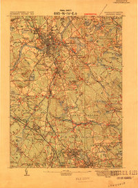 1918 Lawrence1918 Print · USGSGreater Lawrence and the Merrimac Valley are captured here during the late First World War era, showing a landscape defined by industrial rail and historic village centers. Researchers can trace the sprawling Boston and Maine Railroad network to specific sites like the State Almshouse or the Andover Theological Seminary.2 unique versions available
 - 1921 Map of Suncook
 1921 Suncook1921 Print · USGSMerrimack and Suncook River valleys thrive in the early 1920s as bustling centers of rail travel and local education. Genealogists can locate family homesteads near dozens of rural schoolhouses like Borough School or trace the old Boston and Maine Railroad through Suncook and Hooksett.5 unique versions available
 - 1921 Map of Lowell
 1921 Lowell1921 Print · USGSThe industrial corridor of the Merrimack Valley is captured here during the early twentieth century, showing the dense urban grid of Lowell alongside rural Middlesex County. Researchers can trace the extensive reach of the Boston and Maine Railroad and locate local landmarks like the Poor Farm or Flat Rock Quarry.
 - 1926 Map of Hillsboro
 1926 Hillsboro1926 Print · USGSHillsborough County's mill towns and hill farms are captured here in the mid-1920s as the rail-and-river economy remained the local heartbeat. Researchers can trace the Boston and Maine line through Slab City or locate the Birthplace of Franklin Pierce near Jackman Reservoir.2 unique versions available
 - 1927 Map of Concord
 1927 Concord1927 Print · USGSMerrimack and Hillsborough counties show a landscape of river-driven industry and rural school districts during the mid-twenties. Genealogists can trace family lines through dozens of local schoolhouses and institutions like St Pauls School or the Quaker Church.6 unique versions available
 - 1929 Map of Hillsboro
 1929 Hillsboro1929 Print · USGSCentral New Hampshire in the late twenties reveals a landscape of river-powered towns and remote hill farms. Trace family history at the Birthplace of Franklin Pierce or locate old schoolhouses like Liberty Union Sch and Hemlock Sch.5 unique versions available
 - 1930 Map of Lovewell Mountain
 1930 Lovewell Mountain1930 Print · USGSThe Cheshire and Sullivan County borderlands come alive in this late 1920s survey of the New Hampshire highlands. Researchers can locate long-standing crossroads like East Lempster, find vanished rural education at Fifield Sch, or trace the old Loverens Mill site.4 unique versions available
 - 1931 Map of Lowell
 1931 Lowell1931 Print · USGSSouthern New Hampshire and northern Massachusetts met along the river and rail lines in the early thirties. Local researchers can trace family lands near St Marie Convent, the site of Musquash Sch, and the heights of Jeremy Hill.
 - 1931 Map of Groton
 1931 Groton1931 Print · USGSThe Massachusetts and New Hampshire borderlands in the early thirties reveal a landscape of river-powered rail and rural industry. Genealogists can trace family landmarks and transport hubs like Hollis Sta, Potanopa Pond, and the Runnels Bridge.
 - 1931 Map of Fitchburg
 1931 Fitchburg1931 Print · USGSThe Massachusetts and New Hampshire border region was a network of mill villages and mountain ridges in the early thirties. Genealogists and historians can locate rural landmarks like School No 8, the High Bridge, and the Boston and Maine rail line.
 - 1935 Map of Groton
 1935 Groton1935 Print · USGSCrossing the New Hampshire border in the 1930s, this area was a bustling hub of rail transport and riverside industry. Researchers can trace the legacy of communal life at Shaker Village, locate the campus of Groton School, or follow the lines of the Boston and Maine RR through towns like Pepperell and Shirley.
Showing maps 1-25 of 286
Top cities of Hillsborough County
- Manchester historical maps
- Nashua historical maps
- Merrimack historical maps
- Hudson historical maps
- Bedford historical maps
- Goffstown historical maps
See more
Frequently asked questions
- What are the different types of historical maps available for Hillsborough County?
- What is the oldest map of Hillsborough County?
- Where can I purchase historical maps of Hillsborough County for my home or office?
- Where can I download high-res historical maps of Hillsborough County?
- Are there historical topographic maps available for Hillsborough County?
- Is there historical aerial imagery available for Hillsborough County?
- Where are historical maps of Hillsborough County sourced from?