1900s (20th Century) Maps of Auburn, New Hampshire
Explore 26 historic maps of Auburn from the 1900s (20th Century). These maps offer a rare glimpse into what life looked like during the 1900s — showing old roads, neighborhoods, homes, and landmarks that have changed or disappeared over time.
Whether you're researching your family's past, planning a metal detecting trip, or studying how Auburn's landscape evolved across the 1900s, these high-resolution maps are a powerful tool for exploring the history of this region.
- Focus on a specific era: All maps on this page are from the 1900s, giving you a focused view of this time period.
- See what’s changed: Compare century-old streets, trails, and buildings to today's modern landscape using overlays and satellite layers.
- Research with precision: Use these maps for genealogy, historical research, land use analysis, or educational projects.
- View, download, or print: Maps are fully viewable online in high resolution, and can be downloaded or printed for your own records.
Start exploring Auburn's history through authentic maps from the 1900s. This is your window into the past.
Auburn, NH maps
(26)- 1905 Map of Manchester
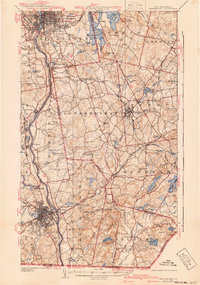
 1905 Manchester1905 Print · USGSSouthern New Hampshire at the turn of the century reveals a bustling region of river-powered industry and growing rail towns. Genealogists and historians can trace the early footprints of Manchester and Nashua or locate landmarks like Thorntons Ferry and the Londonderry Lithia Spring.4 unique versions available
 - 1921 Map of Suncook
 1921 Suncook1921 Print · USGSMerrimack and Suncook River valleys thrive in the early 1920s as bustling centers of rail travel and local education. Genealogists can locate family homesteads near dozens of rural schoolhouses like Borough School or trace the old Boston and Maine Railroad through Suncook and Hooksett.5 unique versions available
 - 1941 Map of Manchester
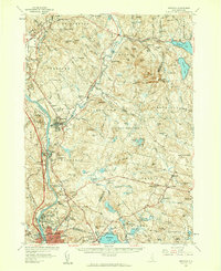
 1941 Manchester1941 Print · USGSSouthern New Hampshire is captured here just before the mid-century boom, showing the river-and-rail corridor between Manchester and Nashua. Researchers can trace old ferry sites like Thorntons Ferry and find vanished rural landmarks like Londonderry Lithia Spring or the Musquash School.3 unique versions available
 - 1943 Map of Lowell
 1943 Lowell1943 Print · USGSCentral New England industrial hubs and rural borderlands are mapped here during the early 1940s. Genealogists can trace family names across Mt Misery, Barrett Hill, and small settlements like Collinsville or North Pelham.
 - 1944 Map of Suncook
 1944 Suncook1944 Print · USGSSuncook and the surrounding New Hampshire hill towns are captured in the 1940s as industry met a rugged landscape. Trace ancestral homes and community hubs like Candia Station, the Sanitarium, and the Buck Street Sch during this era of transition.
 - 1948 Map of Boston
 1948 Boston1948 Print · USGSEastern Massachusetts and southern New Hampshire appear at an industrial peak in the late 1940s, just as suburban growth began to accelerate. Genealogists and historians can trace rail lines like the Boston and Albany RR or locate coastal landmarks like Graves Lighthouse and Fort Devens.2 unique versions available
 - 1949 Map of Portland
 1949 Portland1949 Print · USGSCoastal Maine and the New Hampshire interior are shown in detail during the late forties, from the bustling harbors to the lakeside villages. Researchers can trace historical rail networks like the Boston & Maine RR and locate coastal defenses such as Fort Preble.3 unique versions available
 - 1953 Map of Manchester, 1958 Print
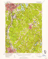 1953 Manchester1958 Print · USGSSouthern New Hampshire thrives in the early fifties as industrial cities and military installations like Grenier Air Force Base anchor the Merrimack Valley. Trace ancestral roots at St Josephs Cem or locate old river crossings like Thorntons Ferry.4 unique versions available
 - 1956 Map of Portland, 1963 Print
 1956 Portland1963 Print · USGSSouthern Maine and eastern New Hampshire are captured here in the mid-fifties, during a time of major highway expansion and military growth. You can trace the path of the Maine Turnpike and locate landmarks like the Portsmouth Naval Shipyard and Sebago Lake.4 unique versions available
 - 1956 Map of Boston, 1967 Print
 1956 Boston1967 Print · USGSThe Massachusetts coastline and industrial interior are seen here during the mid-century peak of suburban and highway expansion. Researchers can trace historic harbor defenses like Fort Revere, local landmarks such as Faneuil Hall, and the vast Parker River National Wildlife Refuge.6 unique versions available
 - 1957 Map of Suncook, 1959 Print
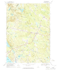
 1957 Suncook1959 Print · USGSCentral New Hampshire comes into focus during the late fifties, capturing the growth of Manchester and the surrounding river valleys. Genealogists can trace family names at Pembroke Cem or locate historic schools like Pembroke Academy and Center Sch.4 unique versions available
 - 1958 Map of Boston
 1958 Boston1958 Print · USGSEastern Massachusetts and southern New Hampshire are shown at the height of the industrial era, before the full expansion of the interstate system. Trace coastal defenses at Fort Warren, historic rail lines like the Boston and Maine, and the development of the Mass. 128 corridor.2 unique versions available
 - 1959 Map of Portland
 1959 Portland1959 Print · USGSThe Maine and New Hampshire coastlines meet in this mid-century portrait of maritime commerce and inland rail networks. Researchers can trace the legacy of coastal defense at Fort Williams and follow the historic path of the Maine Central RR through the White Mountain National Forest.2 unique versions available
 - 1961 Map of Boston
 1961 Boston1961 Print · USGSThe Massachusetts coastline and its industrial interior are detailed here in the mid-twentieth century, from the Monadnock highlands to Cape Cod. Researchers can trace the rail routes of the Boston and Maine or locate landmarks like Fort Devens and the Wachusett Reservoir.2 unique versions available
 - 1963 Map of Portland
 1963 Portland1963 Print · USGSCoastal Maine and New Hampshire thrived as maritime and industrial hubs during the mid-sixties, linked by a dense network of rail and river. Researchers can trace historic transit corridors like the Maine Central RR and locate key sites such as the Portsmouth Naval Shipyard or Pease Air Force Base.3 unique versions available
 - 1968 Map of Manchester North, 1971 Print
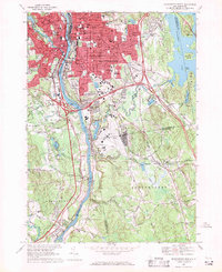
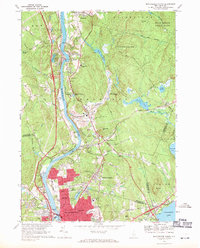 1968 Manchester North1971 Print · USGSThe northern edge of Manchester and the river-bound community of Hooksett are captured here in the late sixties as urban growth meets the wooded New Hampshire hills. Local historians can trace the paths of the Boston and Maine Railroad and find long-standing landmarks like Mt Saint Mary College and the Martin Cem.3 unique versions available
 - 1968 Map of Derry, 1971 Print
 1968 Derry1971 Print · USGSDerry and Chester appear in the late sixties as vibrant academic and residential hubs in Rockingham County. Genealogists and local historians can trace the grounds of Pinkerton Academy, locate the Village Cem, or find the tracks of the Boston and Maine Railroad.3 unique versions available
 - 1968 Map of Manchester South, 1971 Print
 1968 Manchester South1971 Print · USGSManchester and its southern suburbs were undergoing significant growth in the late sixties as industrial roots met modern infrastructure. Genealogists can trace family plots in Pine Grove Cemetery or locate neighborhood landmarks like St Peters Orphanage and Reeds Ferry.4 unique versions available
 - 1969 Map of Candia, 1971 Print
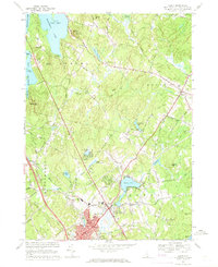
 1969 Candia1971 Print · USGSRockingham County in the late sixties shows a landscape of wooded state parks and quiet rail corridors. Genealogists can locate family landmarks like the Holbrook Cem, the Moore Sch, and the Boston and Maine Railroad grade.2 unique versions available
 - 1977 Map of Manchester South, 1981 Print
 1977 Manchester South1981 Print · USGSHillsborough County in the late seventies is captured here through detailed aerial photography showing the rapid expansion of the Manchester area. Genealogists and local researchers can trace the riverfront at Reeds Ferry or study the shoreline of Pine Island Pond.
 - 1977 Map of Manchester North, 1981 Print
 1977 Manchester North1981 Print · USGSThe Merrimack River valley in the late seventies shows a landscape undergoing rapid modernization and highway expansion. Genealogists and local historians can trace the street grids of Manchester as they meet landmarks like Hooksett and Massabesic Lake.
 - 1977 Map of Derry, 1981 Print
 1977 Derry1981 Print · USGSDerry and Rockingham County appear in the late seventies as historic village centers meet the expanding highway network. Local historians can trace the footprint of Derry Village, the shoreline of Beaver Lake, and the wooded slopes of Mine Hill.
 - 1984 Map of Lowell
 1984 Lowell1984 Print · USGSThe Merrimack Valley industrial corridor is captured here in the mid-eighties, showing the interconnected growth of Lowell, Nashua, and Lawrence. Genealogists and historians can trace the paths of the Boston and Maine railroad or locate institutional landmarks like Merrimack College and the Fort Devens Military Reservation.
 - 1986 Map of Concord
 1986 Concord1986 Print · USGSCentral New Hampshire in the mid-eighties shows a landscape of river-valley cities and rural villages connected by the growing interstate system. Genealogists and historians can trace old community centers like Gilmanton Ironworks or follow the Boston and Maine Railroad through Concord and Tilton.
 - 1988 Map of Lowell
 1988 Lowell1988 Print · USGSThe industrial corridor of the Merrimack Valley is captured in the late eighties as it transitioned into a modern technological and residential hub. Genealogists and researchers can trace the urban layouts of Lowell and Nashua alongside landmarks like Massabesic Lake and Miller State Park.2 unique versions available
Showing maps 1-25 of 26
Top cities near Auburn
- Manchester historical maps
- Nashua historical maps
- Haverhill historical maps
- Methuen historical maps
- Concord historical maps
- Derry historical maps
See more
Frequently asked questions
- What are the different types of historical maps available for Auburn?
- What is the oldest map of Auburn?
- Where can I purchase historical maps of Auburn for my home or office?
- Where can I download high-res historical maps of Auburn?
- Are there historical topographic maps available for Auburn?
- Is there historical aerial imagery available for Auburn?
- Where are historical maps of Auburn sourced from?