Old Maps of East Kingston, New Hampshire for Hiking & Exploration
Hike through history with 35 historic maps of East Kingston. Explore old trails, ghost towns, and forgotten backroads — perfect for outdoor adventurers and local explorers.
- Rediscover forgotten places: Map out old mining camps, roads, and footpaths that no longer exist on modern maps.
- Layer with modern tools: Combine with LiDAR or satellite views to plan hikes through historical terrain.
- Made for exploration: Popular among hikers, overlanders, and local history lovers.
Use these maps to find adventure and explore the hidden past of East Kingston.
East Kingston, NH maps
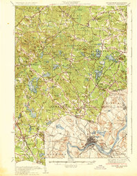
(35)- 1888 Map of Newburyport
 1888 Newburyport1888 Print · USGSThe North Shore and Seacoast regions meet at the turn of the century along the Merrimac River. Trace the early rail lines of the Boston and Maine Railroad or locate coastal landmarks like the U.S. Life Saving Station and Range Light.
 - 1888 Map of Haverhill
 1888 Haverhill1888 Print · USGSThe Merrimack Valley at the end of the nineteenth century reveals a landscape shaped by heavy rail and river industry. Genealogists can trace family footprints through historic hubs like Salem Depot, Ayers Village, and the bustling streets of Haverhill.
 - 1890 Map of Haverhill
 1890 Haverhill1890 Print · USGSSoutheastern New Hampshire and northern Massachusetts meet here in the 1890s along the industrial corridor of the Merrimac River. Local historians can trace the early rail network through Newton Junction, Salem Depot, and the dense street grids of Haverhill.
 - 1890 Map of Newburyport
 1890 Newburyport1890 Print · USGSThe coastal borderlands of Massachusetts and New Hampshire are shown here during a peak era of maritime and rail activity. Genealogists and local historians can trace family-named sites across Newbury Old Town, Byfield, and the bustling docks at Salisbury Point.
 - 1893 Map of Haverhill
 1893 Haverhill1893 Print · USGSThe Merrimack Valley at the end of the nineteenth century was a bustling network of rail-side villages and river industry. Genealogists can trace family lines through transit hubs like Newton Junction, rural hamlets like Ayer Village, and local landmarks like Spicket Hill.7 unique versions available
 - 1894 Map of Newburyport
 1894 Newburyport1894 Print · USGSCoastal Massachusetts and New Hampshire are captured here in the late nineteenth century, from the bustling riverfront of Newburyport to the marshes of Hampton. Genealogists and historians can trace rail lines, coastal landmarks like the U.S. Life Saving Station, and old neighborhoods in Amesbury or Newbury Old Town.7 unique versions available
 - 1932 Map of Newburyport
 1932 Newburyport1932 Print · USGSThe New Hampshire seacoast and southern Rockingham County are shown here in the early thirties, just as coastal recreation and inland farming reached a mature balance. Genealogists can locate family-named landmarks like Nason Corner, Dearborn Academy, and various district schools.4 unique versions available
 - 1934 Map of Exeter
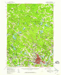
 1934 Exeter1934 Print · USGSThe New Hampshire seacoast and Merrimack Valley met the Atlantic in the mid-thirties as a network of rail and river commerce. Genealogists can trace family lines through Newbury Old Town or locate historic institutions like Phillips Exeter Academy and Dearborn Academy.5 unique versions available
 - 1935 Map of Haverhill
 1935 Haverhill1935 Print · USGSThe borderlands of New Hampshire and Massachusetts appear here in the mid-1930s, showing a landscape defined by the Merrimack River and a dense rail network. Genealogists can trace family landmarks like Philbrick Hill or locate old schoolhouses including South Road Sch and the Depot Sch.5 unique versions available
 - 1943 Map of Lowell
 1943 Lowell1943 Print · USGSCentral New England industrial hubs and rural borderlands are mapped here during the early 1940s. Genealogists can trace family names across Mt Misery, Barrett Hill, and small settlements like Collinsville or North Pelham.
 - 1943 Map of Cape Ann
 1943 Cape Ann1943 Print · USGSCoastal Massachusetts and New Hampshire appear here during the wartime era, showing the maritime and rail infrastructure that defined the North Shore. Genealogists can trace family names across Asbury Grove, Merrimacport, and the Boston & Maine RR rail corridor.
 - 1948 Map of Boston
 1948 Boston1948 Print · USGSEastern Massachusetts and southern New Hampshire appear at an industrial peak in the late 1940s, just as suburban growth began to accelerate. Genealogists and historians can trace rail lines like the Boston and Albany RR or locate coastal landmarks like Graves Lighthouse and Fort Devens.2 unique versions available
 - 1950 Map of Exeter, 1952 Print
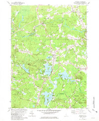
 1950 Exeter1952 Print · USGSCoastal New Hampshire's rural character and established town centers are captured here at mid-century, just as local road networks began to expand. Researchers can trace ancestral roots through family-named landmarks like Gooch Corner, Dows Corner, and the Westview Cem.5 unique versions available
 - 1956 Map of Haverhill, 1959 Print
 1956 Haverhill1959 Print · USGSMid-century New England comes to life across the New Hampshire and Massachusetts border during this period of significant growth. Genealogists and historians can trace the Whittier Birthplace, numerous local schools like Tilton Sch, and the busy corridors of the Boston and Maine Railroad.3 unique versions available
 - 1956 Map of Boston, 1967 Print
 1956 Boston1967 Print · USGSThe Massachusetts coastline and industrial interior are seen here during the mid-century peak of suburban and highway expansion. Researchers can trace historic harbor defenses like Fort Revere, local landmarks such as Faneuil Hall, and the vast Parker River National Wildlife Refuge.6 unique versions available
 - 1958 Map of Boston
 1958 Boston1958 Print · USGSEastern Massachusetts and southern New Hampshire are shown at the height of the industrial era, before the full expansion of the interstate system. Trace coastal defenses at Fort Warren, historic rail lines like the Boston and Maine, and the development of the Mass. 128 corridor.2 unique versions available
 - 1961 Map of Boston
 1961 Boston1961 Print · USGSThe Massachusetts coastline and its industrial interior are detailed here in the mid-twentieth century, from the Monadnock highlands to Cape Cod. Researchers can trace the rail routes of the Boston and Maine or locate landmarks like Fort Devens and the Wachusett Reservoir.2 unique versions available
 - 1977 Map of Exeter, 1981 Print
 1977 Exeter1981 Print · USGSThe coastal New Hampshire landscape is captured here in the late 1970s, showcasing the transition from village centers to rural outskirts. Researchers can trace land use patterns near Exeter and locate family-named intersections like Eastman Corners and Parkman Corner.
 - 1981 Map of Kingston
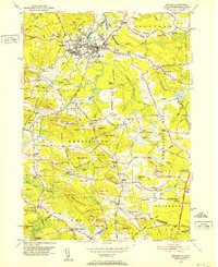
 1981 Kingston1981 Print · USGSSouthern New Hampshire's pond country is captured here in the early eighties, showing the historic village centers of Kingston and Brentwood. Genealogists can trace family sites at Ye Old Cem or Brentwood Cem and locate landmarks like the Ye Old Meeting House.2 unique versions available
 - 1984 Map of Lowell
 1984 Lowell1984 Print · USGSThe Merrimack Valley industrial corridor is captured here in the mid-eighties, showing the interconnected growth of Lowell, Nashua, and Lawrence. Genealogists and historians can trace the paths of the Boston and Maine railroad or locate institutional landmarks like Merrimack College and the Fort Devens Military Reservation.
 - 1984 Map of Gloucester
 1984 Gloucester1984 Print · USGSCoastal Massachusetts and the New Hampshire borderlands are shown here in the mid-eighties, from the granite shores of Cape Ann to the Merrimack River. Researchers can trace the legacy of maritime trade and higher education at Salem State College or follow the Boston and Maine rail lines through Ipswich and Beverly.
 - 1985 Map of Exeter
 1985 Exeter1985 Print · USGSThe New Hampshire seacoast in the mid-eighties shows a landscape of colonial roots meeting modern energy infrastructure. Genealogists and historians can trace long-standing family corners and sites like Phillips Exeter Academy or Coffins Mill alongside the emerging Seabrook nuclear facility.
 - 1987 Map of Exeter
 1987 Exeter1987 Print · USGSThe Rockingham County coast and inland corridors are captured here in the late eighties, featuring the transition from Exeter to the Atlantic shore. Researchers can trace the development of the Seabrook Power Plant or locate local landmarks like Phillips Exeter Academy and Coffins Mill.
 - 1988 Map of Lowell
 1988 Lowell1988 Print · USGSThe industrial corridor of the Merrimack Valley is captured in the late eighties as it transitioned into a modern technological and residential hub. Genealogists and researchers can trace the urban layouts of Lowell and Nashua alongside landmarks like Massabesic Lake and Miller State Park.2 unique versions available
 - 1992 Map of Exeter, 1998 Print
 1992 Exeter1998 Print · USGSCoastal New Hampshire's transition from historic river towns to modern energy infrastructure is captured here in the early nineties. Genealogists and local historians can trace family-named crossroads like Eastman Corners, locate the campus of Phillips Exeter Academy, and identify old industrial sites like Coffins Mill.
Showing maps 1-25 of 35
Top cities near East Kingston
- Lawrence historical maps
- Haverhill historical maps
- Methuen historical maps
- Derry historical maps
- Andover historical maps
- Dover historical maps
See more
Frequently asked questions
- What are the different types of historical maps available for East Kingston?
- What is the oldest map of East Kingston?
- Where can I purchase historical maps of East Kingston for my home or office?
- Where can I download high-res historical maps of East Kingston?
- Are there historical topographic maps available for East Kingston?
- Is there historical aerial imagery available for East Kingston?
- Where are historical maps of East Kingston sourced from?