Old Maps of Charlestown, New Hampshire for Genealogy
Trace your family roots with 21 historic maps of Charlestown. These high-res maps reveal old neighborhoods, homesites, landmarks, and streets — helping you uncover where your ancestors lived and how the area evolved over time.
- Explore historic neighborhoods: Identify where your relatives may have lived in the 1800s or 1900s.
- Compare maps over time: Trace the changes in streets, buildings, and landmarks for multi-generational research.
- Perfect for genealogy & ancestry research: Used by family historians and researchers to map out lineage and migration.
These maps are an incredible resource for exploring your personal connection to Charlestown's past.
Charlestown, NH maps
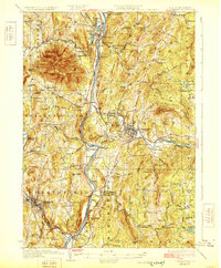
(21)- 1926 Map of Claremont, 1955 Print
 1926 Claremont1955 Print · USGSCovers Charlestown, including Claremont, Newport, and other nearby areas
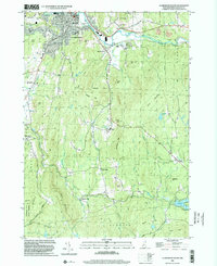
 - 1927 Map of Bellows Falls
 1927 Bellows Falls1927 Print · USGSCovers Charlestown, including Brockways Mills, Springfield, and other nearby areas4 unique versions available
 - 1929 Map of Claremont
 1929 Claremont1929 Print · USGSCovers Charlestown, including Claremont, Newport, and other nearby areas4 unique versions available
 - 1930 Map of Bellows Falls
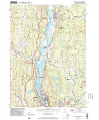
 1930 Bellows Falls1930 Print · USGSCovers Charlestown, including Brockways Mills, Springfield, and other nearby areas7 unique versions available
 - 1950 Map of Glens Falls
 1950 Glens Falls1950 Print · USGSCovers Charlestown, including Queensbury, Saratoga Springs, and other nearby areas
 - 1956 Map of Glens Falls, 1968 Print
 1956 Glens Falls1968 Print · USGSCovers Charlestown, including Queensbury, Saratoga Springs, and other nearby areas3 unique versions available
 - 1957 Map of Claremont, 1960 Print
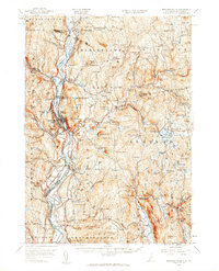
 1957 Claremont1960 Print · USGSCovers Charlestown, including Claremont, Newport, and other nearby areas3 unique versions available
 - 1957 Map of Bellows Falls, 1960 Print
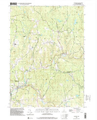
 1957 Bellows Falls1960 Print · USGSCovers Charlestown, including Brockways Mills, Springfield, and other nearby areas4 unique versions available
 - 1959 Map of Glens Falls
 1959 Glens Falls1959 Print · USGSCovers Charlestown, including Queensbury, Saratoga Springs, and other nearby areas2 unique versions available
 - 1964 Map of Glens Falls
 1964 Glens Falls1964 Print · USGSCovers Charlestown, including Queensbury, Saratoga Springs, and other nearby areas
 - 1984 Map of Springfield
 1984 Springfield1984 Print · USGSCovers Charlestown, including Claremont, Newport, and other nearby areas
 - 1985 Map of Bellows Falls
 1985 Bellows Falls1985 Print · USGSCovers Charlestown, including Brockways Mills, Springfield, and other nearby areas2 unique versions available
 - 1985 Map of Claremont, 1986 Print
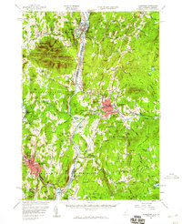
 1985 Claremont1986 Print · USGSCovers Charlestown, including Keene, Claremont, and other nearby areas2 unique versions available
 - 1998 Map of Springfield, 2002 Print
 1998 Springfield2002 Print · USGSCovers Charlestown, including Claremont, Springfield, and other nearby areas
 - 1998 Map of Claremont South, 2002 Print
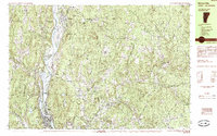
 1998 Claremont South2002 Print · USGSCovers Charlestown, including Claremont, Newport, and other nearby areas
 - 1998 Map of Bellows Falls, 2002 Print
 1998 Bellows Falls2002 Print · USGSCovers Charlestown, including Brockways Mills, Springfield, and other nearby areas
 - 1998 Map of Alstead, 2002 Print
 1998 Alstead2002 Print · USGSCovers Charlestown, including Walpole, Alstead, and other nearby areas
 - 2024 Map of Bellows Falls, 2024 Print
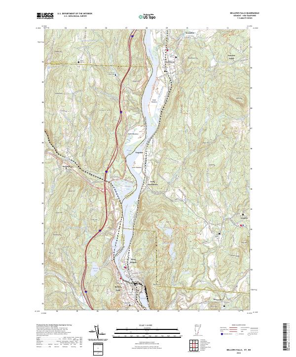 2024 Bellows Falls2024 Print · USGSCovers Charlestown, including Brockways Mills, Springfield, and other nearby areas
 - 2024 Map of Springfield, 2024 Print
 2024 Springfield2024 Print · USGSCovers Charlestown, including Claremont, Springfield, and other nearby areas
 - 2024 Map of Alstead, 2024 Print
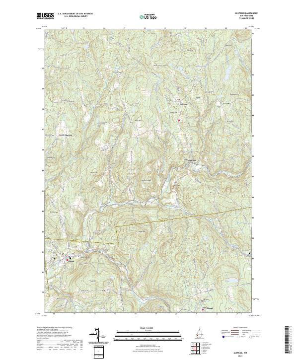 2024 Alstead2024 Print · USGSCovers Charlestown, including Walpole, Alstead, and other nearby areas
 - 2024 Map of Claremont South, 2024 Print
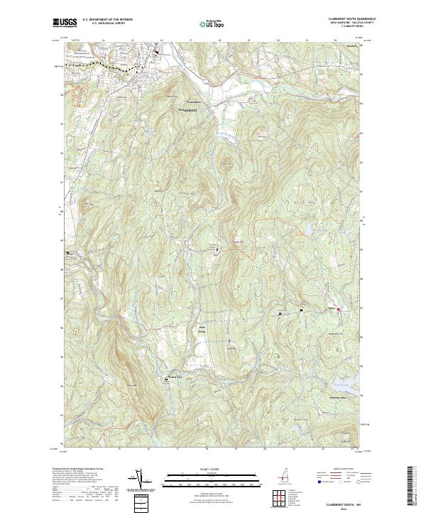 2024 Claremont South2024 Print · USGSCovers Charlestown, including Claremont, Newport, and other nearby areas
End of results
Showing maps 1-21 of 21
Top cities near Charlestown
- Claremont historical maps
- Brockways Mills historical maps
- Newport historical maps
- Springfield historical maps
- Walpole historical maps
- Grantham historical maps
See more
Top neighborhoods of Charlestown
- South Charlestown historical maps
- Snumshire historical maps
- Trapshire historical maps
- Hemlock Center historical maps
- North Charlestown historical maps
- South Hemlock historical maps
See more
Frequently asked questions
- What are the different types of historical maps available for Charlestown?
- What is the oldest map of Charlestown?
- Where can I purchase historical maps of Charlestown for my home or office?
- Where can I download high-res historical maps of Charlestown?
- Are there historical topographic maps available for Charlestown?
- Is there historical aerial imagery available for Charlestown?
- Where are historical maps of Charlestown sourced from?