Old Maps of Port Republic, New Jersey
Explore 43 old maps of Port Republic, spanning from 1887 to today. These high-resolution historic maps reveal how streets, neighborhoods, landmarks, and natural features evolved over time — perfect for genealogy, metal detecting, research, and local history exploration.
What you can do with these maps:
- See how Port Republic changed over time: Compare historical maps to modern-day views to trace roads, homesites, rail lines & more.
- View detailed metadata: Each map includes creators, publishers, year, scale, and archive source.
- Overlay maps with satellite & LiDAR: Visualize the past alongside modern tools to explore terrain & human change.
- Trusted historical sources: Maps sourced from the USGS, Library of Congress, and other archives.
- Access maps your way: View online, download high-res files, or order prints for personal or research use.
Start exploring old maps of Port Republic to uncover forgotten places, hidden landmarks, and the deep history beneath your feet.
Port Republic, NJ maps
(43)- 1887 Map of Atlantic City
 1887 Atlantic City1887 Print · USGSCoastal New Jersey in the late 1800s reveals a rapidly growing resort landscape defined by its heavy rail connections and maritime safety network. You can trace the early city grid of Atlantic City, follow the West Jersey and Atlantic Railroad over the marshes, or locate the Absecon Light and shorebound Life Saving Stations.
 - 1888 Map of Little Egg Harbor
 1888 Little Egg Harbor1888 Print · USGSThe Jersey Shore and Pine Barrens meet here during the late Victorian era, before the modern development of the coastline. Genealogists and historians can trace the early Tuckerton Railroad through settlements like Staffordville, Nugentown, and Sea Haven.2 unique versions available
 - 1890 Map of Mullica
 1890 Mullica1890 Print · USGSThe Mullica River valley and the New Jersey Pine Barrens are captured here during the late 1800s, when water-powered industry still shaped the landscape. Researchers can trace the early rail corridors and vanished industrial sites like Batsto, Harrisville, and Atsion.
 - 1893 Map of Little Egg Harbor
 1893 Little Egg Harbor1893 Print · USGSCoastal New Jersey thrived at the end of the century as a landscape of rail-connected shore towns and intricate salt marsh thoroughfares. Genealogists and historians can trace old family settlements from New Gretna to Tuckerton, or locate maritime landmarks like Little Egg Harbor Light and Stafford Forge.4 unique versions available
 - 1894 Map of Atlantic City
 1894 Atlantic City1894 Print · USGSAtlantic City and its neighboring coastal hamlets are shown at the height of the late Victorian era. Genealogists and historians can trace the early rail networks like the Camden and Atlantic Railroad or locate family roots in Leeds Point and Oceanville.8 unique versions available
 - 1894 Map of Mullica
 1894 Mullica1894 Print · USGSCoastal New Jersey in the late nineteenth century was a landscape of tide-water marshes and industrial hamlets. Researchers can trace the early rail corridors of the Camden and Atlantic Railroad and locate vanished nodes like Batsto and Harrisville.
 - 1898 Map of Mullica
 1898 Mullica1898 Print · USGSThe Mullica River valley of the late nineteenth century shows a landscape transitioning from colonial-era industry to a rail-connected economy. Genealogists and historians can trace old Pine Barrens settlements like Batsto, Quaker Bridge, and Crowleytown before modern development changed the region.4 unique versions available
 - 1900 Map of Rancocas
 1900 Rancocas1900 Print · USGSSouthern New Jersey at the turn of the century reveals a land of timber, mills, and emerging rail junctions. Genealogists and historians can trace the locations of family-owned landmarks like Jennings Mill, Ballingers Mill, and early settlements such as Colemantown and Fellowship.2 unique versions available
 - 1919 Map of Mullica, 1921 Print
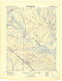 1919 Mullica1921 Print · USGSCoastal New Jersey's Pine Barrens and river landings are captured here in the early 1900s during a period of transition between water-based commerce and expanding rail lines. Researchers can trace the legacy of iron and agriculture through sites like Batsto, Harris Ville, and the Tranquility Bogs.
 - 1920 Map of Little Egg Harbor
 1920 Little Egg Harbor1920 Print · USGSThe New Jersey shore south of Manahawken was a landscape of salt marshes and pine plains during the early twentieth century. Genealogists and historians can trace the old Tuckerton Railroad line and find now-changed coastal landmarks like Tucker Beach and Stafford Forge.
 - 1940 Map of Atlantic City, 1953 Print
 1940 Atlantic City1953 Print · USGSThe New Jersey coastline during the pre-war era is mapped here in detail, showcasing the resort boom and rail connections of the day. Researchers can trace the layout of famous boardwalk landmarks like the Steel Pier and the Pennsylvania-Reading Seashore Lines into the city.
 - 1941 Map of Atlantic City
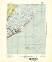 1941 Atlantic City1941 Print · USGSAtlantic City and its neighboring shore towns are captured in the early 1940s, showing a world of grand boardwalk piers and intricate tidal marshlands. Trace the routes of the Pennsylvania-Reading Seashore Lines or locate landmarks like Absecon Light and the Heinz Pier.2 unique versions available
 - 1942 Map of Tuckerton
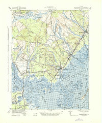 1942 Tuckerton1942 Print · USGSThe Jersey Shore and Pine Barrens meet here just as the coastal infrastructure was maturing before mid-century. Researchers can trace the layout of Tuckerton, locate the old Stafford Forge, and explore the maze of sedges in Little Egg Harbor.2 unique versions available
 - 1942 Map of Egg Harbor
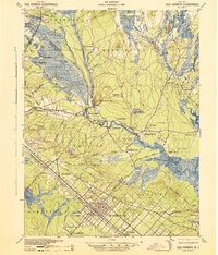 1942 Egg Harbor1942 Print · USGSSouth Jersey's Pine Barrens were a mix of industrial remnants and early military footprints during the Second World War. Researchers can trace the layout of the Abandoned World War Cantonment or explore old glass and iron centers like Batsto and Harrisville.
 - 1946 Map of Wilmington, 1948 Print
 1946 Wilmington1948 Print · USGSThe Delaware Valley and Jersey Shore emerge in this mid-century portrait of a region defined by river commerce and seaside growth. Genealogists and historians can trace the rail networks of the Pennsylvania Railroad, locate early airfields like Dover Airpark, and find river defenses at Fort Delaware.2 unique versions available
 - 1951 Map of New Gretna, 1954 Print
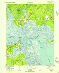 1951 New Gretna1954 Print · USGSThe coastal wetlands of Burlington and Atlantic counties are captured here in the early fifties, just as the Garden State Parkway was being built. Genealogists can trace family lines near New Gretna, Port Republic, and the Hillside Cem.7 unique versions available
 - 1952 Map of Oceanville, 1955 Print
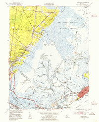 1952 Oceanville1955 Print · USGSThe Atlantic County shoreline in the early fifties reveals a landscape of tidal marshes and growing coastal towns. Genealogists and historians can trace family-named routes like Leeds Point Road or locate landmarks such as the Seaview Country Club and Lily Lake.3 unique versions available
 - 1955 Map of Wilmington
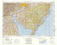 1955 Wilmington1955 Print · USGSThe Delaware Valley and Jersey Shore are seen here during the mid-fifties era of rapid suburban expansion and highway development. You can trace the path of the New Jersey Turnpike, locate the Fort Dix Military Reservation, or explore the rail networks of the Pennsylvania Railroad.
 - 1956 Map of Green Bank, 1957 Print
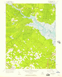 1956 Green Bank1957 Print · USGSCoastal New Jersey in the mid-1950s reveals a unique blend of planned settlements and preserved wilderness along the Mullica River. Researchers can trace early family sites at Clarks Mill Burying Ground or explore the rail network of the Pennsylvania-Reading Seashore Lines.4 unique versions available
 - 1957 Map of Wilmington
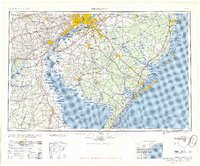 1957 Wilmington1957 Print · USGSThe mid-Atlantic coastal plain comes alive in the mid-fifties as the New Jersey Turnpike and Garden State Parkway redefine travel. Researchers can trace the rail-to-road transition and find landmarks like Ship John Shoal Light and the Fort Dix Military Reservation.2 unique versions available
 - 1959 Map of Wilmington
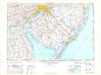 1959 Wilmington1959 Print · USGSThe Delaware Valley and Jersey Shore are seen here in the late fifties, during a period of massive suburban and highway expansion. Researchers can trace mid-century infrastructure like the N J Turnpike or locate coastal landmarks from Barnegat Bay to the Maurice River.3 unique versions available
 - 1966 Map of Wilmington, 1968 Print
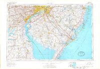 1966 Wilmington1968 Print · USGSThe Delaware Valley and Jersey Shore are seen here in the mid-1960s, documenting a landscape of dense industrial cities and emerging coastal resorts. Researchers can trace the sprawling rail networks of the Pennsylvania Railroad or locate landmarks like Fort Dix Military Reservation and Elk Neck State Park.4 unique versions available
 - 1972 Map of Wilmington, 1976 Print
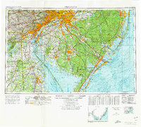 1972 Wilmington1976 Print · USGSThe Delaware Valley and Jersey Shore are seen here in the 1970s, showcasing the region's dense transport networks and vast state forests. Trace early coastal development near Atlantic City or locate rural landmarks like Mount Holly and Dover Air Force Base.2 unique versions available
 - 1984 Map of Atlantic City, 1985 Print
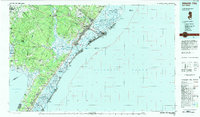 1984 Atlantic City1985 Print · USGSThe Jersey Shore and Pine Barrens are captured here in the mid-eighties, showing the coastal transition from salt marsh to forest. Genealogists and historians can trace family locations from Estell Manor to North Wildwood or explore the vast bounds of the Belleplain State Forest.
 - 1984 Map of Hammonton, 1986 Print
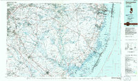 1984 Hammonton1986 Print · USGSSouthern New Jersey is captured in the mid-eighties as suburban growth pressed against the vast Pinelands. Researchers can trace the development of the Atlantic City Expressway corridor and locate landmarks like Ancora Psychiatric Hospital and the sprawling Wharton State Forest.3 unique versions available
Showing maps 1-25 of 43
Top cities near Port Republic
- Egg Harbor Township historical maps
- Atlantic City historical maps
- Galloway Township historical maps
- Stafford Township historical maps
- Hamilton Township historical maps
- Hammonton historical maps
See more
Top neighborhoods of Port Republic
Frequently asked questions
- What are the different types of historical maps available for Port Republic?
- What is the oldest map of Port Republic?
- Where can I purchase historical maps of Port Republic for my home or office?
- Where can I download high-res historical maps of Port Republic?
- Are there historical topographic maps available for Port Republic?
- Is there historical aerial imagery available for Port Republic?
- Where are historical maps of Port Republic sourced from?