Old Maps of Oakland, New Jersey for Metal Detecting
Plan your next treasure hunt with 72 historic maps of Oakland. Find old homesites, ghost towns, trails, and gathering spots that may be lost to time — perfect for identifying promising metal detecting locations.
- Locate forgotten sites: Uncover places like long-lost settlements, abandoned rail lines, or gathering spots.
- Plan better hunts: Use map overlays combined with LiDAR or satellite views to narrow in on historically rich areas.
- Made for detectorists: Thousands of hobbyists use these maps to discover relics, coins, and hidden history.
Use these historic maps to boost your research and find new opportunities beneath the surface of Oakland.
Oakland, NJ maps
(72)- 1888 Map of Morristown
 1888 Morristown1888 Print · USGSNorthern New Jersey's transition from an industrial mining hub to a rail-connected suburb is evident in the late 1880s. Genealogists and historians can locate the Hibernia Mine, trace the Morris Canal Feeder, and find old river crossings like Columbia Bridge.
 - 1888 Map of Paterson
 1888 Paterson1888 Print · USGSNortheastern New Jersey in the late nineteenth century was a complex network of industrial canals and rising commuter towns. Genealogists and historians can trace the Morris Canal, the Jersey City Waterworks, and early rail lines through Hackensack and Paterson.
 - 1891 Map of Greenwood Lake
 1891 Greenwood Lake1891 Print · USGSThe Highlands of New York and New Jersey are captured here in the late nineteenth century during a peak era of iron mining and rail expansion. Researchers can trace the industrial footprint of the Sterling Furnace, locate family-named mines like Carey Mine, and follow the historic routes of the New York Susquehanna and Western Railroad.
 - 1891 Map of Ramapo
 1891 Ramapo1891 Print · USGSThe Ramapo Mountains and northern New Jersey borderlands appear here in the decade before the turn of the century. Genealogists and local historians can trace the early rail networks through Sloatsburg and Suffern, or locate family sites in Pearl River and Ramseys.
 - 1892 Map of Paterson
 1892 Paterson1892 Print · USGSNorthern New Jersey and the industrial core of Paterson are seen here in the late nineteenth century as rail and water infrastructure expanded. Trace the development of early utility systems like the Jersey City Waterworks or explore the rail lines of the Lodi Branch R.R. and West Shore Railroad.
 - 1893 Map of Greenwood Lake
 1893 Greenwood Lake1893 Print · USGSThe iron-rich highlands of the New York-New Jersey border come to life in this late-century survey of the lakes and ridges between Passaic and Orange counties. Genealogists and industrial historians can trace the paths of the Sterling Mountain Railroad and find long-established sites like Sterling Furnace or the Layton Mines.6 unique versions available
 - 1893 Map of Ramapo
 1893 Ramapo1893 Print · USGSThe Ramapo Valley and the New Jersey borderlands come alive in the late Victorian era, showing a landscape defined by mountain passes and a dense rail network. Genealogists can trace family names and early homesteads in Johnsontown, Eagle Valley, and Pearl River before modern development changed the region.6 unique versions available
 - 1894 Map of Morristown
 1894 Morristown1894 Print · USGSNorthern New Jersey was a landscape of iron and water in the late nineteenth century, as the canal era gave way to steam power. Trace the winding Morris Canal, the mining works at Hibernia, and historic river crossings like Horse Neck Bridge.
 - 1898 Map of Morristown
 1898 Morristown1898 Print · USGSMorris and Essex counties at the turn of the century show a complex landscape of early industrial rail lines and historic water routes. Researchers can trace the path of the Morris Canal and find vanished local landmarks like Malapardis, Beach Glen, and Swinefield Bridge.2 unique versions available
 - 1898 Map of Paterson
 1898 Paterson1898 Print · USGSNorthern New Jersey's industrial and rail corridors are captured here in the late nineteenth century, from the silk mills of Paterson to the Hackensack marshes. Genealogists can locate family sites near Laurel Grove Cemetery, the Morris Canal, and early villages like Wortendyke.
 - 1900 Map of Passaic
 1900 Passaic1900 Print · USGSNorthern New Jersey and the New York Harbor are captured here at the close of the nineteenth century, showing a landscape defined by rail, river, and coastal defense. Researchers can trace the original path of the Morris Canal, locate Seton Hall College, and explore the batteries at Fort Wadsworth.
 - 1900 Map of Paterson
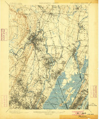 1900 Paterson1900 Print · USGSNortheastern New Jersey at the turn of the century shows a landscape defined by the Morris Canal and a dense network of early railroads. Researchers can trace ancestral roots through vanished rail stops and sites like Laurel Grove Cemetery, Wortendyke, and Sicomac.
 - 1903 Map of Paterson
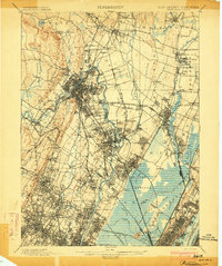 1903 Paterson1903 Print · USGSNorthern New Jersey's transition from an industrial river valley to a dense rail-connected region is captured here just after the turn of the century. You can trace the path of the Morris Canal, locate the old Dundee Dam, or find early settlements like Peetzburg and Etna.8 unique versions available
 - 1903 Map of Greenwood Lake, 1909 Print
 1903 Greenwood Lake1909 Print · USGSThe Highlands of New York and New Jersey are captured here at the height of their industrial era, showing a landscape of iron mines and mountain railroads. Genealogists and historians can locate heritage sites like Sterling Furnace, Dayton Mines, and the rural community of New Newfoundland.
 - 1905 Map of Passaic
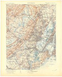 1905 Passaic1905 Print · USGSNorthern New Jersey and Staten Island appear here at a pivotal moment of early 20th-century growth and industrialization. Researchers can trace the development of transit hubs like Convent Sta. or locate legacy landmarks including Hillside Cemetery and the Moravian Cemetery.4 unique versions available
 - 1906 Map of Morristown
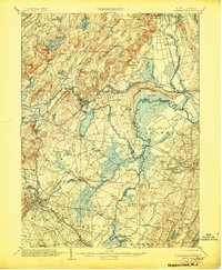 1906 Morristown1906 Print · USGSNorthern New Jersey's transition from industrial highlands to riverine lowlands is captured here just after the turn of the century. Genealogists can trace family roots in Hibernia or Boonton and locate historic crossings like Columbia Bridge and the Morris Canal.6 unique versions available
 - 1910 Map of Ramapo
 1910 Ramapo1910 Print · USGSThe Ramapo Valley at the turn of the century served as a vital transit corridor between New York and New Jersey, dominated by rail lines and river industry. Genealogists and local historians can trace the foundations of Sloatsburg, Suffern, and Pearl River, alongside landmarks like the Ramapo Cem. and the Powder Works.6 unique versions available
 - 1910 Map of Greenwood Lake
 1910 Greenwood Lake1910 Print · USGSThe Highlands of northern New Jersey and southern New York are shown here during a peak era of iron mining and rail expansion. Genealogists and industrial historians can trace the foundations of Sterling Furnace, Charlotteburg Mine, and the New Milford Sta. along the Erie Railroad.9 unique versions available
 - 1931 Map of Ramapo
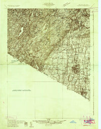 1931 Ramapo1931 Print · USGSRockland County in the late twenties and early thirties shows a unique mix of expanding suburban rail towns and state park wilderness. Genealogists and historians can trace Letchworth Village, the old Hogan Kamp Mine, and early schools like Bardonia Sch.3 unique versions available
 - 1936 Map of Ramsey
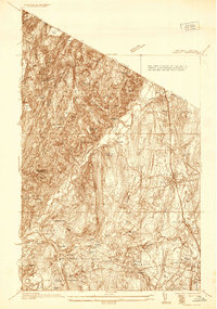 1936 Ramsey1936 Print · USGSNorthern New Jersey during the mid-1930s shows a landscape of highland camps and expanding rail towns along the Erie RR. Trace family roots and local landmarks from Ramsey to Mahwah, including the Don Bosco Institute and Macmillan Reservoir.
 - 1938 Map of Paterson
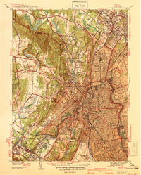 1938 Paterson1938 Print · USGSPaterson and the Passaic River valley are captured in the late thirties, showing the transition from dense industrial centers to the wooded ridges of the Watchung Mountains. Local historians can trace the foundations of St Michaels Orphanage, the early runways of Murchio Airport, and the grounds of Fairlawn Cem.2 unique versions available
 - 1938 Map of Ramapo
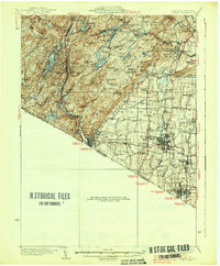 1938 Ramapo1938 Print · USGSRockland County in the late 1930s is revealed here as a landscape of institutional campuses, rail-side villages, and emerging parklands. Genealogists can trace family connections at Letchworth Village, St Agatha Home, and vanished hamlets like Sandyfield or Johnsontown.3 unique versions available
 - 1940 Map of Ramsey
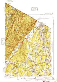 1940 Ramsey1940 Print · USGSNorthern Bergen County in the late thirties is caught between its mountain wilderness and the rail-driven growth of the valley. Researchers can trace the Erie railroad line through Ramsey or locate historic estates and camps like Skylands and Camp Yaw-Paw.2 unique versions available
 - 1942 Map of Passaic
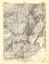 1942 Passaic1942 Print · USGSNorthern New Jersey and New York harbor appear in detail at the start of the war, showing a landscape of burgeoning suburbs and vital industry. Trace family roots and local history across the Passaic River valley, from Paterson to the Watchung Mountains.
 - 1943 Map of Ramsey
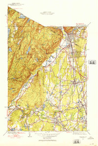 1943 Ramsey1943 Print · USGSThe Ramapo Valley comes into sharp focus during the 1940s as rail-side communities like Ramsey and Allendale expand along the Erie RR. Researchers can locate specialized sites from the Don Bosco Institute to high-altitude landmarks like Hawk Rock and Houvenkopf Mtn Sch.2 unique versions available
Showing maps 1-25 of 72
Top cities near Oakland
- New York historical maps
- Ramapo historical maps
- Paterson historical maps
- Clarkstown historical maps
- Clifton historical maps
- Passaic historical maps
See more
Top neighborhoods of Oakland
Frequently asked questions
- What are the different types of historical maps available for Oakland?
- What is the oldest map of Oakland?
- Where can I purchase historical maps of Oakland for my home or office?
- Where can I download high-res historical maps of Oakland?
- Are there historical topographic maps available for Oakland?
- Is there historical aerial imagery available for Oakland?
- Where are historical maps of Oakland sourced from?