Old Maps of Pemberton Township, New Jersey
Explore 61 old maps of Pemberton Township, spanning from 1884 to today. These high-resolution historic maps reveal how streets, neighborhoods, landmarks, and natural features evolved over time — perfect for genealogy, metal detecting, research, and local history exploration.
What you can do with these maps:
- See how Pemberton Township changed over time: Compare historical maps to modern-day views to trace roads, homesites, rail lines & more.
- View detailed metadata: Each map includes creators, publishers, year, scale, and archive source.
- Overlay maps with satellite & LiDAR: Visualize the past alongside modern tools to explore terrain & human change.
- Trusted historical sources: Maps sourced from the USGS, Library of Congress, and other archives.
- Access maps your way: View online, download high-res files, or order prints for personal or research use.
Start exploring old maps of Pemberton Township to uncover forgotten places, hidden landmarks, and the deep history beneath your feet.
Pemberton Township, NJ maps
(61)- 1884 Map of Whitings
 1884 Whitings1884 Print · USGSThe Pinelands of Ocean County come alive in the 1880s as a hub for rail travel and early industry. Genealogists can trace family-named sites like Boyd's Hotel, Zeb's Bridge, and Chicken Bone along the historic Tuckerton Railroad corridor.
 - 1888 Map of Bordentown
 1888 Bordentown1888 Print · USGSCentral New Jersey in the 1880s was a bustling corridor of river commerce and intersecting rail lines. Genealogists and local historians can trace the early footprints of Bordentown, locate the junctions of the Pennsylvania Railroad, and find rural settlements like Recklesstown and Arneytown.
 - 1888 Map of Pemberton
 1888 Pemberton1888 Print · USGSThe industrial Pine Barrens of the 1880s come to life in this survey of Burlington County, showing a landscape of glassworks, furnaces, and isolated mill towns. Genealogists can trace family connections in Magnolia and Buddtown or find defunct stops like Evansville Station.
 - 1888 Map of Whitings, 1900 Print
 1888 Whitings1900 Print · USGSThe Pine Barrens of Ocean County thrived as a rail hub in the late 1880s, centered on the busy junction at Whitings. Researchers can trace the heritage of remote early settlements and industry at Union Clay Works, Dover Forge, and Chicken Bone.3 unique versions available
 - 1893 Map of Bordentown
 1893 Bordentown1893 Print · USGSCentral New Jersey in the late nineteenth century was a bustling corridor of rail lines and established river towns. Genealogists and historians can trace the early footprints of Bordentown, Hamilton Square, and the various branches of the Pennsylvania Railroad.3 unique versions available
 - 1894 Map of Pemberton
 1894 Pemberton1894 Print · USGSThe Pine Barrens of the late nineteenth century reveal a landscape of early iron furnaces and emerging rail depots. Genealogists and historians can trace the foundations of Hanover Furnace, find the isolated Ong Hat settlement, and follow the Central R.R. of New Jersey Southern Division through Chatsworth.
 - 1898 Map of Pemberton
 1898 Pemberton1898 Print · USGSThe industrial heart of the New Jersey Pine Barrens comes to life in this late Victorian-era survey. Genealogists and historians can trace the foundations of Hampton Furnace, the Lebanon Glassworks, and the remote settlement of Indian Mills.4 unique versions available
 - 1900 Map of Rancocas
 1900 Rancocas1900 Print · USGSSouthern New Jersey at the turn of the century reveals a land of timber, mills, and emerging rail junctions. Genealogists and historians can trace the locations of family-owned landmarks like Jennings Mill, Ballingers Mill, and early settlements such as Colemantown and Fellowship.2 unique versions available
 - 1906 Map of Bordentown
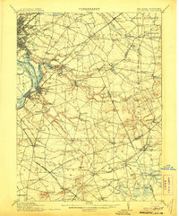 1906 Bordentown1906 Print · USGSThe Delaware River corridor and Burlington County interior are seen here in the early 1900s, showing a landscape shaped by rail and river commerce. Genealogists can trace early homesteads and hamlets near Bordentown, Hamilton Square, and the mills at Walnford.6 unique versions available
 - 1907 Map of Trenton
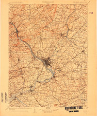 1907 Trenton1907 Print · USGSThe Delaware River valley hums with turn-of-the-century industry and transport as river canals and railroads converge between New Jersey and Pennsylvania. Genealogists and local historians can trace the footprint of the George School, find early post offices like Holland PO, or locate old mill sites such as Blackwells Mills.4 unique versions available
 - 1918 Map of Camp Dix
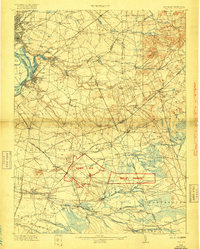 1918 Camp Dix1918 Print · USGSNew Jersey at the height of the Great War features the sprawling mobilization grounds of Camp Dix and its expansive Rifle Range. Genealogists and historians can trace defunct stops like Imlaystown Sta or locate family roots near New Egypt and Colliers Mill.2 unique versions available
 - 1942 Map of Whiting
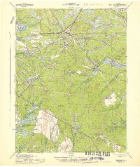 1942 Whiting1942 Print · USGSThe Jersey Pine Barrens are captured here during the early years of the war, showing the region's transition between industry and military use. Genealogists and historians can trace old settlements like Woodmansie, early aviation at Coyle Field, and the rail junction at Whiting.2 unique versions available
 - 1942 Map of Pemberton
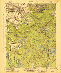 1942 Pemberton1942 Print · USGSBurlington County during the early years of the war is caught between its deep industrial roots and new military mobilization. Researchers can trace historic iron sites like Mary Ann Furnace, family locations such as Sooy Place, and the rail lines serving Whitesbog.
 - 1944 Map of Newark, 1971 Print
 1944 Newark1971 Print · USGSThe industrial corridor from Philadelphia to New York was in a period of massive transition during the mid-forties. Genealogists and researchers can trace the rail lines of the Lehigh Valley RR, locate military installations like Picatinny Arsenal, and explore the early sprawl near Levittown.5 unique versions available
 - 1946 Map of Wilmington, 1948 Print
 1946 Wilmington1948 Print · USGSThe Delaware Valley and Jersey Shore emerge in this mid-century portrait of a region defined by river commerce and seaside growth. Genealogists and historians can trace the rail networks of the Pennsylvania Railroad, locate early airfields like Dover Airpark, and find river defenses at Fort Delaware.2 unique versions available
 - 1948 Map of Columbus
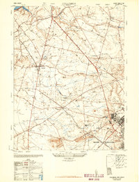 1948 Columbus1948 Print · USGSBurlington County in the late nineteen-forties shows a landscape of productive dairies and growing military installations. Researchers can trace the layout of the Fort Dix Military Reservation or locate family roots near Mansfield Square and the Helis Stock Farm.2 unique versions available
 - 1948 Map of Bordentown, 1954 Print
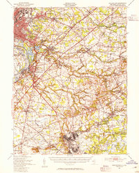 1948 Bordentown1954 Print · USGSCentral New Jersey stands at the crossroads of military expansion and early highway development in the years following the war. Genealogists and historians can trace the rural layouts of Bordentown and New Egypt or locate landmarks like Arneys Mount and the Pa Maritime Academy.2 unique versions available
 - 1949 Map of Newark
 1949 Newark1949 Print · USGSThe industrial corridor between Philadelphia and New York comes alive in this post-war survey. Genealogists and historians can trace the massive rail networks of the Reading Railroad and locate major installations like Fort Dix or Picatinny Arsenal.2 unique versions available
 - 1949 Map of Pemberton, 1954 Print
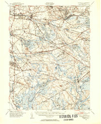 1949 Pemberton1954 Print · USGSThe Jersey Pine Barrens and the northern edge of the Atlantic coastal plain are captured here just after the war, showing a landscape of transition. Researchers can trace historic industrial sites like Hampton Furnace or locate family landmarks at Sooy Place and Buddtown.2 unique versions available
 - 1949 Map of Whiting, 1954 Print
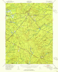 1949 Whiting1954 Print · USGSThe Pinelands of Ocean and Burlington Counties are shown just after the war, when rail hubs and forest reserves defined the landscape. Genealogists and historians can trace the junction at Whiting or locate smaller sites like Woodmansie, the Clay Works, and Keswick Grove.3 unique versions available
 - 1949 Map of Pemberton, 1959 Print
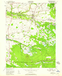 1949 Pemberton1959 Print · USGSMid-century Burlington County comes alive in this survey, capturing the region just as the military and local industry were defining its modern character. Researchers can trace family roots through Vincentown and Birmingham, locate the Brick Kilns, or study the extensive Cranberry Bogs.
 - 1951 Map of Browns Mills
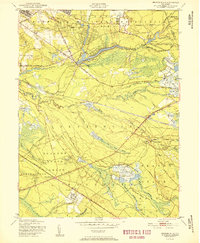 1951 Browns Mills1951 Print · USGSMid-century Burlington County is defined here by military expansion and the agricultural heritage of the Pine Barrens. Researchers can trace historic industrial sites and unique settlements like Whitesbog, Ongs Hat, and the specialized Cranberry Bogs of the region.
 - 1951 Map of Pemberton
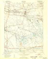 1951 Pemberton1951 Print · USGSBurlington County enters the early fifties with a landscape defined by the Rancocas Creek forks and the expanding presence of the military. Trace local history through the Brick Kilns at Birmingham, the rural crossroads of Comical Corners, and the working Budds Cranberry Bogs.2 unique versions available
 - 1951 Map of Whiting
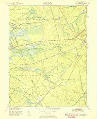 1951 Whiting1951 Print · USGSThe New Jersey Pine Barrens are captured here at mid-century, defined by the heavy rail corridors of the Pennsylvania Railroad and military lands. Researchers can trace the layout of Whiting, follow the network of Cranberry Bogs, and locate remote sites like Pasadena and Bullock.
 - 1955 Map of Wilmington
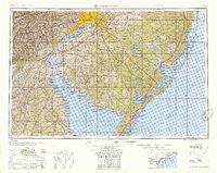 1955 Wilmington1955 Print · USGSThe Delaware Valley and Jersey Shore are seen here during the mid-fifties era of rapid suburban expansion and highway development. You can trace the path of the New Jersey Turnpike, locate the Fort Dix Military Reservation, or explore the rail networks of the Pennsylvania Railroad.
Showing maps 1-25 of 61
Top cities near Pemberton Township
- Hamilton Township historical maps
- Jackson Township historical maps
- Manchester Township historical maps
- Winslow Township historical maps
- Freehold Township historical maps
- Falls Township historical maps
See more
Top neighborhoods of Pemberton Township
- Presidential Lakes Estates historical maps
- Upton historical maps
- Whitesbog historical maps
- Browns Mills historical maps
- Earlys Crossing historical maps
- Hanover Furnace historical maps
See more
Frequently asked questions
- What are the different types of historical maps available for Pemberton Township?
- What is the oldest map of Pemberton Township?
- Where can I purchase historical maps of Pemberton Township for my home or office?
- Where can I download high-res historical maps of Pemberton Township?
- Are there historical topographic maps available for Pemberton Township?
- Is there historical aerial imagery available for Pemberton Township?
- Where are historical maps of Pemberton Township sourced from?