2020s Maps of Pemberton Township, New Jersey
Explore 4 historic maps of Pemberton Township from the 2020s. These maps offer a rare glimpse into what life looked like during the 2020s — showing old roads, neighborhoods, homes, and landmarks that have changed or disappeared over time.
Whether you're researching your family's past, planning a metal detecting trip, or studying how Pemberton Township's landscape evolved across the 2020s, these high-resolution maps are a powerful tool for exploring the history of this region.
- Focus on a specific era: All maps on this page are from the 2020s, giving you a focused view of this time period.
- See what’s changed: Compare century-old streets, trails, and buildings to today's modern landscape using overlays and satellite layers.
- Research with precision: Use these maps for genealogy, historical research, land use analysis, or educational projects.
- View, download, or print: Maps are fully viewable online in high resolution, and can be downloaded or printed for your own records.
Start exploring Pemberton Township's history through authentic maps from the 2020s. This is your window into the past.
Pemberton Township, NJ maps
(4)- 2023 Map of Pemberton, 2023 Print
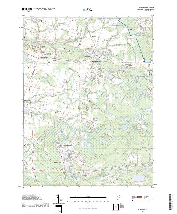 2023 Pemberton2023 Print · USGSThe Burlington County landscape near Pemberton is captured here in the early twenty-first century, showing the intersection of military grounds and Pine Barrens wetlands. Researchers can locate long-standing settlements like Buddtown, Retreat, and Vincentown alongside landmarks like Fort Dix and Smithville Lake.
 - 2023 Map of Browns Mills, 2023 Print
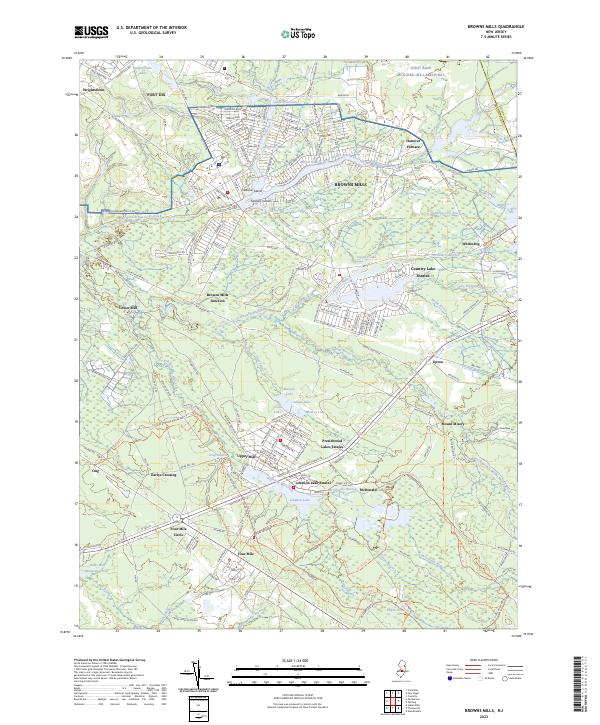 2023 Browns Mills2023 Print · USGSThe Pine Barrens of Burlington County are shown here in modern detail, from the military grounds of Fort Dix to the historic bogs of Whitesbog. Researchers can trace old settlement patterns and water-driven industry at Hanover Furnace, Lower Mill, and Mount Misery.
 - 2023 Map of Whiting, 2023 Print
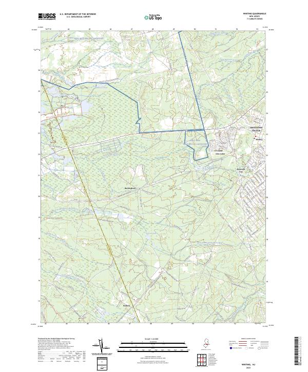 2023 Whiting2023 Print · USGSOcean County's Pinelands landscape is revealed here in its modern form, balancing military borders with growing residential centers. Local historians can trace the paths of the Whitesbog Village Driving Tour Trl or locate settlements like Whiting and Buckingham.
 - 2023 Map of Columbus, 2023 Print
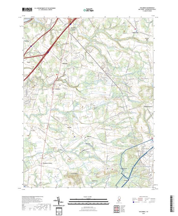 2023 Columbus2023 Print · USGSThis modern survey of Burlington County shows the enduring rural layout of South Jersey's farm country. Genealogists and historians can trace local family landmarks and burial sites including the Springfield Meeting House, Columbus Cem, and Wallace Mill.
End of results
Showing maps 1-4 of 4
Top cities near Pemberton Township
- Hamilton Township historical maps
- Jackson Township historical maps
- Manchester Township historical maps
- Winslow Township historical maps
- Freehold Township historical maps
- Falls Township historical maps
See more
Top neighborhoods of Pemberton Township
- Presidential Lakes Estates historical maps
- Upton historical maps
- Whitesbog historical maps
- Browns Mills historical maps
- Earlys Crossing historical maps
- Hanover Furnace historical maps
See more
Frequently asked questions
- What are the different types of historical maps available for Pemberton Township?
- What is the oldest map of Pemberton Township?
- Where can I purchase historical maps of Pemberton Township for my home or office?
- Where can I download high-res historical maps of Pemberton Township?
- Are there historical topographic maps available for Pemberton Township?
- Is there historical aerial imagery available for Pemberton Township?
- Where are historical maps of Pemberton Township sourced from?