Old Maps of Lower Mill, Pemberton Township for Metal Detecting
Plan your next treasure hunt with 22 historic maps of Lower Mill. Find old homesites, ghost towns, trails, and gathering spots that may be lost to time — perfect for identifying promising metal detecting locations.
- Locate forgotten sites: Uncover places like long-lost settlements, abandoned rail lines, or gathering spots.
- Plan better hunts: Use map overlays combined with LiDAR or satellite views to narrow in on historically rich areas.
- Made for detectorists: Thousands of hobbyists use these maps to discover relics, coins, and hidden history.
Use these historic maps to boost your research and find new opportunities beneath the surface of Lower Mill.
Lower Mill, Pemberton Township maps
(22)- 1888 Map of Pemberton
 1888 Pemberton1888 Print · USGSThe industrial Pine Barrens of the 1880s come to life in this survey of Burlington County, showing a landscape of glassworks, furnaces, and isolated mill towns. Genealogists can trace family connections in Magnolia and Buddtown or find defunct stops like Evansville Station.
 - 1894 Map of Pemberton
 1894 Pemberton1894 Print · USGSThe Pine Barrens of the late nineteenth century reveal a landscape of early iron furnaces and emerging rail depots. Genealogists and historians can trace the foundations of Hanover Furnace, find the isolated Ong Hat settlement, and follow the Central R.R. of New Jersey Southern Division through Chatsworth.
 - 1898 Map of Pemberton
 1898 Pemberton1898 Print · USGSThe industrial heart of the New Jersey Pine Barrens comes to life in this late Victorian-era survey. Genealogists and historians can trace the foundations of Hampton Furnace, the Lebanon Glassworks, and the remote settlement of Indian Mills.4 unique versions available
 - 1900 Map of Rancocas
 1900 Rancocas1900 Print · USGSSouthern New Jersey at the turn of the century reveals a land of timber, mills, and emerging rail junctions. Genealogists and historians can trace the locations of family-owned landmarks like Jennings Mill, Ballingers Mill, and early settlements such as Colemantown and Fellowship.2 unique versions available
 - 1918 Map of Camp Dix
 1918 Camp Dix1918 Print · USGSNew Jersey at the height of the Great War features the sprawling mobilization grounds of Camp Dix and its expansive Rifle Range. Genealogists and historians can trace defunct stops like Imlaystown Sta or locate family roots near New Egypt and Colliers Mill.2 unique versions available
 - 1942 Map of Pemberton
 1942 Pemberton1942 Print · USGSBurlington County during the early years of the war is caught between its deep industrial roots and new military mobilization. Researchers can trace historic iron sites like Mary Ann Furnace, family locations such as Sooy Place, and the rail lines serving Whitesbog.
 - 1946 Map of Wilmington, 1948 Print
 1946 Wilmington1948 Print · USGSThe Delaware Valley and Jersey Shore emerge in this mid-century portrait of a region defined by river commerce and seaside growth. Genealogists and historians can trace the rail networks of the Pennsylvania Railroad, locate early airfields like Dover Airpark, and find river defenses at Fort Delaware.2 unique versions available
 - 1949 Map of Pemberton, 1954 Print
 1949 Pemberton1954 Print · USGSThe Jersey Pine Barrens and the northern edge of the Atlantic coastal plain are captured here just after the war, showing a landscape of transition. Researchers can trace historic industrial sites like Hampton Furnace or locate family landmarks at Sooy Place and Buddtown.2 unique versions available
 - 1951 Map of Browns Mills
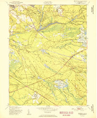 1951 Browns Mills1951 Print · USGSMid-century Burlington County is defined here by military expansion and the agricultural heritage of the Pine Barrens. Researchers can trace historic industrial sites and unique settlements like Whitesbog, Ongs Hat, and the specialized Cranberry Bogs of the region.
 - 1955 Map of Wilmington
 1955 Wilmington1955 Print · USGSThe Delaware Valley and Jersey Shore are seen here during the mid-fifties era of rapid suburban expansion and highway development. You can trace the path of the New Jersey Turnpike, locate the Fort Dix Military Reservation, or explore the rail networks of the Pennsylvania Railroad.
 - 1957 Map of Wilmington
 1957 Wilmington1957 Print · USGSThe mid-Atlantic coastal plain comes alive in the mid-fifties as the New Jersey Turnpike and Garden State Parkway redefine travel. Researchers can trace the rail-to-road transition and find landmarks like Ship John Shoal Light and the Fort Dix Military Reservation.2 unique versions available
 - 1957 Map of Browns Mills, 1961 Print
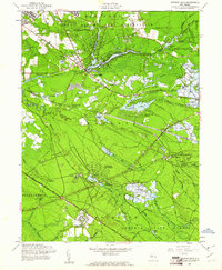 1957 Browns Mills1961 Print · USGSThe heart of the New Jersey Pine Barrens comes alive in the late fifties as the cranberry industry and military installations shape the landscape. Genealogists and historians can trace the Pennsylvania Railroad corridor through Whitesbog, Upton, and the historic Hanover Furnace.4 unique versions available
 - 1959 Map of Wilmington
 1959 Wilmington1959 Print · USGSThe Delaware Valley and Jersey Shore are seen here in the late fifties, during a period of massive suburban and highway expansion. Researchers can trace mid-century infrastructure like the N J Turnpike or locate coastal landmarks from Barnegat Bay to the Maurice River.3 unique versions available
 - 1966 Map of Wilmington, 1968 Print
 1966 Wilmington1968 Print · USGSThe Delaware Valley and Jersey Shore are seen here in the mid-1960s, documenting a landscape of dense industrial cities and emerging coastal resorts. Researchers can trace the sprawling rail networks of the Pennsylvania Railroad or locate landmarks like Fort Dix Military Reservation and Elk Neck State Park.4 unique versions available
 - 1972 Map of Wilmington, 1976 Print
 1972 Wilmington1976 Print · USGSThe Delaware Valley and Jersey Shore are seen here in the 1970s, showcasing the region's dense transport networks and vast state forests. Trace early coastal development near Atlantic City or locate rural landmarks like Mount Holly and Dover Air Force Base.2 unique versions available
 - 1984 Map of Hammonton, 1986 Print
 1984 Hammonton1986 Print · USGSSouthern New Jersey is captured in the mid-eighties as suburban growth pressed against the vast Pinelands. Researchers can trace the development of the Atlantic City Expressway corridor and locate landmarks like Ancora Psychiatric Hospital and the sprawling Wharton State Forest.3 unique versions available
 - 1997 Map of Browns Mills, 1998 Print
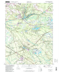 1997 Browns Mills1998 Print · USGSThe Pine Barrens of Burlington County are shown here in the late twentieth century, centered on the historic cranberry industry and military borders. Researchers can locate the famed Whitesbog plantation, the Deborah Sanatorium, and the industrial site of Hanover Furnace.
 - 2011 Map of Browns Mills, 2011 Print
 2011 Browns Mills2011 Print · USGSCovers Lower Mill, including Southampton Township, Plumsted Township, and other nearby areas
 - 2014 Map of Browns Mills, 2014 Print
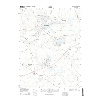 2014 Browns Mills2014 Print · USGSCovers Lower Mill, including Southampton Township, Plumsted Township, and other nearby areas
 - 2016 Map of Browns Mills, 2016 Print
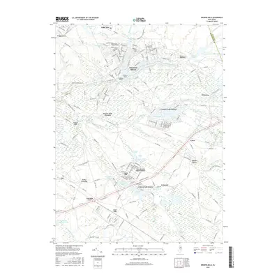 2016 Browns Mills2016 Print · USGSCovers Lower Mill, including Southampton Township, Plumsted Township, and other nearby areas
 - 2019 Map of Browns Mills, 2019 Print
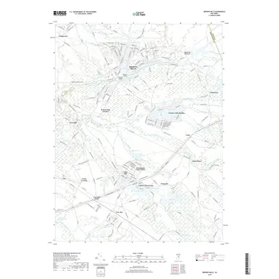 2019 Browns Mills2019 Print · USGSCovers Lower Mill, including Southampton Township, Plumsted Township, and other nearby areas
 - 2023 Map of Browns Mills, 2023 Print
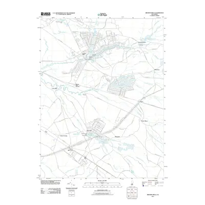
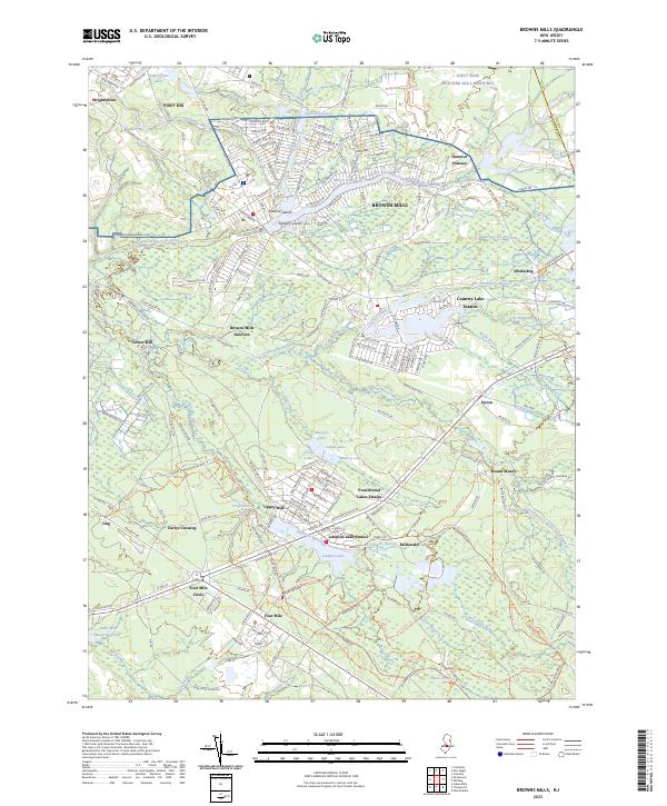 2023 Browns Mills2023 Print · USGSThe Pine Barrens of Burlington County are shown here in modern detail, from the military grounds of Fort Dix to the historic bogs of Whitesbog. Researchers can trace old settlement patterns and water-driven industry at Hanover Furnace, Lower Mill, and Mount Misery.
End of results
Showing maps 1-22 of 22
Top cities near Lower Mill
- Hamilton Township historical maps
- Jackson Township historical maps
- Manchester Township historical maps
- Winslow Township historical maps
- Freehold Township historical maps
- Falls Township historical maps
See more
Frequently asked questions
- What are the different types of historical maps available for Lower Mill?
- What is the oldest map of Lower Mill?
- Where can I purchase historical maps of Lower Mill for my home or office?
- Where can I download high-res historical maps of Lower Mill?
- Are there historical topographic maps available for Lower Mill?
- Is there historical aerial imagery available for Lower Mill?
- Where are historical maps of Lower Mill sourced from?