2020s Maps of Greenwich Township, New Jersey
Explore 4 historic maps of Greenwich Township from the 2020s. These maps offer a rare glimpse into what life looked like during the 2020s — showing old roads, neighborhoods, homes, and landmarks that have changed or disappeared over time.
Whether you're researching your family's past, planning a metal detecting trip, or studying how Greenwich Township's landscape evolved across the 2020s, these high-resolution maps are a powerful tool for exploring the history of this region.
- Focus on a specific era: All maps on this page are from the 2020s, giving you a focused view of this time period.
- See what’s changed: Compare century-old streets, trails, and buildings to today's modern landscape using overlays and satellite layers.
- Research with precision: Use these maps for genealogy, historical research, land use analysis, or educational projects.
- View, download, or print: Maps are fully viewable online in high resolution, and can be downloaded or printed for your own records.
Start exploring Greenwich Township's history through authentic maps from the 2020s. This is your window into the past.
Greenwich Township, NJ maps
(4)- 2023 Map of Bombay Hook Island, 2023 Print
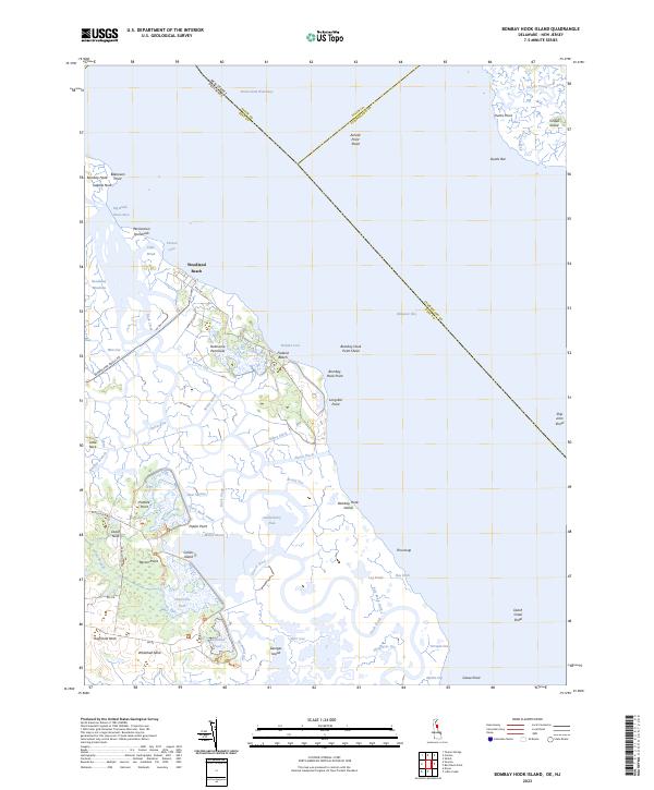 2023 Bombay Hook Island2023 Print · USGSThe Kent County coastline and the expansive marshes of the Delaware Bay come to life in this recent survey. Local historians can trace the intricate network of Money Marsh, the Dutch Neck Canal, and historical landings at Woodland Beach.
 - 2023 Map of Canton, 2023 Print
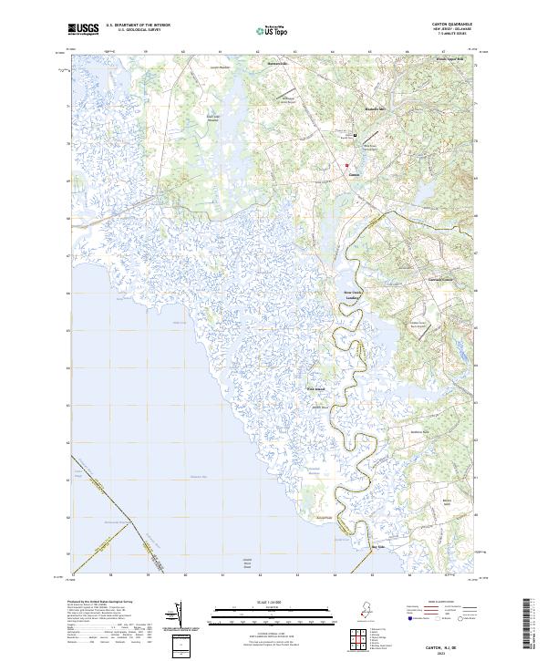 2023 Canton2023 Print · USGSCoastal Salem and Cumberland counties meet along the winding marshes of the Delaware Bay in this modern survey. Genealogists and historians can trace family-named sites from Bacons Neck and Garrison Corner to the old grounds of Canton Baptist Cem.
 - 2023 Map of Shiloh, 2023 Print
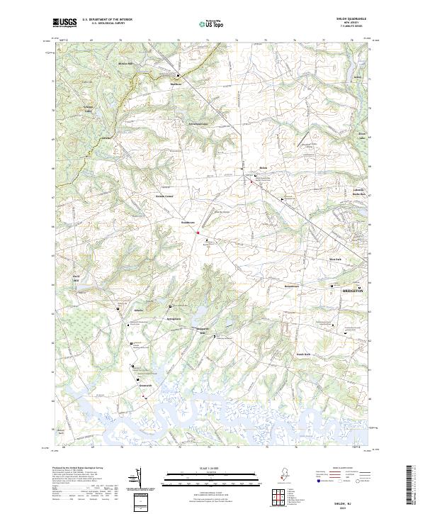 2023 Shiloh2023 Print · USGSCumberland County at the modern day remains deeply rooted in its colonial-era layout and religious heritage. Researchers can trace family lines and early industry through the numerous burial grounds and mill sites like the Old Cohansey Graveyard and Sheppards Mill.
 - 2023 Map of Ben Davis Point, 2023 Print
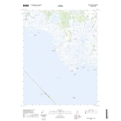 2023 Ben Davis Point2023 Print · USGSThe Cumberland County coast is documented here just as modern sea-level patterns continue to shape the Delaware Bay shoreline. Researchers can trace land use across Bacons Neck and Sea Breeze, or locate local landmarks like Holly Corner Cem.
End of results
Showing maps 1-4 of 4
Top cities near Greenwich Township
- Dover historical maps
- Millville historical maps
- Bridgeton historical maps
- Pennsville Township historical maps
- Smyrna historical maps
- Fairfield Township historical maps
See more
Top neighborhoods of Greenwich Township
- Othello historical maps
- Springtown historical maps
- Greenwich Pier historical maps
- Sheppards Mill historical maps
Frequently asked questions
- What are the different types of historical maps available for Greenwich Township?
- What is the oldest map of Greenwich Township?
- Where can I purchase historical maps of Greenwich Township for my home or office?
- Where can I download high-res historical maps of Greenwich Township?
- Are there historical topographic maps available for Greenwich Township?
- Is there historical aerial imagery available for Greenwich Township?
- Where are historical maps of Greenwich Township sourced from?