Old Maps of Cumberland County, New Jersey for Hiking & Exploration
Hike through history with 175 historic maps of Cumberland County. Explore old trails, ghost towns, and forgotten backroads — perfect for outdoor adventurers and local explorers.
- Rediscover forgotten places: Map out old mining camps, roads, and footpaths that no longer exist on modern maps.
- Layer with modern tools: Combine with LiDAR or satellite views to plan hikes through historical terrain.
- Made for exploration: Popular among hikers, overlanders, and local history lovers.
Use these maps to find adventure and explore the hidden past of Cumberland County.
Cumberland County, NJ maps
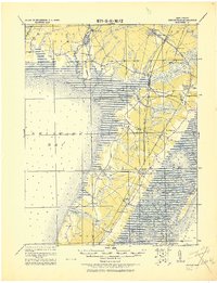
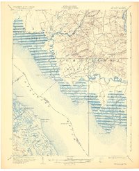
(175)- 1888 Map of Dennisville
 1888 Dennisville1888 Print · USGSCoastal Cape May County thrived in the late nineteenth century as a network of rail lines and tide-water landings. Genealogists can trace family names and vanished settlements from Cape May Court House to the West Jersey Railroad depots at Swain Station and Burleigh.
 - 1890 Map of Hammonton
 1890 Hammonton1890 Print · USGSThe South Jersey Pine Barrens emerge in the late nineteenth century as a complex network of rail lines and agrarian outposts. Genealogists and local historians can trace the foundations of Hammonton, Williamstown, and vanished stops like Banzard Station and New Germany.
 - 1890 Map of Salem
 1890 Salem1890 Print · USGSSouth Jersey at the height of the Victorian era is captured here, showing the dense network of rail lines and creek-side landings. Genealogists and historians can trace family-named sites like Avis Mills, Hancock's Bridge, and Sharptown.2 unique versions available
 - 1890 Map of Tuckahoe
 1890 Tuckahoe1890 Print · USGSCoastal New Jersey in the 1890s shows a landscape of riverfront villages and early industrial sites connected by new rails. Genealogists can trace family roots through riverside settlements like Mauricetown or locate historic industry at Old Etna Furnace and Monroe Forge.
 - 1890 Map of Maurice Cove
 1890 Maurice Cove1890 Print · USGSCumberland County’s shoreline in the late nineteenth century is a complex landscape of tidal creeks and maritime infrastructure. Researchers can trace the early rail terminus at Port Norris or locate offshore hazards like Dead Man's Shoal and Egg Island Light.
 - 1890 Map of Bay Side
 1890 Bay Side1890 Print · USGSCoastal Cumberland and Salem counties were defined by tidal marshes and new rail connections in the late 1880s. Genealogists and historians can trace old property lines near Maskell's Mill, locate the Cohansey Light Old Light, and follow the path of the New Jersey Southern Railroad.
 - 1890 Map of Bridgeton
 1890 Bridgeton1890 Print · USGSCumberland County at the close of the nineteenth century is a bustling region of river commerce and intersecting iron rails. Researchers can trace early railroad stations like Finley Station and Rosenhayn or locate coastal landings such as Findell's Landing and Newport Landing.
 - 1890 Map of Glassboro
 1890 Glassboro1890 Print · USGSSouth Jersey was a thriving network of rail-side towns and mills in the late nineteenth century. Genealogists and historians can trace family roots through settlements like Pitman Grove or locate long-standing industry at Ewan's Mills and Frie's Mill.2 unique versions available
 - 1891 Map of Maurice Cove
 1891 Maurice Cove1891 Print · USGSCumberland County's coastal marshlands and the Delaware Bay oyster industry are captured here during the late Victorian era. Researchers can trace the dual rail lines serving Port Norris or locate offshore hazards like Dead Man Shoal and Egg Island Light.3 unique versions available
 - 1893 Map of Tuckahoe
 1893 Tuckahoe1893 Print · USGSSouthern New Jersey is documented here during the late nineteenth century as the industrial focus shifted from iron forges to the railroad. Genealogists can trace family connections in Port Elizabeth, Tuckahoe, and Mauricetown, or locate historic industrial sites like Old Etna Furnace and Bennett Mill.4 unique versions available
 - 1894 Map of Dennisville
 1894 Dennisville1894 Print · USGSCape May County's maritime and rail landscape is captured here in the late nineteenth century before the modern development of the shore. Genealogists and historians can trace old family settlements and landings like Nummytown, Goshen Landing, and Heislerville.4 unique versions available
 - 1894 Map of Bay Side
 1894 Bay Side1894 Print · USGSThe Delaware Bayshore was a landscape of tidal marshes and remote landings in the late nineteenth century. Genealogists can trace family names and livelihoods through Laning Wharf, the milling sites at Maskell Mill, and maritime outposts like Ship John Light.5 unique versions available
 - 1894 Map of Hammonton
 1894 Hammonton1894 Print · USGSHammonton and the surrounding Pine Barrens appear here in the late nineteenth century as a thriving agricultural and railroad crossroads. Genealogists and historians can trace early property hubs like the Fruit Growers Union, industrial sites such as Pancoast Mill, and the rail junctions at Winslow Junction.
 - 1894 Map of Bridgeton
 1894 Bridgeton1894 Print · USGSCumberland County thrived as a hub of rail and river commerce in the 1880s and 90s, with growing industrial centers and tidal landings. Genealogists and historians can trace family roots through settlements like Gouldtown, Cedarville, and Rosenhayn, or locate vanished rail stops like Bridgeton Junction.4 unique versions available
 - 1898 Map of Salem
 1898 Salem1898 Print · USGSSouthwestern New Jersey at the close of the nineteenth century shows a complex web of rural river settlements and early rail junctions. Trace the paths of the West Jersey and Seashore railroad and locate historical sites like Berry Chapel or Avis Mills.4 unique versions available
 - 1898 Map of Glassboro
 1898 Glassboro1898 Print · USGSSouthern New Jersey's rail-and-river network is frozen in time just before the turn of the century. Trace family roots and vanished depots through Glassboro, the crossroads at Elmer, and the winding Maurice River during this era of rapid growth.6 unique versions available
 - 1898 Map of Hammonton
 1898 Hammonton1898 Print · USGSAtlantic and Camden counties are captured here in the late nineteenth century as the Pine Barrens were transformed by fruit farming and a massive rail network. Researchers can trace the legacy of early industry and transport at Fruit Growers Union, Winslow Junction, and the historic Waterford Works.3 unique versions available
 - 1899 Map of Vineland
 1899 Vineland1899 Print · USGSCumberland and Salem counties come alive in the late nineteenth century, showcasing a thriving coastal economy of rail lines and river ports. Genealogists and researchers can trace family lands near Maskells Mill, the oyster docks of Bivalve, or the rural junction at New England Cross Roads.3 unique versions available
 - 1900 Map of Rancocas
 1900 Rancocas1900 Print · USGSSouthern New Jersey at the turn of the century reveals a land of timber, mills, and emerging rail junctions. Genealogists and historians can trace the locations of family-owned landmarks like Jennings Mill, Ballingers Mill, and early settlements such as Colemantown and Fellowship.2 unique versions available
 - 1901 Map of Camden
 1901 Camden1901 Print · USGSThe Delaware River valley at the turn of the century shows a bustling corridor of early industrial growth and established mill towns. Researchers can trace the heritage of local industry at Sycamore Mills or locate early settlements like Penns Grove and Village Green.3 unique versions available
 - 1918 Map of Tuckahoe, 1921 Print
 1918 Tuckahoe1921 Print · USGSSouthern New Jersey’s pine barrens and river valleys are captured here during a period of transition between early industry and railroad expansion. Genealogists and researchers can trace the locations of Walker's Forge, the West Jersey Railroad, and forgotten milling sites like Bennett Mill.
 - 1919 Map of Hammonton
 1919 Hammonton1919 Print · USGSThe Pine Barrens of the early twentieth century are defined here by a massive web of competing railroads and small mill settlements. Researchers can trace historic family landmarks and transit hubs like Winslow Junction, Iron Mills, and Pestletown during the region's peak agricultural era.
 - 1919 Map of Vineland, 1921 Print
 1919 Vineland1921 Print · USGSCumberland County’s coastal oyster ports and inland industrial centers are captured here during a period of peak maritime activity. Genealogists and historians can trace rail lines like the Central R. R. of New Jersey or locate vanished sites like Whitehall Ldg. and Sheppards Mill.
 - 1919 Map of Dennisville, 1921 Print
 1919 Dennisville1921 Print · USGSCape May County's southern peninsula is documented here during the height of the coastal rail era, before modern development reshaped the shoreline. Genealogists and historians can trace the foundations of local commerce through sites like Bidwell Town Mill, Goshen Landing, and the many family-named stops along the Philadelphia & Reading R.R.
 - 1931 Map of Bay Side
 1931 Bay Side1931 Print · USGSThe tidal marshes of the lower Delaware River come alive in the early thirties, showcasing the maritime and agricultural roots of South Jersey. Genealogists and historians can trace family-named sites like Maskell Mill, the rail path of the Southern Jersey R R, and old bayfront landings at Sea Breeze.2 unique versions available
Showing maps 1-25 of 175
Top cities of Cumberland County
- Vineland historical maps
- Millville historical maps
- Bridgeton historical maps
- Maurice River Township historical maps
- Fairfield Township historical maps
- Commercial Township historical maps
See more
Frequently asked questions
- What are the different types of historical maps available for Cumberland County?
- What is the oldest map of Cumberland County?
- Where can I purchase historical maps of Cumberland County for my home or office?
- Where can I download high-res historical maps of Cumberland County?
- Are there historical topographic maps available for Cumberland County?
- Is there historical aerial imagery available for Cumberland County?
- Where are historical maps of Cumberland County sourced from?