1990s Maps of Hunterdon County, New Jersey
Explore 8 historic maps of Hunterdon County from the 1990s. These maps offer a rare glimpse into what life looked like during the 1990s — showing old roads, neighborhoods, homes, and landmarks that have changed or disappeared over time.
Whether you're researching your family's past, planning a metal detecting trip, or studying how Hunterdon County's landscape evolved across the 1990s, these high-resolution maps are a powerful tool for exploring the history of this region.
- Focus on a specific era: All maps on this page are from the 1990s, giving you a focused view of this time period.
- See what’s changed: Compare century-old streets, trails, and buildings to today's modern landscape using overlays and satellite layers.
- Research with precision: Use these maps for genealogy, historical research, land use analysis, or educational projects.
- View, download, or print: Maps are fully viewable online in high resolution, and can be downloaded or printed for your own records.
Start exploring Hunterdon County's history through authentic maps from the 1990s. This is your window into the past.
Hunterdon County, NJ maps
(8)- 1995 Map of Lambertville, 1998 Print
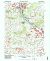 1995 Lambertville1998 Print · USGSThe riverfront culture of the mid-nineties is preserved here as the Delaware River flows between Lambertville and New Hope. Genealogists and local historians can trace rural schoolhouse locations like Fairfield Sch and the grounds of the Mercer County Workhouse.
 - 1995 Map of Pennington, 1998 Print
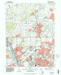 1995 Pennington1998 Print · USGSMercer County at the close of the century shows a unique mix of Revolutionary War sites and modern institutional growth. Researchers can trace family sites at St Hedwigs Cemetery or explore landmarks like Bear Tavern and Twin Pine Airport.
 - 1995 Map of Gladstone, 1998 Print
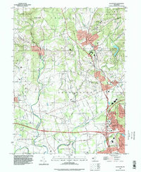 1995 Gladstone1998 Print · USGSThe Somerset and Morris County border country is documented here during the late twentieth century, showing a landscape of refined country estates and historic villages. Trace local history at the Washington Camp Ground or the old center of Pluckemin.
 - 1995 Map of Rocky Hill, 2000 Print
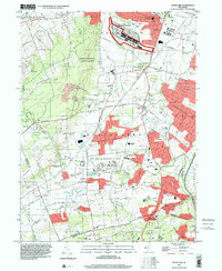 1995 Rocky Hill2000 Print · USGSSomerset and Mercer Counties are captured in the mid-nineties, showing a transition between rural preservation and significant institutional development. Researchers can trace the layout of the GSA Belle Meade Depot, the North Princeton Developmental Center, and the historic D & R Canal State Park corridor.
 - 1997 Map of Lumberville, 1998 Print
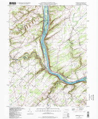 1997 Lumberville1998 Print · USGSBucks County and Hunterdon County riverside life comes into focus in this late-nineties survey of the Delaware River corridor. Researchers can trace rural settlement patterns through local landmarks like Brick Church Sch, Point Pleasant, and the river-hugging Raritan Canal.
 - 1997 Map of Frenchtown, 1999 Print
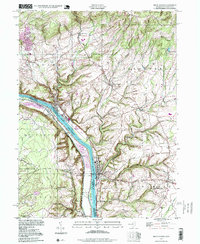 1997 Frenchtown1999 Print · USGSThe Delaware River valley at the close of the twentieth century remains a landscape of historic river towns and steep ridge-lines. Genealogists and hikers can trace the geography of Frenchtown, Upper Black Eddy, and the upland Alexandria Cem.
 - 1997 Map of Riegelsville, 1999 Print
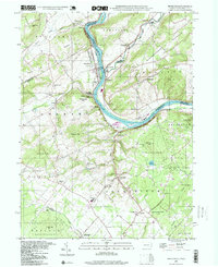 1997 Riegelsville1999 Print · USGSThe Delaware River valley at the turn of the millennium shows a landscape defined by historic industrial sites and riverside settlements. Researchers can trace local genealogy and land use through landmarks like Durham Furnace, Union Cem, and the Durham Sch.
 - 1999 Map of Easton, 2001 Print
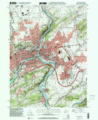 1999 Easton2001 Print · USGSThe tri-city area of Pennsylvania and New Jersey thrives at this river confluence at the turn of the millennium. Researchers can trace the historic Morris Canal, locate family plots at Easton Heights Cemetery, and find old schools like Barber School.
End of results
Showing maps 1-8 of 8
Top cities of Hunterdon County
- Raritan Township historical maps
- Readington Township historical maps
- Union historical maps
- Holland Township historical maps
- Flemington historical maps
- East Amwell Township historical maps
See more
Frequently asked questions
- What are the different types of historical maps available for Hunterdon County?
- What is the oldest map of Hunterdon County?
- Where can I purchase historical maps of Hunterdon County for my home or office?
- Where can I download high-res historical maps of Hunterdon County?
- Are there historical topographic maps available for Hunterdon County?
- Is there historical aerial imagery available for Hunterdon County?
- Where are historical maps of Hunterdon County sourced from?