1990s Maps of Howell Township, New Jersey
Explore 3 historic maps of Howell Township from the 1990s. These maps offer a rare glimpse into what life looked like during the 1990s — showing old roads, neighborhoods, homes, and landmarks that have changed or disappeared over time.
Whether you're researching your family's past, planning a metal detecting trip, or studying how Howell Township's landscape evolved across the 1990s, these high-resolution maps are a powerful tool for exploring the history of this region.
- Focus on a specific era: All maps on this page are from the 1990s, giving you a focused view of this time period.
- See what’s changed: Compare century-old streets, trails, and buildings to today's modern landscape using overlays and satellite layers.
- Research with precision: Use these maps for genealogy, historical research, land use analysis, or educational projects.
- View, download, or print: Maps are fully viewable online in high resolution, and can be downloaded or printed for your own records.
Start exploring Howell Township's history through authentic maps from the 1990s. This is your window into the past.
Howell Township, NJ maps
(3)- 1995 Map of Lakewood, 2000 Print
 1995 Lakewood2000 Print · USGSOcean County's suburban expansion is in full view during the mid-1990s as retirement communities and educational centers grow around the Metedeconk River. Genealogists and local historians can trace landmarks like St Marys Cem, the grounds of Georgian Court College, and early settlements like Seven Stars.
 - 1995 Map of Marlboro, 2000 Print
 1995 Marlboro2000 Print · USGSMonmouth County in the mid-1990s reveals a landscape of historic crossroads, expanding suburban neighborhoods, and significant institutional grounds. Researchers can trace the footprints of the Marlboro State Hospital, old cemeteries, and local landmarks like the Old Brick Reformed Ch and Scobeyville.
 - 1995 Map of Farmingdale, 2001 Print
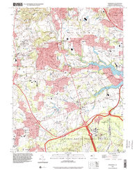
 1995 Farmingdale2001 Print · USGSMonmouth County in the mid-nineties shows a mix of military installations and suburban growth centered around the Farmingdale borough. Locate family landmarks and historic sites like Bethel Ch, Evergreen Cem, and the sprawling Earle Naval Weapons Station.
End of results
Showing maps 1-3 of 3
Top cities near Howell Township
- Toms River historical maps
- Lakewood Township historical maps
- Brick Township historical maps
- Middletown Township historical maps
- Old Bridge Township historical maps
- Jackson Township historical maps
See more
Top neighborhoods of Howell Township
- Larrabees historical maps
- Fairfield historical maps
- Adelphia historical maps
- Ardena historical maps
- Squankum historical maps
- Matthews historical maps
See more
Frequently asked questions
- What are the different types of historical maps available for Howell Township?
- What is the oldest map of Howell Township?
- Where can I purchase historical maps of Howell Township for my home or office?
- Where can I download high-res historical maps of Howell Township?
- Are there historical topographic maps available for Howell Township?
- Is there historical aerial imagery available for Howell Township?
- Where are historical maps of Howell Township sourced from?