Old Maps of Denville, New Jersey for Genealogy
Trace your family roots with 51 historic maps of Denville. These high-res maps reveal old neighborhoods, homesites, landmarks, and streets — helping you uncover where your ancestors lived and how the area evolved over time.
- Explore historic neighborhoods: Identify where your relatives may have lived in the 1800s or 1900s.
- Compare maps over time: Trace the changes in streets, buildings, and landmarks for multi-generational research.
- Perfect for genealogy & ancestry research: Used by family historians and researchers to map out lineage and migration.
These maps are an incredible resource for exploring your personal connection to Denville's past.
Denville, NJ maps
(51)- 1888 Map of Morristown
 1888 Morristown1888 Print · USGSNorthern New Jersey's transition from an industrial mining hub to a rail-connected suburb is evident in the late 1880s. Genealogists and historians can locate the Hibernia Mine, trace the Morris Canal Feeder, and find old river crossings like Columbia Bridge.
 - 1888 Map of Lake Hopatcong
 1888 Lake Hopatcong1888 Print · USGSThe iron and water-power corridors of northern New Jersey are captured here in the late nineteenth century. Trace the industrial footprint of the Morris Canal and major rail lines through early centers like Port Oram, Stanhope, and Dover.
 - 1894 Map of Morristown
 1894 Morristown1894 Print · USGSNorthern New Jersey was a landscape of iron and water in the late nineteenth century, as the canal era gave way to steam power. Trace the winding Morris Canal, the mining works at Hibernia, and historic river crossings like Horse Neck Bridge.
 - 1894 Map of Lake Hopatcong
 1894 Lake Hopatcong1894 Print · USGSThe New Jersey Highlands are captured here in the 1890s, when the iron-rich hills were still crisscrossed by canal boats and steam locomotives. Researchers can trace the early layout of Lake Hopatcong or locate lost industrial sites near Shippenport and Hacklebarney.
 - 1898 Map of Lake Hopatcong
 1898 Lake Hopatcong1898 Print · USGSNorthwest New Jersey's highland lake country is captured here during a period of intense industrial and resort development. Researchers can trace the path of the Morris Canal, locate historical mining operations at Mine Hill, and explore early lakeside settlements like Mt. Arlington and Landing.2 unique versions available
 - 1898 Map of Morristown
 1898 Morristown1898 Print · USGSMorris and Essex counties at the turn of the century show a complex landscape of early industrial rail lines and historic water routes. Researchers can trace the path of the Morris Canal and find vanished local landmarks like Malapardis, Beach Glen, and Swinefield Bridge.2 unique versions available
 - 1900 Map of Passaic
 1900 Passaic1900 Print · USGSNorthern New Jersey and the New York Harbor are captured here at the close of the nineteenth century, showing a landscape defined by rail, river, and coastal defense. Researchers can trace the original path of the Morris Canal, locate Seton Hall College, and explore the batteries at Fort Wadsworth.
 - 1900 Map of Raritan
 1900 Raritan1900 Print · USGSNorth Jersey in the late nineteenth century was a complex web of mountain ridges and vital rail corridors. Researchers can trace ancestral routes through old junctions like High Bridge, industrial sites at Mine Hill, and the shores of Lake Hopatcong.
 - 1905 Map of Lake Hopatcong
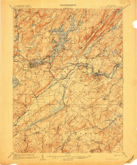 1905 Lake Hopatcong1905 Print · USGSNorthern New Jersey during the early twentieth century shows a landscape shaped by iron mining, railroads, and the growing resort culture around Lake Hopatcong. Genealogists and historians can trace family roots through old settlements like Succasunna, the industrial sites at Mine Hill, and the U.S. Navy Powder Depot.3 unique versions available
 - 1905 Map of Raritan
 1905 Raritan1905 Print · USGSNorthern New Jersey's ridges and valleys are meticulously detailed here at the turn of the century. You can trace the complex rail networks of the Lehigh Valley R.R. and locate family landmarks from Swayze Mills to the Powder Depot near Picatinny Peak.2 unique versions available
 - 1905 Map of Passaic
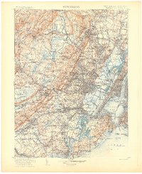 1905 Passaic1905 Print · USGSNorthern New Jersey and Staten Island appear here at a pivotal moment of early 20th-century growth and industrialization. Researchers can trace the development of transit hubs like Convent Sta. or locate legacy landmarks including Hillside Cemetery and the Moravian Cemetery.4 unique versions available
 - 1906 Map of Morristown
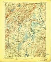 1906 Morristown1906 Print · USGSNorthern New Jersey's transition from industrial highlands to riverine lowlands is captured here just after the turn of the century. Genealogists can trace family roots in Hibernia or Boonton and locate historic crossings like Columbia Bridge and the Morris Canal.6 unique versions available
 - 1942 Map of Passaic
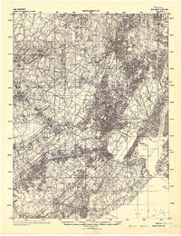 1942 Passaic1942 Print · USGSNorthern New Jersey and New York harbor appear in detail at the start of the war, showing a landscape of burgeoning suburbs and vital industry. Trace family roots and local history across the Passaic River valley, from Paterson to the Watchung Mountains.
 - 1944 Map of Newark, 1971 Print
 1944 Newark1971 Print · USGSThe industrial corridor from Philadelphia to New York was in a period of massive transition during the mid-forties. Genealogists and researchers can trace the rail lines of the Lehigh Valley RR, locate military installations like Picatinny Arsenal, and explore the early sprawl near Levittown.5 unique versions available
 - 1947 Map of Mendham
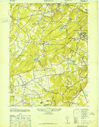 1947 Mendham1947 Print · USGSMorris County's landscape in the late 1940s balances growing settlements with massive institutions and protected parklands. Genealogists can locate family sites near Mendham or trace the grounds of the Greystone Park State Hospital for Insane.
 - 1947 Map of Dover
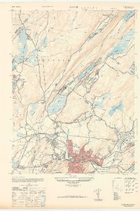 1947 Dover1947 Print · USGSDover and the Rockaway River valley are captured in the late 1940s, showing a landscape defined by industrial centers and lakeside retreats. Trace local history along the Morris Canal or find landmarks like the Star of the Sea Church and Wharton.
 - 1947 Map of Boonton
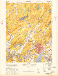 1947 Boonton1947 Print · USGSPost-war Morris County is captured here as a landscape of massive reservoirs, iron mining roots, and growing suburban lake communities. Genealogists and historians can trace the industrial footprint of the Hibernia Mine or locate early aviation sites like the Aircraft Radio Corporation Airport.
 - 1947 Map of Morristown
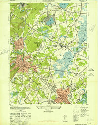 1947 Morristown1947 Print · USGSMorris County was undergoing rapid post-war growth when this survey recorded its transitioning rail-and-river landscape. Genealogists and local historians can trace the foundations of Morristown, Madison, and Whippany, alongside major landmarks like Greystone Park State Hospital and Washingtons Hdqtrs.
 - 1949 Map of Newark
 1949 Newark1949 Print · USGSThe industrial corridor between Philadelphia and New York comes alive in this post-war survey. Genealogists and historians can trace the massive rail networks of the Reading Railroad and locate major installations like Fort Dix or Picatinny Arsenal.2 unique versions available
 - 1954 Map of Dover
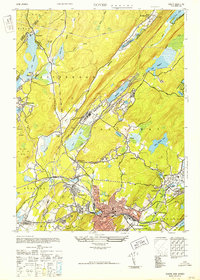 1954 Dover1954 Print · USGSNorthern New Jersey's Morris County is documented here at a time of significant industrial and recreational growth. Genealogists and historians can trace the paths of the Morris Canal, locate the Star of the Sea Church, and explore old tracts in Wharton and Dover.5 unique versions available
 - 1954 Map of Boonton, 1955 Print
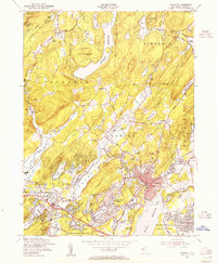 1954 Boonton1955 Print · USGSMid-century Morris County is defined here by industrial military sites and sprawling lakeside developments during a period of suburban expansion. Trace the rail lines of the Wharton and Northern or locate local landmarks like Trinity Ch and Hibernia Cem.6 unique versions available
 - 1954 Map of Morristown, 1955 Print
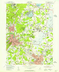 1954 Morristown1955 Print · USGSMorristown and its neighboring boroughs are shown in the mid-fifties during a period of robust institutional and suburban growth. Genealogists can locate family sites near Evergreen Cemetery or trace the early campus layouts of Drew University and Greystone Park State Hospital.5 unique versions available
 - 1954 Map of Mendham, 1961 Print
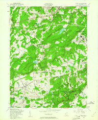 1954 Mendham1961 Print · USGSMorris County in the mid-fifties is characterized by its transition from rural estates to established institutional grounds and historical preserves. You can trace the Revolutionary history of Jockey Hollow, find family roots at Mount Freedom Hebrew Cem, or locate the extensive campus of Greystone Park State Hospital.5 unique versions available
 - 1956 Map of Newark
 1956 Newark1956 Print · USGSThe industrial heart of the Mid-Atlantic is captured here at the dawn of the highway era, tracing the dense corridors between Newark and Philadelphia. Genealogists and local historians can map the rail networks of the Reading RR or locate mid-century military life at Fort Dix Military Reservation.2 unique versions available
 - 1957 Map of Newark
 1957 Newark1957 Print · USGSThe industrial and military heart of the Mid-Atlantic is mapped during its post-war suburban boom. Genealogists and historians can trace the intricate rail corridors of the Reading Railroad and locate key landmarks from Princeton University to Fort Hancock.
Showing maps 1-25 of 51
Top cities near Denville
- Union historical maps
- Wayne historical maps
- Parsippany-Troy Hills historical maps
- West Orange historical maps
- Westfield historical maps
- Mount Olive historical maps
See more
Top neighborhoods of Denville
- Lake Arrowhead historical maps
- Franklin historical maps
- Union Hill historical maps
- Denville Township historical maps
Frequently asked questions
- What are the different types of historical maps available for Denville?
- What is the oldest map of Denville?
- Where can I purchase historical maps of Denville for my home or office?
- Where can I download high-res historical maps of Denville?
- Are there historical topographic maps available for Denville?
- Is there historical aerial imagery available for Denville?
- Where are historical maps of Denville sourced from?