Old Maps of Mendham, New Jersey for Metal Detecting
Plan your next treasure hunt with 32 historic maps of Mendham. Find old homesites, ghost towns, trails, and gathering spots that may be lost to time — perfect for identifying promising metal detecting locations.
- Locate forgotten sites: Uncover places like long-lost settlements, abandoned rail lines, or gathering spots.
- Plan better hunts: Use map overlays combined with LiDAR or satellite views to narrow in on historically rich areas.
- Made for detectorists: Thousands of hobbyists use these maps to discover relics, coins, and hidden history.
Use these historic maps to boost your research and find new opportunities beneath the surface of Mendham.
Mendham, NJ maps
(32)- 1888 Map of Lake Hopatcong
 1888 Lake Hopatcong1888 Print · USGSThe iron and water-power corridors of northern New Jersey are captured here in the late nineteenth century. Trace the industrial footprint of the Morris Canal and major rail lines through early centers like Port Oram, Stanhope, and Dover.
 - 1891 Map of Somerville
 1891 Somerville1891 Print · USGSSomerset County was a bustling corridor of industry and rail commerce at the close of the nineteenth century. Genealogists and local historians can trace family roots through specific stops like North Branch Depot or explore the early infrastructure of Bound Brook and the Water Power Cos Raceway.2 unique versions available
 - 1893 Map of Somerville
 1893 Somerville1893 Print · USGSSomerset County in the late nineteenth century is a hub of rail-driven commerce and riverfront industry. Local historians can trace the early footprints of Bernardsville and Basking Ridge or locate vanished landmarks like Burnt Mill and North Branch Depot.
 - 1894 Map of Lake Hopatcong
 1894 Lake Hopatcong1894 Print · USGSThe New Jersey Highlands are captured here in the 1890s, when the iron-rich hills were still crisscrossed by canal boats and steam locomotives. Researchers can trace the early layout of Lake Hopatcong or locate lost industrial sites near Shippenport and Hacklebarney.
 - 1898 Map of Lake Hopatcong
 1898 Lake Hopatcong1898 Print · USGSNorthwest New Jersey's highland lake country is captured here during a period of intense industrial and resort development. Researchers can trace the path of the Morris Canal, locate historical mining operations at Mine Hill, and explore early lakeside settlements like Mt. Arlington and Landing.2 unique versions available
 - 1898 Map of Somerville
 1898 Somerville1898 Print · USGSSomerset County in the late nineteenth century is a landscape of established river towns and critical rail junctions. Genealogists and historians can trace the growth of Somerville, locate small communities like Pluckemin, or follow the Water Power Cos Raceway near Raritan.2 unique versions available
 - 1900 Map of Raritan
 1900 Raritan1900 Print · USGSNorth Jersey in the late nineteenth century was a complex web of mountain ridges and vital rail corridors. Researchers can trace ancestral routes through old junctions like High Bridge, industrial sites at Mine Hill, and the shores of Lake Hopatcong.
 - 1905 Map of Lake Hopatcong
 1905 Lake Hopatcong1905 Print · USGSNorthern New Jersey during the early twentieth century shows a landscape shaped by iron mining, railroads, and the growing resort culture around Lake Hopatcong. Genealogists and historians can trace family roots through old settlements like Succasunna, the industrial sites at Mine Hill, and the U.S. Navy Powder Depot.3 unique versions available
 - 1905 Map of Raritan
 1905 Raritan1905 Print · USGSNorthern New Jersey's ridges and valleys are meticulously detailed here at the turn of the century. You can trace the complex rail networks of the Lehigh Valley R.R. and locate family landmarks from Swayze Mills to the Powder Depot near Picatinny Peak.2 unique versions available
 - 1905 Map of Somerville
 1905 Somerville1905 Print · USGSCentral New Jersey at the start of the twentieth century shows a landscape shaped by the Raritan River and early rail expansion. Researchers can trace the Delaware and Raritan Canal, locate landmarks like Chimney Rock, and find old centers like Pluckemin and Bernardsville.3 unique versions available
 - 1944 Map of Newark, 1971 Print
 1944 Newark1971 Print · USGSThe industrial corridor from Philadelphia to New York was in a period of massive transition during the mid-forties. Genealogists and researchers can trace the rail lines of the Lehigh Valley RR, locate military installations like Picatinny Arsenal, and explore the early sprawl near Levittown.5 unique versions available
 - 1947 Map of Mendham
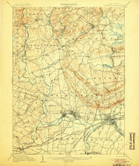
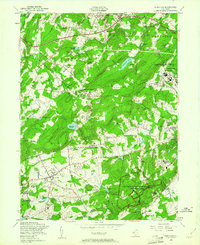
 1947 Mendham1947 Print · USGSMorris County's landscape in the late 1940s balances growing settlements with massive institutions and protected parklands. Genealogists can locate family sites near Mendham or trace the grounds of the Greystone Park State Hospital for Insane.
 - 1947 Map of Bernardsville
 1947 Bernardsville1947 Print · USGSSomerset County saw significant development following the war as the rail network linked historic villages with new institutional centers. Genealogists can locate family landmarks like Osborn Mills, the Stone House, and the Greenlawn Memory Park Cem.
 - 1949 Map of Newark
 1949 Newark1949 Print · USGSThe industrial corridor between Philadelphia and New York comes alive in this post-war survey. Genealogists and historians can trace the massive rail networks of the Reading Railroad and locate major installations like Fort Dix or Picatinny Arsenal.2 unique versions available
 - 1954 Map of Bernardsville, 1956 Print
 1954 Bernardsville1956 Print · USGSThe Somerset and Morris County borderlands come into focus in the mid-1950s, showing a landscape of established estates and growing townships. Genealogists and historians can trace local landmarks like Somerset Hills Cemetery, the U S Veterans Hospital, and Osborn Mills.6 unique versions available
 - 1954 Map of Mendham, 1961 Print
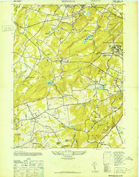
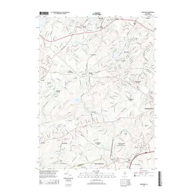
 1954 Mendham1961 Print · USGSMorris County in the mid-fifties is characterized by its transition from rural estates to established institutional grounds and historical preserves. You can trace the Revolutionary history of Jockey Hollow, find family roots at Mount Freedom Hebrew Cem, or locate the extensive campus of Greystone Park State Hospital.5 unique versions available
 - 1956 Map of Newark
 1956 Newark1956 Print · USGSThe industrial heart of the Mid-Atlantic is captured here at the dawn of the highway era, tracing the dense corridors between Newark and Philadelphia. Genealogists and local historians can map the rail networks of the Reading RR or locate mid-century military life at Fort Dix Military Reservation.2 unique versions available
 - 1957 Map of Newark
 1957 Newark1957 Print · USGSThe industrial and military heart of the Mid-Atlantic is mapped during its post-war suburban boom. Genealogists and historians can trace the intricate rail corridors of the Reading Railroad and locate key landmarks from Princeton University to Fort Hancock.
 - 1960 Map of Newark
 1960 Newark1960 Print · USGSThe industrial heart of the Mid-Atlantic is shown at mid-century, stretching from the dense urban centers of Newark and Philadelphia to the Blue Mountain ridges. Researchers can trace historic rail lines, coastal defenses at Fort Hancock, and the riverfront growth of Trenton and Easton.3 unique versions available
 - 1964 Map of Newark
 1964 Newark1964 Print · USGSGreater New Jersey and eastern Pennsylvania appear at the peak of their industrial and rail-centered development in the mid-sixties. Genealogists and historians can trace the paths of the Pennsylvania RR, identify mid-century landmarks like CAMP KILMER, or follow the Schuylkill River through READING.2 unique versions available
 - 1984 Map of Newark, 1985 Print
 1984 Newark1985 Print · USGSNorthern New Jersey's massive industrial and transit network is on full display in the mid-eighties, showing the region just before modern redevelopment. Genealogists and historians can trace the dense urban grids of Newark, find historic landmarks like Ellis Island, and locate the sprawling Picatinny Arsenal in the western hills.
 - 1986 Map of Newark, 1987 Print
 1986 Newark1987 Print · USGSNorthern New Jersey during the mid-eighties shows an incredible transition from the industrial harbor to the wooded Highlands. Researchers can trace the massive footprints of Picatinny Arsenal and Newark International Airport or explore protected lands like the Great Swamp National Wildlife Refuge.
 - 2011 Map of Bernardsville, 2011 Print
 2011 Bernardsville2011 Print · USGSCovers Mendham, including Bridgewater Township, Long Hill Township, and other nearby areas
 - 2011 Map of Mendham, 2011 Print
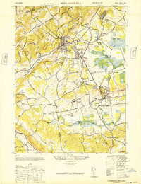
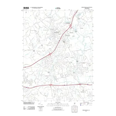
 2011 Mendham2011 Print · USGSCovers Mendham, including Parsippany-Troy Hills, Roxbury Township, and other nearby areas
 - 2014 Map of Mendham, 2014 Print
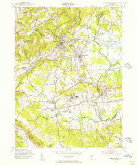
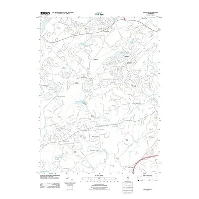
 2014 Mendham2014 Print · USGSCovers Mendham, including Parsippany-Troy Hills, Roxbury Township, and other nearby areas
Showing maps 1-25 of 32
Top cities near Mendham
- Edison historical maps
- Franklin Township historical maps
- Parsippany-Troy Hills historical maps
- Piscataway Township historical maps
- Plainfield historical maps
- Bridgewater Township historical maps
See more
Frequently asked questions
- What are the different types of historical maps available for Mendham?
- What is the oldest map of Mendham?
- Where can I purchase historical maps of Mendham for my home or office?
- Where can I download high-res historical maps of Mendham?
- Are there historical topographic maps available for Mendham?
- Is there historical aerial imagery available for Mendham?
- Where are historical maps of Mendham sourced from?