2020s Maps of Berkeley Township, New Jersey
Explore 5 historic maps of Berkeley Township from the 2020s. These maps offer a rare glimpse into what life looked like during the 2020s — showing old roads, neighborhoods, homes, and landmarks that have changed or disappeared over time.
Whether you're researching your family's past, planning a metal detecting trip, or studying how Berkeley Township's landscape evolved across the 2020s, these high-resolution maps are a powerful tool for exploring the history of this region.
- Focus on a specific era: All maps on this page are from the 2020s, giving you a focused view of this time period.
- See what’s changed: Compare century-old streets, trails, and buildings to today's modern landscape using overlays and satellite layers.
- Research with precision: Use these maps for genealogy, historical research, land use analysis, or educational projects.
- View, download, or print: Maps are fully viewable online in high resolution, and can be downloaded or printed for your own records.
Start exploring Berkeley Township's history through authentic maps from the 2020s. This is your window into the past.
Berkeley Township, NJ maps
(5)- 2023 Map of Seaside Park, 2023 Print
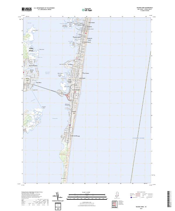 2023 Seaside Park2023 Print · USGSThe Jersey Shore's iconic barrier island communities are captured in this modern survey, showing the dense settlement from the bay to the sea. Trace the street grids and coastal landmarks of Seaside Heights, Lavallette, and the southern expanse of Island Beach.
 - 2023 Map of Toms River, 2023 Print
 2023 Toms River2023 Print · USGSCoastal New Jersey's suburban and riverfront evolution is clear in this contemporary look at the Toms River area and its many residential estates. Genealogists and local historians can locate Old Methodist Cem, the Rogers Family Burial Ground, and the sprawling grounds of Double Trouble.
 - 2023 Map of Forked River, 2023 Print
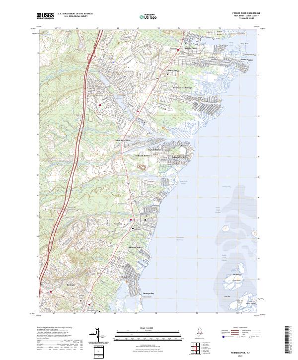 2023 Forked River2023 Print · USGSThe Jersey Shore's intricate waterfront comes alive in this contemporary view of the communities lining Barnegat Bay. Researchers can trace local history through sites like the Old Waretown Presbyterian Cem and the NJ State Game Farm.
 - 2023 Map of Barnegat Light, 2023 Print
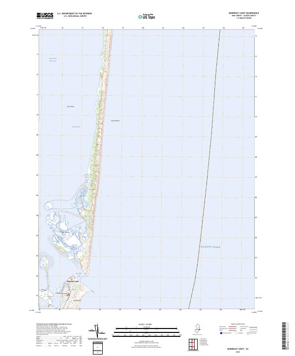 2023 Barnegat Light2023 Print · USGSThe northern tip of Long Beach Island and the southern reaches of the state park lands appear here in recent detail. Researchers can trace the modern layout of Barnegat Light and explore the shifting wetlands of the Sedge Islands and Johnny Allens Cove.
 - 2023 Map of Keswick Grove, 2023 Print
 2023 Keswick Grove2023 Print · USGSThe Pine Barrens of Ocean County are seen here in a modern era of significant residential expansion. Researchers can trace the development of Crestwood Village and Holiday Heights alongside historic sites like Dover Forge and the Dover Cranberry Bog.
End of results
Showing maps 1-5 of 5
Top cities near Berkeley Township
- Toms River historical maps
- Lakewood Township historical maps
- Brick Township historical maps
- Howell Township historical maps
- Jackson Township historical maps
- Manchester Township historical maps
See more
Top neighborhoods of Berkeley Township
- Dover Forge historical maps
- Crystal Lake historical maps
- Holly Park historical maps
- Glen Cove historical maps
- Berkeley Shores historical maps
- River Bank historical maps
See more
Frequently asked questions
- What are the different types of historical maps available for Berkeley Township?
- What is the oldest map of Berkeley Township?
- Where can I purchase historical maps of Berkeley Township for my home or office?
- Where can I download high-res historical maps of Berkeley Township?
- Are there historical topographic maps available for Berkeley Township?
- Is there historical aerial imagery available for Berkeley Township?
- Where are historical maps of Berkeley Township sourced from?