Old Maps of Jackson Township, New Jersey for Academic Research
Study the evolution of Jackson Township with 84 high-resolution historic maps. Whether you're teaching, researching, or modeling changes in land use, these maps provide essential visual documentation of urban, environmental, and geographic change.
- Analyze long-term change: Track patterns in development, transportation, and natural features.
- Ideal for environmental or urban studies: Support academic projects with primary historical map data.
- Use in the classroom or lab: Educators and researchers rely on these maps to bring historical context to life.
These maps are a powerful tool for teaching, research, and visualizing how Jackson Township has changed over the decades.
Jackson Township, NJ maps
(84)- 1884 Map of Whitings
 1884 Whitings1884 Print · USGSThe Pinelands of Ocean County come alive in the 1880s as a hub for rail travel and early industry. Genealogists can trace family-named sites like Boyd's Hotel, Zeb's Bridge, and Chicken Bone along the historic Tuckerton Railroad corridor.
 - 1888 Map of Asbury Park
 1888 Asbury Park1888 Print · USGSCoastal Monmouth and Ocean counties are shown in the late nineteenth century as Victorian-era resorts began to transform the New Jersey shoreline. Genealogists and historians can trace the early rail networks of the Long Branch Railroad and locate vanished station stops like Fairfield Station or Shark River Station.
 - 1888 Map of Cassville
 1888 Cassville1888 Print · USGSCoastal New Jersey's interior pine and mill country is captured here during the 1880s, long before modern highways reshaped the region. Genealogists and local historians can trace the foundations of old family-named sites like Collier's Mills, Vanhiseville, and the Butterfly Bridge.
 - 1888 Map of Whitings, 1900 Print
 1888 Whitings1900 Print · USGSThe Pine Barrens of Ocean County thrived as a rail hub in the late 1880s, centered on the busy junction at Whitings. Researchers can trace the heritage of remote early settlements and industry at Union Clay Works, Dover Forge, and Chicken Bone.3 unique versions available
 - 1893 Map of Asbury Park
 1893 Asbury Park1893 Print · USGSThe Jersey Shore was booming in the late nineteenth century as coastal resorts and life-saving stations rose along the Atlantic. Trace early rail travel and maritime safety through L.S. Station Bay Head, Point Pleasant, and the New York and Long Branch Railroad.2 unique versions available
 - 1894 Map of Cassville
 1894 Cassville1894 Print · USGSThe interior of Monmouth and Ocean Counties is revealed here in the late nineteenth century, showing a landscape defined by water-powered industry. Researchers can trace the heritage of old milling hubs like Jackson Mills and Collier Mills or the rail lines of the New Jersey Southern Railroad.
 - 1900 Map of Cassville
 1900 Cassville1900 Print · USGSMonmouth and Ocean Counties appear at the turn of the century, showing a landscape defined by water-powered milling and early rail transport. Genealogists can trace family names at Lahaway Plantations, Carrs Tavern, and through the many mills including Colliers Mill.3 unique versions available
 - 1901 Map of Asbury Park
 1901 Asbury Park1901 Print · USGSThe Jersey Shore at the turn of the century reveals a landscape of growing coastal resorts and busy railroad junctions. Genealogists can trace family roots in old hamlets like Allaire, Seven Stars, and Farmingdale as they appeared before suburbanization.5 unique versions available
 - 1902 Map of Navesink
 1902 Navesink1902 Print · USGSCoastal New Jersey and the Raritan valley are shown here at the turn of the century, when industrial hubs and maritime defenses defined the shoreline. Genealogists can trace family roots through settlements like Old Bridge and Milltown, or locate local landmarks like the State Reform School.3 unique versions available
 - 1918 Map of Camp Dix
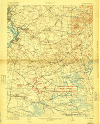 1918 Camp Dix1918 Print · USGSNew Jersey at the height of the Great War features the sprawling mobilization grounds of Camp Dix and its expansive Rifle Range. Genealogists and historians can trace defunct stops like Imlaystown Sta or locate family roots near New Egypt and Colliers Mill.2 unique versions available
 - 1919 Map of Asbury Park, 1921 Print
 1919 Asbury Park1921 Print · USGSCoastal Monmouth and Ocean Counties come alive in the early twentieth century, showing the rapid growth of beach resorts alongside quiet pineland settlements. Researchers can trace the early rail corridors of the Pennsylvania Railroad and locate maritime landmarks like L.S. Station Manasquan Beach and Point Pleasant.
 - 1942 Map of Whiting
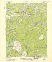 1942 Whiting1942 Print · USGSThe Jersey Pine Barrens are captured here during the early years of the war, showing the region's transition between industry and military use. Genealogists and historians can trace old settlements like Woodmansie, early aviation at Coyle Field, and the rail junction at Whiting.2 unique versions available
 - 1942 Map of Farmingdale
 1942 Farmingdale1942 Print · USGSMonmouth County and the northern edge of Ocean County are shown here in the early 1940s during a period of industrial rail reliance. Trace the rail junctions at Farmingdale or locate historic settlements like Allaire, Squankum, and Jerseyville.
 - 1944 Map of Jersey Homesteads
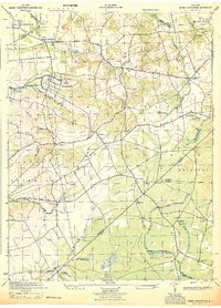 1944 Jersey Homesteads1944 Print · USGSMonmouth and Ocean counties appear here during the mid-forties, capturing a landscape of rural hamlets and small mills. Researchers can trace the New Deal-era Jersey Homesteads and find ancestral sites like Francis Mills, Carrs Tavern, and Perrineville.
 - 1944 Map of Newark, 1971 Print
 1944 Newark1971 Print · USGSThe industrial corridor from Philadelphia to New York was in a period of massive transition during the mid-forties. Genealogists and researchers can trace the rail lines of the Lehigh Valley RR, locate military installations like Picatinny Arsenal, and explore the early sprawl near Levittown.5 unique versions available
 - 1946 Map of Wilmington, 1948 Print
 1946 Wilmington1948 Print · USGSThe Delaware Valley and Jersey Shore emerge in this mid-century portrait of a region defined by river commerce and seaside growth. Genealogists and historians can trace the rail networks of the Pennsylvania Railroad, locate early airfields like Dover Airpark, and find river defenses at Fort Delaware.2 unique versions available
 - 1947 Map of Lakewood
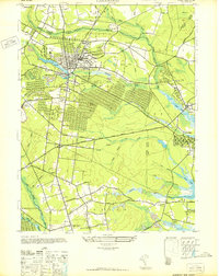 1947 Lakewood1947 Print · USGSCoastal Ocean County in the late 1940s shows a mix of growing townships and pine-lined waterways just as the regional highway system expanded. Genealogists and historians can trace old residential grids in Lakewood, locate family plots at Evergreen Cem, or follow the Central Railroad of New Jersey.
 - 1947 Map of Lakehurst
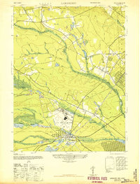 1947 Lakehurst1947 Print · USGSOcean County emerges as a strategic hub in the years following World War II, defined by military aviation and quiet woodland settlements. Researchers can trace the sprawling grounds of the US Naval Air Station, the local streets of Lakehurst, and the remote Newman Sch.2 unique versions available
 - 1947 Map of Roosevelt
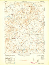 1947 Roosevelt1947 Print · USGSCentral New Jersey's rural interior is captured here just after the war, showing the unique intersection of Monmouth, Mercer, and Ocean counties. Genealogists and local historians can trace family-named sites like Carrs Tavern, Holmeson, and the extensive Cranberry bogs near Prospertown.2 unique versions available
 - 1947 Map of Adelphia
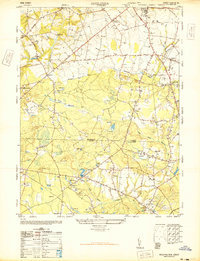 1947 Adelphia1947 Print · USGSMonmouth and Ocean Counties are captured here in the late 1940s, showing a landscape defined by industry and agriculture before major suburbanization. Trace the footprints of early mill sites like Jacksons Mills and Wyckoff Mills, or the extensive cranberry bogs along the Manasquan River.2 unique versions available
 - 1948 Map of Cassville
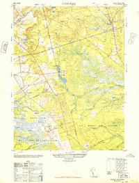 1948 Cassville1948 Print · USGSMid-century Ocean County was a landscape of Pinelands agriculture and expanding military reservations. You can trace the footprint of early industry through numerous Cranberry bogs, a Dismantled Railroad, and settlements like Cassville and Archers Corner.2 unique versions available
 - 1948 Map of Roosevelt
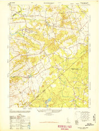 1948 Roosevelt1948 Print · USGSMonmouth County rural life is captured in the late 1940s, showing the early days of the Roosevelt colony and established hamlets. Genealogists can trace family landmarks and crossroads like Stone Tavern, Clarksburg, and the numerous Cranberry bogs near Prospertown.
 - 1948 Map of Lakehurst, 1954 Print
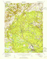 1948 Lakehurst1954 Print · USGSPost-war central New Jersey comes to life here, showing the rural landscapes of Ocean and Monmouth counties before major suburbanization. Trace the footprints of the U S Naval Air Station and historic mill towns like Jacksons Mills and Cassville.2 unique versions available
 - 1949 Map of Newark
 1949 Newark1949 Print · USGSThe industrial corridor between Philadelphia and New York comes alive in this post-war survey. Genealogists and historians can trace the massive rail networks of the Reading Railroad and locate major installations like Fort Dix or Picatinny Arsenal.2 unique versions available
 - 1949 Map of Whiting, 1954 Print
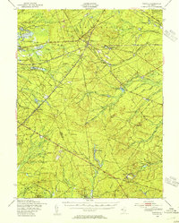 1949 Whiting1954 Print · USGSThe Pinelands of Ocean and Burlington Counties are shown just after the war, when rail hubs and forest reserves defined the landscape. Genealogists and historians can trace the junction at Whiting or locate smaller sites like Woodmansie, the Clay Works, and Keswick Grove.3 unique versions available
Showing maps 1-25 of 84
Top cities near Jackson Township
- Toms River historical maps
- Lakewood Township historical maps
- Brick Township historical maps
- Howell Township historical maps
- Monroe Township historical maps
- Manchester Township historical maps
See more
Top neighborhoods of Jackson Township
- Edgewood Park historical maps
- Vista Center historical maps
- Bennetts Mills historical maps
- Colliers Mills historical maps
- Francis Mills historical maps
- Maryland historical maps
See more
Frequently asked questions
- What are the different types of historical maps available for Jackson Township?
- What is the oldest map of Jackson Township?
- Where can I purchase historical maps of Jackson Township for my home or office?
- Where can I download high-res historical maps of Jackson Township?
- Are there historical topographic maps available for Jackson Township?
- Is there historical aerial imagery available for Jackson Township?
- Where are historical maps of Jackson Township sourced from?