Old Maps of Holly Lake Estates, Little Egg Harbor Township for Hiking & Exploration
Hike through history with 13 historic maps of Holly Lake Estates. Explore old trails, ghost towns, and forgotten backroads — perfect for outdoor adventurers and local explorers.
- Rediscover forgotten places: Map out old mining camps, roads, and footpaths that no longer exist on modern maps.
- Layer with modern tools: Combine with LiDAR or satellite views to plan hikes through historical terrain.
- Made for exploration: Popular among hikers, overlanders, and local history lovers.
Use these maps to find adventure and explore the hidden past of Holly Lake Estates.
Holly Lake Estates, Little Egg Harbor Township maps
(13)- 1888 Map of Little Egg Harbor
 1888 Little Egg Harbor1888 Print · USGSCovers Holly Lake Estates, including Galloway Township, Stafford Township, and other nearby areas2 unique versions available
 - 1893 Map of Little Egg Harbor
 1893 Little Egg Harbor1893 Print · USGSCovers Holly Lake Estates, including Galloway Township, Stafford Township, and other nearby areas4 unique versions available
 - 1920 Map of Little Egg Harbor
 1920 Little Egg Harbor1920 Print · USGSCovers Holly Lake Estates, including Galloway Township, Stafford Township, and other nearby areas
 - 1942 Map of Tuckerton
 1942 Tuckerton1942 Print · USGSCovers Holly Lake Estates, including Galloway Township, Stafford Township, and other nearby areas2 unique versions available
 - 1946 Map of Wilmington, 1948 Print
 1946 Wilmington1948 Print · USGSCovers Holly Lake Estates, including Philadelphia, Toms River, and other nearby areas2 unique versions available
 - 1952 Map of Tuckerton, 1954 Print
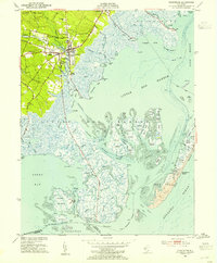 1952 Tuckerton1954 Print · USGSCovers Holly Lake Estates, including Galloway Township, Little Egg Harbor Township, and other nearby areas6 unique versions available
 - 1955 Map of Wilmington
 1955 Wilmington1955 Print · USGSCovers Holly Lake Estates, including Philadelphia, Toms River, and other nearby areas
 - 1957 Map of Wilmington
 1957 Wilmington1957 Print · USGSCovers Holly Lake Estates, including Philadelphia, Toms River, and other nearby areas2 unique versions available
 - 1959 Map of Wilmington
 1959 Wilmington1959 Print · USGSCovers Holly Lake Estates, including Philadelphia, Toms River, and other nearby areas3 unique versions available
 - 1966 Map of Wilmington, 1968 Print
 1966 Wilmington1968 Print · USGSCovers Holly Lake Estates, including Philadelphia, Toms River, and other nearby areas4 unique versions available
 - 1972 Map of Wilmington, 1976 Print
 1972 Wilmington1976 Print · USGSCovers Holly Lake Estates, including Philadelphia, Toms River, and other nearby areas2 unique versions available
 - 1984 Map of Hammonton, 1986 Print
 1984 Hammonton1986 Print · USGSCovers Holly Lake Estates, including Toms River, Cherry Hill Township, and other nearby areas3 unique versions available
 - 1995 Map of Tuckerton, 1998 Print
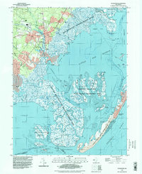 1995 Tuckerton1998 Print · USGSCovers Holly Lake Estates, including Galloway Township, Little Egg Harbor Township, and other nearby areas
End of results
Showing maps 1-13 of 13
Frequently asked questions
- What are the different types of historical maps available for Holly Lake Estates?
- What is the oldest map of Holly Lake Estates?
- Where can I purchase historical maps of Holly Lake Estates for my home or office?
- Where can I download high-res historical maps of Holly Lake Estates?
- Are there historical topographic maps available for Holly Lake Estates?
- Is there historical aerial imagery available for Holly Lake Estates?
- Where are historical maps of Holly Lake Estates sourced from?