Old Maps of Cedar Glen Lakes, Manchester Township for Academic Research
Study the evolution of Cedar Glen Lakes with 18 high-resolution historic maps. Whether you're teaching, researching, or modeling changes in land use, these maps provide essential visual documentation of urban, environmental, and geographic change.
- Analyze long-term change: Track patterns in development, transportation, and natural features.
- Ideal for environmental or urban studies: Support academic projects with primary historical map data.
- Use in the classroom or lab: Educators and researchers rely on these maps to bring historical context to life.
These maps are a powerful tool for teaching, research, and visualizing how Cedar Glen Lakes has changed over the decades.
Cedar Glen Lakes, Manchester Township maps
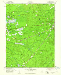
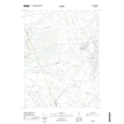
(18)- 1884 Map of Whitings
 1884 Whitings1884 Print · USGSThe Pinelands of Ocean County come alive in the 1880s as a hub for rail travel and early industry. Genealogists can trace family-named sites like Boyd's Hotel, Zeb's Bridge, and Chicken Bone along the historic Tuckerton Railroad corridor.
 - 1888 Map of Whitings, 1900 Print
 1888 Whitings1900 Print · USGSThe Pine Barrens of Ocean County thrived as a rail hub in the late 1880s, centered on the busy junction at Whitings. Researchers can trace the heritage of remote early settlements and industry at Union Clay Works, Dover Forge, and Chicken Bone.3 unique versions available
 - 1942 Map of Whiting
 1942 Whiting1942 Print · USGSThe Jersey Pine Barrens are captured here during the early years of the war, showing the region's transition between industry and military use. Genealogists and historians can trace old settlements like Woodmansie, early aviation at Coyle Field, and the rail junction at Whiting.2 unique versions available
 - 1946 Map of Wilmington, 1948 Print
 1946 Wilmington1948 Print · USGSThe Delaware Valley and Jersey Shore emerge in this mid-century portrait of a region defined by river commerce and seaside growth. Genealogists and historians can trace the rail networks of the Pennsylvania Railroad, locate early airfields like Dover Airpark, and find river defenses at Fort Delaware.2 unique versions available
 - 1949 Map of Whiting, 1954 Print
 1949 Whiting1954 Print · USGSThe Pinelands of Ocean and Burlington Counties are shown just after the war, when rail hubs and forest reserves defined the landscape. Genealogists and historians can trace the junction at Whiting or locate smaller sites like Woodmansie, the Clay Works, and Keswick Grove.3 unique versions available
 - 1951 Map of Whiting
 1951 Whiting1951 Print · USGSThe New Jersey Pine Barrens are captured here at mid-century, defined by the heavy rail corridors of the Pennsylvania Railroad and military lands. Researchers can trace the layout of Whiting, follow the network of Cranberry Bogs, and locate remote sites like Pasadena and Bullock.
 - 1955 Map of Wilmington
 1955 Wilmington1955 Print · USGSThe Delaware Valley and Jersey Shore are seen here during the mid-fifties era of rapid suburban expansion and highway development. You can trace the path of the New Jersey Turnpike, locate the Fort Dix Military Reservation, or explore the rail networks of the Pennsylvania Railroad.
 - 1957 Map of Wilmington
 1957 Wilmington1957 Print · USGSThe mid-Atlantic coastal plain comes alive in the mid-fifties as the New Jersey Turnpike and Garden State Parkway redefine travel. Researchers can trace the rail-to-road transition and find landmarks like Ship John Shoal Light and the Fort Dix Military Reservation.2 unique versions available
 - 1957 Map of Whiting, 1961 Print
 1957 Whiting1961 Print · USGSThe Pine Barrens of Ocean County are documented here in the late fifties, showing the vital rail intersection at Whiting. Genealogists and historians can trace the tracks of the Pennsylvania Railroad and locate vanished stop points like Bullock and Wheatland.4 unique versions available
 - 1959 Map of Wilmington
 1959 Wilmington1959 Print · USGSThe Delaware Valley and Jersey Shore are seen here in the late fifties, during a period of massive suburban and highway expansion. Researchers can trace mid-century infrastructure like the N J Turnpike or locate coastal landmarks from Barnegat Bay to the Maurice River.3 unique versions available
 - 1966 Map of Wilmington, 1968 Print
 1966 Wilmington1968 Print · USGSThe Delaware Valley and Jersey Shore are seen here in the mid-1960s, documenting a landscape of dense industrial cities and emerging coastal resorts. Researchers can trace the sprawling rail networks of the Pennsylvania Railroad or locate landmarks like Fort Dix Military Reservation and Elk Neck State Park.4 unique versions available
 - 1972 Map of Wilmington, 1976 Print
 1972 Wilmington1976 Print · USGSThe Delaware Valley and Jersey Shore are seen here in the 1970s, showcasing the region's dense transport networks and vast state forests. Trace early coastal development near Atlantic City or locate rural landmarks like Mount Holly and Dover Air Force Base.2 unique versions available
 - 1984 Map of Hammonton, 1986 Print
 1984 Hammonton1986 Print · USGSSouthern New Jersey is captured in the mid-eighties as suburban growth pressed against the vast Pinelands. Researchers can trace the development of the Atlantic City Expressway corridor and locate landmarks like Ancora Psychiatric Hospital and the sprawling Wharton State Forest.3 unique versions available
 - 2011 Map of Whiting, 2011 Print
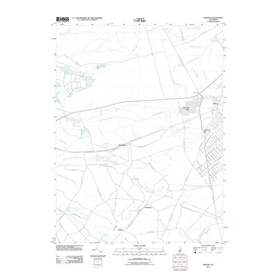 2011 Whiting2011 Print · USGSCovers Cedar Glen Lakes, including Jackson Township, Manchester Township, and other nearby areas
 - 2014 Map of Whiting, 2014 Print
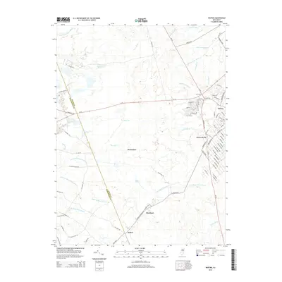 2014 Whiting2014 Print · USGSCovers Cedar Glen Lakes, including Jackson Township, Manchester Township, and other nearby areas
 - 2016 Map of Whiting, 2016 Print
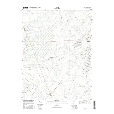 2016 Whiting2016 Print · USGSCovers Cedar Glen Lakes, including Jackson Township, Manchester Township, and other nearby areas
 - 2019 Map of Whiting, 2019 Print
 2019 Whiting2019 Print · USGSCovers Cedar Glen Lakes, including Jackson Township, Manchester Township, and other nearby areas
 - 2023 Map of Whiting, 2023 Print
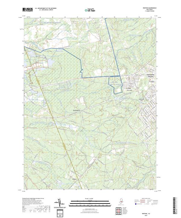 2023 Whiting2023 Print · USGSOcean County's Pinelands landscape is revealed here in its modern form, balancing military borders with growing residential centers. Local historians can trace the paths of the Whitesbog Village Driving Tour Trl or locate settlements like Whiting and Buckingham.
End of results
Showing maps 1-18 of 18
Top cities near Cedar Glen Lakes
- Toms River historical maps
- Lakewood Township historical maps
- Hamilton Township historical maps
- Howell Township historical maps
- Jackson Township historical maps
- Manchester Township historical maps
See more
Frequently asked questions
- What are the different types of historical maps available for Cedar Glen Lakes?
- What is the oldest map of Cedar Glen Lakes?
- Where can I purchase historical maps of Cedar Glen Lakes for my home or office?
- Where can I download high-res historical maps of Cedar Glen Lakes?
- Are there historical topographic maps available for Cedar Glen Lakes?
- Is there historical aerial imagery available for Cedar Glen Lakes?
- Where are historical maps of Cedar Glen Lakes sourced from?